New Haven (Vermont)
| New Haven | ||
|---|---|---|
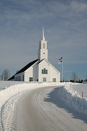
 The United Reform Church in New Haven |
||
| Location in Vermont | ||
|
|
||
| Basic data | ||
| Foundation : | November 2, 1761 | |
| State : | United States | |
| State : | Vermont | |
| County : | Addison County | |
| Coordinates : | 44 ° 6 ′ N , 73 ° 10 ′ W | |
| Time zone : | Eastern ( UTC − 5 / −4 ) | |
| Residents : | 1,727 (as of 2010) | |
| Population density : | 16.2 inhabitants per km 2 | |
| Area : | 107.6 km 2 (approx. 42 mi 2 ) of which 106.7 km 2 (approx. 41 mi 2 ) is land |
|
| Height : | 106 m | |
| Postal code : | 05472 | |
| Area code : | +1 802 | |
| FIPS : | 50-48700 | |
| GNIS ID : | 1462160 | |
| Website : | www.NewHavenVT.com | |
New Haven is a town in Addison County of the state of Vermont in the United States with 1,727 inhabitants (according to the 2010 census).
geography
Geographical location
The community is located on the fertile, agriculturally intensively used plains around Lake Champlain , west of the foothills of the Green Mountains . However, there are neither mountains nor lakes in the area of the municipality. The area is crossed by three rivers that flow to Lake Champlain from the Green Mountains: Otter Creek , Little Otter Creek, and New Haven River .
Neighboring communities
All information as air lines between the official coordinates of the places from the 2010 census.
- Northeast: Monkton , 3.4 mi
- East: Bristol , 8.1 mi
- South: Middlebury , 3.5 mi
- Southwest: Weybridge , 4.2 mi
- West: Addison , 11.6 miles
- West: Waltham , 4.4 mi
- Northwest: Ferrisburgh , 13.0 km
climate
The mean mean temperature in New Haven is between −8.9 ° C (16 ° Fahrenheit ) in January and 20.6 ° C (69 ° Fahrenheit) in July. This means that the place is around 10 degrees cooler than the long-term average in the USA. The snowfall between October and May is more than five and a half meters, about twice as high as the average snow depth in the USA, the daily sunshine duration is at the lower end of the range of values in the USA, between September and December even significantly below.
history
New Haven was proclaimed for settlement and sold on November 2, 1761 as part of the New Hampshire Grants with 23,390 acres (about 95 km²). The area was divided into 56 parcels for settlers, four for school and church upkeep, and two for the personal property of New Hampshire Governor Benning Wentworth . The first settlers came from Salisbury , Connecticut in 1769 . They established their first settlement at Otter Creek Falls near what is now Vergennes . The leader of the settler group, John Everts, set up a cannon on a rock with a barrel pointing towards the sky as a sign of his claims. This cannon later became a well-known landmark and, after it became overgrown over time and was no longer visible, it was supplemented by a large iron bar. It was considered by many residents of the region to be the center of the area on Lake Champlain that was populated by Europeans until the mid-19th century.
In the meantime, New York , initially a British colony and later a state of the young United States, had claimed the land of what is now Vermont and sold the land. Against this resistance formed from the original settlers; there were civil war-like attacks on both sides. At the Otter Creek Falls, a fort was therefore built by Ethan Allen to protect the settlers against the "Yorkers" in the area of today's Vergennes ; His brother Ebenezer Allen became the commander of the troops stationed there.
The settlers were expelled during the War of Independence , but returned after the peace agreement. The constituent assembly of New Haven took place in 1785. When Vergennes was founded as an independent town in 1783, small parts of the originally declared area were separated. In 1796 the area of the town was again reduced by the handover of an area in the northwest of the town to the new establishment Waltham ; at the same time, however, the addition of a gore (an area that has not been allocated due to measurement errors) on the northern border was partially offset. As a result of these changes, the area of the town deviates significantly from the otherwise often approximately square basic shape of the Vermont communities.
The town's population grew rapidly. The first churches were founded in 1797. Some marble deposits in the area were used, but the main source of income was agriculture. In 1840, the census records show primarily sheep-rearing with significant wool production as the main occupation; The main crops grown are potatoes and, much less so, maize.
From 1847, the construction of the Bellows Falls – Burlington railway , which reached through the mountains from the Connecticut River and the metropolitan areas of the east coast to the lake and thus opened up new sales opportunities, also made New Haven easier to reach. A first stop was far from the main town; this was changed by the construction of a branch line to Bristol with a station in the main settlement of New Havens from 1891. Both routes promoted the conversion of the town's livestock farming from sheep to dairy farming; While this conversion lasted until around 1890 in the neighboring communities, it was completed in Bristol, where a dairy was also established, which became an important customer of the railway and New Haven was completed by 1870. As a result, however, there was no major industrialization, and both communities remained focused on agriculture. In 1930 the branch line was closed; the station on the main line was closed to passenger traffic. The migration to the metropolitan areas that began in the first third of the 20th century also affected New Haven. The population decreased steadily until the mid 1960s. This trend was only broken with the emigration from the metropolitan areas to the surrounding rural communities, which became dormitories. In New Haven, which became the dormitory town for the two neighboring centers of Vergennes and Middlebury, the population almost doubled from 922 inhabitants in 1960 to 2010 with 1727 inhabitants.
Religions
A congregation of the United Church of Christ is established in New Hafen .
Population development
| Census Results - Town of New Haven, Vermont | ||||||||||
|---|---|---|---|---|---|---|---|---|---|---|
| year | 1700 | 1710 | 1720 | 1730 | 1740 | 1750 | 1760 | 1770 | 1780 | 1790 |
| Residents | 723 | |||||||||
| year | 1800 | 1810 | 1820 | 1830 | 1840 | 1850 | 1860 | 1870 | 1880 | 1890 |
| Residents | 1135 | 1688 | 1566 | 1834 | 1503 | 1663 | 1419 | 1355 | 1355 | 1224 |
| year | 1900 | 1910 | 1920 | 1930 | 1940 | 1950 | 1960 | 1970 | 1980 | 1990 |
| Residents | 1107 | 1161 | 1001 | 964 | 881 | 932 | 922 | 1039 | 1217 | 1375 |
| year | 2000 | 2010 | 2020 | 2030 | 2040 | 2050 | 2060 | 2070 | 2080 | 2090 |
| Residents | 1666 | 1727 | ||||||||
Economy and Infrastructure
traffic
Since the rail station was closed to passenger traffic, the connection to the outside world has been made primarily by road traffic via Vermont State Route 7, which runs north-south through New Haven . A local airport, Middlebury State Airport , is around 16 km away near Middlebury.
Public facilities
There are no public facilities in New Haven other than normal local government and elementary school. The closest hospital is the Porter Medial Center in Middlebury.
education
New Haven is part of the Addison Northeast Supervisory Union with Bristol, Lincoln, Monkton, Starksboro and Mt. Abraham .
In New Haven there is a six-class elementary school with an attached kindergarten, the Bemann Elementary School . The surrounding communities, especially Middlebury, must be approached to attend secondary schools.
The New Haven Community Central Library is located in the Town Offices building.
Personalities
sons and daughters of the town
- Josiah Bushnell Grinnell (1821–1891), Iowa representative to the House of Representatives
Personalities who have worked on site
- James Meacham (1810–1856), politician, member of the US House of Representatives, and pastor in New Haven
literature
- Zadock Thompson: History of Vermont, natural, civil and statistical, in three parts . 3rd volume. Chauncey Goodrich, Burlington 1842, p. 128 ( limited preview in Google Book search).
- Samuel Swift: History of Addison County . Middlebury 1859 ( archive.org ).
- Abby Maria Hemenway: The Vermont historical Gazetteer . 1st volume. Burlington 1867, p. 68 ff .
- HP Smith: History of Addison County. Chapter 27: The History of the Town of New Haven . D. Mason & co., Syracuse, NY 1886, pp. 522-555 ( archive.org ).
Web links
- Homepage of the municipality (English)
- Profile of the municipality on the official portal www.Vermont.gov
- Entry on VirtualVermont (English) ( Memento from April 24, 2016 in the Internet Archive )
Individual evidence
- ^ New Haven in the United States Geological Survey's Geographic Names Information System , accessed October 1, 2014
- ↑ Population data from the 2010 US Census in the American Factfinder
- ↑ Coordinates of the locations of the Census Authority 2010
- ↑ Climate data at www.City-Data.com (English)
- ↑ Population 1790–2010 according to the census results
- ↑ ANESU. In: anesu.org. Retrieved July 28, 2017 .
- ↑ Homepage of the Bemann Elementary School (English)


