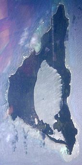
Nomuka
| Nomuka | |
|---|---|
| Map of Nomuka and surroundings | |
| Waters | Pacific Ocean |
| Archipelago | Ha'apai |
| Geographical location | 20 ° 15 ′ 0 ″ S , 174 ° 47 ′ 20 ″ W |
| surface | 7.12 km² |
| Highest elevation | Koto Maka 45 m |
| Residents | 474 67 inhabitants / km² |
| main place | Nomuka |
Nomuka (also Numuka , earlier Rotterdam or Namuka ) is a 7.12 km² island that belongs to the Kingdom of Tonga . The island has a shallow, swampy brackish lake called Ano Ava (word meaning: swamp hole), with three small islands: Puhoʻava, Loto (the largest island) and Tefisi. The southern bulge of the lake, Mamaha (word meaning: shallow), is even shallower . The lake extends over an area of around 2.5 km² and thus takes up a good third of the island's area.
The island lies to the north of the Nomuka Bank , the largest submarine bank in the Tonga Islands.
The population decreased from 550 to 474 between the 1996 and 2006 censuses. The island is located in the Ha'apai archipelago . Nomuka can only be reached by boat and there are weekly boats from Nukuʻalofa and Lifuka .
Individual evidence


