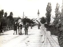
Wagram (St. Pölten)
|
|||
| Basic data | |||
| Surface: | 10.4 km² | ||
| Residents: | 6,433 (December 31, 2015) | ||
| Population density: | 619 inhabitants per km² | ||
| Height: | 267 m above sea level A. | ||
| Post Code: | 3100 | ||
| Geographical location: | 48 ° 12 ′ N , 15 ° 39 ′ E | ||
| Cadastral communities | |||
|
|||
| Location in St. Pölten | |||

|
|||
The place Wagram is located in Lower Austria on the Traisen between Stattersdorf in the south, St. Pölten and Viehofen in the west, Ratzersdorf and Pottenbrunn in the north and Böheimkirchen and Pyhra in the east. It has been a district of St. Pölten since it was incorporated in 1923 , the parts of Ober- and Unter Zwischenbrunn were incorporated in 1939.
The town is separated from the rest of the city by the Traisen in the west, but the connection is ensured by three car bridges.
Surname
The name Wagram is likely to be derived from Wagrain or Wagraine , which is roughly equivalent to Wogenrain. This meant the limit that the waves of the Traisen could reach during floods.
history
The first evidence of settlement can be found in a settlement find from the Lengyel culture dating back to 4800 BC. Chr. Dated. The further settlement has been consistently proven by further finds to this day.
The place is mentioned for the first time in a deed of foundation from the year 1083 of the Passau bishop Altmann .

The first stage on the way from the farming village to the district took place in 1850, when Wagram formed a community together with Stattersdorf . From there, the cadastral communities were transferred to St. Pölten in 1923.
Until 1923, the populated area consisted almost entirely of the two original villages of Oberwagram and Unterwagram in the east of today's area. After the incorporation, a lot of building activity developed. In many cases, single houses were built until the cooperative-organized settlement construction began in the 1930s. The Hubert Schnofl settlement and the garden settlement “German School Association” were built during this time . The elementary school was built in 1936 as an extension to the existing secondary school, the parish church was inaugurated in 1937. The 1960s brought renewed construction, in addition to many individual houses, the St. Michael settlement was completed in 1964.
politics
As a cadastral municipality of St. Pölten, Wagram does not have its own municipal council; the mayors before 1923 can be found in the list of mayors of St. Pölten .
See also: St. Pölten: Politics
economy
Established businesses
In the district there is, among other things, the company Svoboda office furniture and the Postbus garage. The largest cinema in town, the Hollywood Megaplexx is located in Wagram.
Public facilities
In Wagram there is an elementary school and a secondary school as well as four kindergartens. With the nursing homes Haus an der Traisen and Haus St. Elisabeth , half of the homes are in this district. The first construction phase of the Lower Austrian state sports school opened in 1990. In the following years, the area was gradually expanded to include a ball sports hall, a tennis center and an ice rink. There is also a tennis arena on the premises of the state sports school, which is currently not used for international tennis tournaments.
Culture and sights
The parish church of Saint Michael was built between 1937 and 1938 according to the plans of Rudolf Wondracek and inaugurated by Michael Memelauer in the year of completion . The simple building with a cross-shaped floor plan was connected to both the free-standing bell tower and the rectory by an arcade. On June 7, 2009, on the occasion of the 70th anniversary of the church, the parish received its fifth bell, financed by donations. The anniversary chapel in Purkersdorferstrasse was built in 1908 and completely renovated in 1994.
Kulturhaus Wagram
The Kulturhaus Wagram was built from 1995 to 1997 after the project was presented in 1993. In addition to a restaurant, two rooms of different sizes are available. The larger ballroom can hold up to 300 people. The basement is designed for club activities, so there is a large gym next to smaller rooms. A 5800 square meter park with a pavilion and biotope was created to the west of the Kulturhaus. The post office, which was also integrated at the beginning, was closed in 2009.
Web links
Individual evidence
- ↑ Magistrate of the City of St. Pölten: Annual Statistical Report 2015.
- ↑ a b Historical urban development on st-poelten.gv.at
- ↑ Wagram, from Mühlendorf to preferred residential district , chapter on the landscape of Wagrams , page 5
- ↑ Wagram, from Mühlendorf to preferred residential district , chapter Prehistory and Early History , page 8
- ↑ a b Wagram, from Mühlendorf to preferred residential district , chapter The history of Wagrams , pages 6–7
- ↑ a b Wagram, from Mühlendorf to preferred residential district , chapter architectural history of Oberwagram and Unterwagram , pages 155–156
- ↑ Wagram, from Mühlendorf to preferred residential district , chapter Church consecration in Wagram , page 207
- ↑ Parish letter of the parish St. Pölten - Wagram May-June 2009 ( page no longer available , search in web archives ) Info: The link was automatically marked as defective. Please check the link according to the instructions and then remove this notice.
- ↑ Wagram, from Mühlendorf to preferred residential district , chapter Das Kulturhaus Wagram , pages 191–193


