Oldendorp
|
Oldendorp
Jemgum parish
|
|
|---|---|
| Coordinates: 53 ° 18 ′ 29 ″ N , 7 ° 17 ′ 35 ″ E | |
| Height : | 2 m above sea level NHN |
| Area : | 5.29 km² |
| Residents : | 87 (Jun 30, 2015) |
| Population density : | 16 inhabitants / km² |
| Incorporation : | 1st January 1973 |
| Postal code : | 26844 |
| Area code : | 04958 |
|
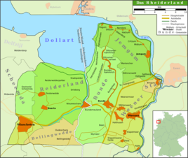
Map of the Rheiderland
|
|
|
Oldendorper Church
|
|
Oldendorp in Rheiderland is a village in the municipality of Jemgum in the district of Leer in Lower Saxony in East Frisia . The cluster village has 87 inhabitants.
Location and area
Oldendorp was founded on the former embankment embankment, which is now about 600 meters south of the dike line. The village lies at an altitude of 0.6 to 0.8 m above sea level. NHN , while the surrounding area is about at sea level or slightly below. In past centuries this led to major drainage problems that could only be solved in 1954 with the commissioning of the pumping station near Ditzum. The soil consists mainly of bend marsh , south of the place there is also low moor. In total, the place covers an area of 5.29 square kilometers.
history
The Emsuferwall was settled in the early Middle Ages. Presumably Oldendorp was also founded during this period. This is indicated by an early medieval burial ground discovered in 1875. For the first time Warftsiedlung is in 909 in a lifting register as Aldonthorpe mentioned. In the late Middle Ages, Oldendorp was the seat of a chief , but it has not yet been possible to locate the castle site with certainty.
Oldendorp originally belonged to the historical Rheiderland territory. At the beginning of modern times this was divided into Oberrheiderland and Niederrheiderland. Oldendorp was henceforth part of the Bailiwick of Ditzum and in the office of Emden, which belonged to the Niederrheiderland.
After the battle of Jena and Auerstedt in 1806, the Rheiderland was spun off from East Frisia due to old Dutch claims and added to the Dutch Ems-Occidental department with the capital Groningen . From then on, Böhmerwold belonged to the canton of Jemgum in the Arrondissement of Winschoten under Dutch and later French rule from 1807.
After the defeat of Napoleon and the collapse of his rule, the Prussians again moved in from 1813 to 1815, and after the Congress of Vienna in 1814/15 they had to cede East Frisia to the Kingdom of Hanover . In 1817, Böhmerwold was assigned to the Jemgum office, which was incorporated into the Weener office in 1859. After the Prussians moved in again, the village became a municipality in the Weener district in 1885 , which was opened in the Leer district in 1932 .
Oldendorp was already a stronghold of the NSDAP before 1933 . However, in the 1932 presidential election , Adolf Hitler received an absolute majority of the votes in the second ballot, after he was able to unite the 20% votes of the DNVP from the first ballot.
At the end of the Second World War , Canadian soldiers fought fierce battles with German troops on the other bank of the Ems. Bullet holes in the west wall of the church still testify to this today.
After the Second World War, the place - like the entire Rheiderland - took in a particularly large number of displaced persons , who at times made up more than 30 percent of the population. This is believed to be due to the fact that Oldendorp was viewed as being so agriculturally powerful that it could feed the additional residents. Since January 1, 1973 the village has been part of the Jemgum municipality.
Development of the place name
For the first time the place is called "Aldonthorpe" in the 10th century. 1367 the name "Aldathorp" is attested. The name means "old village" and stands opposite the neighboring "new village" Nendorf.
religion
The Oldendorper Church was built in the 13th or 14th century as a rectangular hall church with walls up to 1.20 meters thick. In religious terms, the inhabitants of Oldendorp belonged to the provost of Hatzum in the diocese of Münster during the Middle Ages . After the Reformation, the Reformed Confession prevailed. Since 1911, Oldendorp and the neighboring town of Nendorp have formed a congregation that is now looked after by the Ditzum pastor.
Web links
Individual evidence
- ↑ a b c d e f local chronicles of the East Frisian landscape: Böhmerwold, community Jemgum, district Leer (PDF; 24 kB), accessed on March 31, 2010.
- ^ Federal Statistical Office (ed.): Historical municipality directory for the Federal Republic of Germany. Name, border and key number changes in municipalities, counties and administrative districts from May 27, 1970 to December 31, 1982 . W. Kohlhammer GmbH, Stuttgart and Mainz 1983, ISBN 3-17-003263-1 , p. 263 .


