Holtgaste
|
Holtgaste
Jemgum parish
|
|
|---|---|
| Coordinates: 53 ° 18 ′ 32 ″ N , 7 ° 20 ′ 3 ″ E | |
| Height : | 0-3.5 m above sea level NHN |
| Area : | 8.46 km² |
| Residents : | 235 (Jun 30, 2015) |
| Population density : | 28 inhabitants / km² |
| Incorporation : | 1st January 1973 |
| Postal code : | 26844 |
| Area code : | 04958 |
|
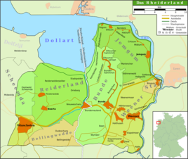
Map of the Rheiderland
|
|
|
Soltborg in the foreground, the Soltborg settlement in the center and Holtgaste in the background
|
|
Holtgaste is a village in the East Frisian community of Jemgum in the district of Leer in Lower Saxony . About 235 people live in the village on an area of 8.46 square kilometers. The locality also includes the smaller villages and farmsteads Soltborg , Ukeborg, Deddeborg, Bentumersiel, Jemgumkloster, Geise and the settlement of Holtgaste, founded in 1935 between the village of Holtgaste and Soltborg.
Holtgaste is a focus of community development in Jemgum. The proximity to the A 31 favors a large industrial area. Large new development areas can also be found outside the historic town center. On the Ems there is an important pumping station for draining the area.
history
Numerous archaeological finds have been made in the local area of Holtgast, including from the Roman Empire . The first known mention of the place was in 1282. The construction of a wooden church in the 9th century, however, indicates a settlement at this time. The eponymous settlement itself is on a Geest back. Further settlements known in the local area are located on z. T. on former terps . For example Jemgum Monastery. This is one of the oldest terps in northern Germany. Another nationally known site is Bentumersiel .
In the Thirty Years 'War Holtgaste suffered badly from the Mansfeld troops , as well as from the billeted troops of the Freikorps Conflans in the Seven Years' War . Holtgaste was hardly damaged in the Second World War. However, the place had to shoulder the burden of a large influx of refugees in the period that followed.
Holtgaste was initially an independent municipality, but in 1961 it became a member of the Jemgum joint municipality. On January 1, 1973, Holtgaste was finally incorporated into the new community of Jemgum.
church
The historic Liudgeri Church from the 13th century with its old cemetery is characteristic of the townscape . It is considered to be the oldest church in the Rheiderland . In front of the current building there was probably a wooden church on the site . Stories say that the church was a hideout for Klaus Störtebeker . The church changed hands in the course of time. At first the monastery was owned. It sold the church in 1282, however, to the bishop of Münster, who handed it over to the Johanniter in Jemgum two years later .
After the Reformation, the Lutheran count family took over the patronage of the church. Hence it is that it is one of the few Lutheran churches in the otherwise mostly Reformed Rheiderland. Today the Holtgast parish shares a parish with the Lutheran parish in the nearby Leeran district of Bingum .
The organ was built by Arnold Rohlfs in 1864/65 and has seven registers .
Population development
With around 239 inhabitants, Holtgaste has fewer inhabitants today than in the first half of the 19th century. At that time over 300 people lived in the place. Holtgaste had the highest population shortly after the war, when many refugees found shelter in the village. The peak was reached in 1950 with 469 inhabitants, after which the number of inhabitants decreased and has only recently stabilized and increased again.
literature
- Wilhelm Lange (Hrsg.): The families of the parish Holtgaste (1695-1900) . Upstalsboom-Gesellschaft, Aurich 2001, ISBN 3-934508-05-7 (Ostfriesland Ortssippenbücher, vol. 59; German Ortssippenbücher, vol. A 299).
Individual evidence
- ↑ Jemgum.de: structural data , accessed on April 15, 2018.
- ^ Federal Statistical Office (ed.): Historical municipality directory for the Federal Republic of Germany. Name, border and key number changes in municipalities, counties and administrative districts from May 27, 1970 to December 31, 1982 . W. Kohlhammer GmbH, Stuttgart and Mainz 1983, ISBN 3-17-003263-1 , p. 263 .


