Böhmerwold
|
Böhmerwold
Jemgum parish
|
|
|---|---|
| Coordinates: 53 ° 14 '2 " N , 7 ° 19' 57" E | |
| Height : | 0–1 m above sea level NHN |
| Area : | 4.73 km² |
| Residents : | 56 (Nov. 30, 2008) |
| Population density : | 12 inhabitants / km² |
| Incorporation : | 1st January 1973 |
| Postal code : | 26844 |
| Area code : | 04958 |
|
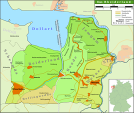
Map of the Rheiderland
|
|
|
Church in Böhmerwold
|
|
Böhmerwold in Rheiderland is a village in the municipality of Jemgum in the district of Leer in Lower Saxony in East Friesland . The village has 56 inhabitants.
Location and area
Böhmerwold is a row settlement in the middle of the Niederrheiderland on the way from Marienchor to Weener and Bunde. It lies at a height of 0.5 m above sea level. NHN , while the surrounding area is about at sea level or slightly below. In total, the place covers an area of 4.73 square kilometers.
history
The village, known as Beddinghem in the 10th century , may have been the predecessor settlement of today's place, which was first mentioned in its current location in 1409. The village probably came into being when the moor in the west of the village was reclaimed by stretching out in the 14th century . Politically, the settlement initially belonged to the Rheiderland. In the late Middle Ages, the offices in East Friesland were reorganized and Böhmerwold was assigned to the Leerort office as part of the Vogtei Bunde .
After the battle of Jena and Auerstedt in 1806, the Rheiderland was spun off from East Frisia due to old Dutch claims and added to the Dutch Ems-Occidental department with the capital Groningen . From then on, Böhmerwold belonged to the canton of Jemgum in the Arrondissement of Winschoten under Dutch and from 1807 under French rule as part of the Commune Landschaftspolder .
After the defeat of Napoleon and the collapse of his rule, the Prussians again moved in from 1813 to 1815, who then ceded East Frisia to the Kingdom of Hanover after the Congress of Vienna in 1814/15 . In 1817, Böhmerwold was assigned to the Jemgum office, which was incorporated into the Weener office in 1859. After the Prussians moved in again, the village became a municipality in the Weener district in 1885 , which was opened in the Leer district in 1932 .
The National Socialists were able to gain a foothold in Böhmerwold early on. As early as 1930, there was evidence of strong right-wing movements and in the 1932 presidential election , Adolf Hitler received the absolute majority of the votes cast with over 70 percent.
The preacher Heinrich Gerhard Bokeloh stood in opposition to the National Socialists. He supplied the Böhmerwold congregation from the Marienchor and belonged to the Confessing Church . After criticizing the attack on Poland , he was arrested in September 1939 after denunciations and taken to the Oranienburg concentration camp, where he was detained for two and a half years.
After the Second World War, the place took on a particularly large number of displaced persons , who at times made up more than 40 percent of the population. This is probably due to the fact that Böhmerwold was viewed as being very productive in agriculture.
On January 1, 1973 Böhmerwold was incorporated into the municipality of Jemgum.
Development of the place name
For the first time the place is called Beddinghem in the 10th century , which is interpreted as the home of the Bettinge (Beddinge) . Presumably members of the Bette or Bedde clan have settled there . Later names are Bedmawertha (1409), Bedma hamryk (1447), Bedamewalt (1475) and Bimerwoldt (1599). The suffix -wold means meadow or pasture in a broken landscape with low bushes.
Population development
Böhmerwold is after Marienchor is the second smallest district of the municipality Jemgum. The village shares the fate of many remote marshland communities and is severely affected by emigration.
|
|
|
religion
The Šumava Church was built in 1703. The brick church is the successor to a small half-timbered building made of wood and clay. In religious terms, the inhabitants of Böhmerwold belonged to the provost of Hatzum in the diocese of Münster during the Middle Ages . After the Reformation, the Reformed Confession prevailed. In 1828 Bunderhammerich and the Norder- and Süder-Christian-Eberhard-Polder were incorporated. The two parishes Marienchor and Böhmerwold have formed a parish community since 1936.
literature
- Helmut Anneessen: The families of the parish Böhmerwold (1695-1900) . Upstalsboom-Gesellschaft, Aurich 2004, ISBN 3-934508-16-2 (Ostfriesland Ortssippenbücher, vol. 68; German Ortssippenbücher, vol. A 364).
Web links
Individual evidence
- ↑ a b c d e f g h i j Ortschronisten der Ostfriesischen Landschaft: Böhmerwold, municipality Jemgum, administrative district Leer (PDF; 29 kB), accessed on March 30, 2010.
- ↑ a b c Federal Statistical Office (ed.): Historical municipality directory for the Federal Republic of Germany. Name, border and key number changes in municipalities, counties and administrative districts from May 27, 1970 to December 31, 1982 . W. Kohlhammer GmbH, Stuttgart and Mainz 1983, ISBN 3-17-003263-1 , p. 263 .


