
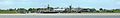
Ditzum
|
Ditzum
Jemgum parish
|
|
|---|---|
 |
|
| Height : | 1 m above sea level NHN |
| Area : | 10.37 km² |
| Residents : | 646 (2015) |
| Population density : | 62 inhabitants / km² |
| Incorporation : | 1st January 1973 |
| Postal code : | 26844 |
| Area code : | 04902 |
 Map of the Rheiderland
|
|
 Street in Ditzum, Ditzumer Mühle in the background
|
|
Ditzum is a fishing and port village on the south bank of Unterems in East Friesland , about two away from its mouth in the Dollard . It is located in the Rheiderland and has belonged to the municipality of Jemgum in the district of Leer in Lower Saxony since a municipal reform in 1973 .
With around 650 inhabitants and an area of 20.4 km², the village is the second largest of the eleven Jemgum districts. Because of its remote location in the north-western corner of the Rheiderland, it is also known as " Endje van de Welt ". Its port with centuries-old continuity and one of the last functioning gates are unique in East Frisia. The historical connection between the terp settlement with windmill, Romanesque church and church tower in the form of a lighthouse (1846) as well as the port and the inland drainage through the Sieltief with its “chicken bridge” is still understandable and important today. This sets it apart from similarly structured terp tarts in the Unterems, which have often lost their original sluice port function due to the dike being moved forward. The Ems ferry stationed in Ditzum in the Emden district of Petkum is the last remaining Ems ferry on East Frisian soil.
history
Village emergence
On the Ems , the tidal deposits created a solid, higher bank wall , which was suitable for residential developments. On this embankment, " Tetteshem " (= Ditzum) was probably founded in the 8th century at an estuary mouth . Initially at ground level, later rising water levels forced the construction of an elevated mound village (apex line around today's Kirchstrasse), which was also protected by a first closed dike line from the 11th century . In the course of time, the terp village west of the Priel developed into a small-parcel clustered village , east of which an agricultural street settlement developed. The fertile marshland still offers ideal conditions for livestock farming. Originally there were six large farms (" Plaatse "), of which only one Gulfhof is preserved in the village today. The tradition as a fishing village dates back to the 16th century, when after the devastating Cosmas and Damianflut and Antoni tide the tidal flats of the Dollard formed ( see below story of Siel and port ) . Accordingly, the garnet catch was first mentioned in 1624. Another economic mainstay was the brickworks , which can be traced back to 1500 until the late 20th century .
Around 1180–1220 AD , the brick church, which today defines the townscape, was built at the southern end of the terp , replacing a previous wooden building.
Late Middle Ages: rule by chiefs and counts
In the final phase of the "Frisian Freedom" between 1350 and 1450, as everywhere in East Friesland, chiefs ruled : at the beginning of the 15th century, a chief Thyo von Ditzum is known . Around 1450 there was a castle in Ditzum west of the church, which probably also served to protect the dike passage. In 1464 the chief's period ended and Ditzum became part of the imperial county of East Friesland . At the turn of the 16th century, the medieval Rheiderland was divided into Upper and Lower Rheiderland. The latter was added to the Office Emden , Ditzum became a bailiwick in the Office Emden. The first Evangelical preacher worked in the church in 1526 . In 1550 it received its current rectory . The last supper table (1660), which is still in use in the church today, and the Baroque pulpit (1684), richly decorated with biblical motifs, are among the most valuable of their kind in East Frisia. In 1640 Ditzum took over the Reformed denomination and formed a small regional church together with Pogum and Petkum .
From Prussia to Prussia
In 1744 Ditzum and the county of East Friesland fell to Prussia . As a result, the economy revived through the development of the state and the movement of goods in the port and Ditzum became the largest craft and merchant location in the Emden district in the middle of the 18th century . The establishment of a school in 1750 (in today's Kirchstrasse) and the construction of a gallery Dutch mill for flour production (1768) testify to the prosperity of the village .
1806 - ´10 the Rheiderland and thus also Ditzum was separated from East Frisia due to old Dutch claims and part of the Kingdom of Holland , after which it belonged directly to the French Empire until 1813 . After Napoléon's defeat in 1814, East Frisia came back to Prussia for two years and fell to the Kingdom of Hanover in 1815 after the Congress of Vienna . At that time (1823) the place had 676 inhabitants, including 11 merchants and 28 craftsmen of various professions. Most of the inhabitants lived from agriculture, including many day laborers and warf people. 1846 six cargo ships were in Ditzum bereedert . In the same year the lighthouse-like church tower, which still characterizes the townscape, was built. In 1866 Ditzum became Prussian again . Since 1873, a paved country road facilitated traffic to Leer (today's L15).
The place changed little until around 1900, only afterwards were extensions. In the east, the dairy and the new three-class school were built (financed from the profits of the ferry company). The west was shaped by the new Mansholt brickworks and a small settlement of customs officers on the Emsdeich. In the 1930s, a workers' settlement was added on Pogumer Strasse.
Weimar Republic
The economic crisis after the First World War led to the looting of starving workers and farm workers in Ditzum in 1919 . At the beginning of the Weimar Republic , the population was still largely left-wing liberal (share of the DDP vote in 1919: 44%). By 1930 at the latest, Ditzum was a relatively important base for the National Socialists in "red East Frisia". Although the NSDAP's share of the vote was still 20% in 1930, two years later it was 71% and thus higher than in neighboring Ems bank villages, which are dominated by workers.
National Socialism and World War II
Due to the proximity to the border with the Netherlands, there were many proceedings for customs offenses and smuggling against Ditzum citizens in the 1930s and especially during the Second World War. In 1938, when the dike was raised in the port a. a. Jewish forced laborers from Austria were used, who were housed in a barrack camp near Pogum. In 1943 the windmill burned down in a storm, but could temporarily continue to be operated as a motor mill.
During the Second World War , the ferry was of military importance for transports to the heavy 10.5 cm flak battery of the MFlakAbt 276 in Pogum . In April 1945 the fronts from the Emsland and the Groningen region approached, and from April 19, 1945 the artillery bombardment of the northern Rheiderland began. Many residents sought protection in the ring kilns of the disused brickworks or in private earth bunkers. The church received several direct hits and suffered severe damage to the roof structure, north wall and east gable, the sawmill on Sieltief was destroyed, many houses were damaged. On the evening of April 24th, the German side blew up the gates in order to delay the advance of the Canadian and Polish troops by flooding the Rheiderland. Two days later the remaining 150 German soldiers and Volkssturm men surrendered without a fight to the Canadians advancing from Pogum. Subsequently, the place was still under heavy fire from the German batteries of Emden and Petkum, which caused the greatest damage to buildings, until the armistice .
Post-war period and structural change
After the Second World War, the population rose from 770 (1939) to a high of 1054 (1950; refugee share 22%) due to the influx of refugees - a figure that has never been reached before or later. Politically, the Ditzumers voted on the left in the first federal election in 1949 ( SPD : 53.3%), since then the CDU and SPD have alternated in favor.
In 1949, after extensive repairs, the massively damaged church was consecrated again. The population growth required new housing. So settlements arose on Hohen Weg south of the poor house (1950) and on the road to Nendorp (1960).
In 1982 Ditzum was included in the Lower Saxony model project "Village Development" (the reason was the large fallow land of the brickworks demolished in 1975/80). As a result, the village development could be tackled parallel to the dike and harbor renovation from 1984 to 1988. In the mid-1980s, new building areas were also built in the west of the village on the land of the demolished Mansholt brickworks. a. the holiday home area "Achter`t Diek". Today these new development areas tower above the densely built-up town center. The restoration of the war-damaged mill in the early 1990s (1992: octagon and gallery, 1994 cap and compass rose) was important for the restoration of the historic village silhouette. Traffic conditions improved significantly in 1974 with the construction of the bypass.
The preservation of the Sielhafen and the successful development of the village laid the groundwork for the reorientation of the fishing village towards tourism . This also benefited from the new A 31 in the direction of the Ruhr area and the completion of the Emstunnel in 1989. Since 1995, the place has been the only one in the district of Leer to be recognized as a " state-approved resort ". Agriculture is still a major economic factor, but its importance is declining.
History of the Siel and the harbor


The settlement and economic history of Ditzum is inextricably linked with the developments of the Ems and Dollart and the drainage of the Niederrheiderland. The current situation is the result of the medieval dollar slump and efforts to reclaim and reclaim lost marsh lands .
In the middle of the 16th century the Emsdeich was still low and consisted of planks between Pogum and Nendorp . Internal drainage and damming of the Ditzumer Priel to the Ems was probably carried out using a small folding handle under the dike. Through this Siel a funnel was emsseitig outside depth that the origin of today's Muhdehafens (from Old Frisian " mutha forms" = mouth). This port enabled the transshipment of goods and thus formed the basis for a certain prosperity.
However, the dike increasingly prevented the inland lowlands (" Hammrich ") from being drained through natural creeks. In particular, the drainage conditions of the Ditzum hinterland, which changed after the devastating Cosmas and Damian floods of 1509, made better drainage necessary. Therefore, a built still made of wood was 1546 Siel as a dyke built. Around 1590 Ditzum owned the largest port in the northern Rheiderland, which Emmius 1616 characterized as a "good port". The ferry, which still exists today, is mentioned for the first time around 1600.
After East Frisia fell to Prussia in 1744 , the coastal protection was greatly improved in technical terms. At the same time, the piling up of fertile Dollard areas gave strong economic impetus, but the additional drainage of the 3000 hectare Bunder-Interest polder via the small Ditzumer Siel was limited. Therefore, in 1752 the wooden culvert, which had been massively damaged by a storm surge in the previous year, was replaced by a more powerful, brick-built sewer. This three-sided vaulted pedicle was 6.28 m wide and 13.8 m long. It could be passed by small river boats with the mast down. The larger water drainage from this sluice deepened the harbor, allowing larger ships to dock. Since the Sieltief was navigable as far as Ditzumerverlaat , the port transshipment also benefited from the construction activity in the polder areas and the federal hinterland .
As a result, the small port was expanded from 1820: Duckdalben made it easier to moor the barges and after only the eastern side of the port had previously been dammed, a low dike was now also built west of the port. This dike was already on the 3rd / 4th. February 1825 flooded in a severe storm surge, whereby Ditzum was almost completely flooded, 2 houses were total losses and 21 houses were badly destroyed.
A further upswing in port traffic took place in 1835 with the construction of a saw mill at Tief (demolished in 1953). This operation as well as the increasing exchange of goods with the polder areas made it necessary in 1841/42 to deepen the sluice depth as far as Ditzumerverlaat .
In 1891 the dilapidated sewer was replaced by a lockable vaulted sewer with a larger flow width of 7 m, so that supply ships could pass better. This sluice is still characteristic of the town today and the last large vaulted sluice of the Rheiderland in operation.
In 1897, the municipality's own steam ferry to Petkum began its lucrative operation. In the same year a new dyke gate was built, which made the port and ferry more accessible and a short time later was used by a lorry railway between the Mansholt'schen steam brickworks, founded around the turn of the century, and the harbor quay.
At the beginning of the 20th century, the port again became too small to handle goods and the fishing fleet, which had now grown to 40 vessels . Therefore, in 1902 fishermen suggested the expansion of the sluice port into a modern fishing port with safe discharge and berths. This work was completed in 1908. As a result, Ditzum received an elevated harbor dike, around 60 m of paved berth, new duck dolphins and today's dike in the harbor dike.
After a sharp decline in shipping and handling during the First World War, the port revived in the 1920s with the reopening of the brickworks that had been shut down due to the war, a new garnet kiln (founded in 1919, closed in 1980, demolished in 2005) with its own landing stage and the relocation of the Bültjer shipyard in 1928 "Butendieks" at their current location again.
At the end of the Second World War, on April 24, 1945, the saline gates were blown up, as a result of which agriculture suffered from penetrating salt water and regular flooding for a long time in the post-war period. In this context, too, the pumping station to the west of the town was put into operation in 1956, which significantly improved inland drainage for around 5000 hectares. A disadvantageous consequence for the port, however, was the decrease in water drainage through the old sluice, which increased the siltation of the port .
The port experienced another brief boom in the early post-war period due to the shipping of bricks, peat and coal. Ferry operations boomed, as the Ditzumer ferry in the region was for a long time the only connection route across the Ems through the blasted Leeraner Emsbrücke. There were also hoarders who wanted to trade food. Regular ferry operations did not resume until 1949. 15 years later, the ferry gained great importance for commuters to the VW plant in Emden .
The devastating storm surge of 16./17. February 1962 endangered the nearby Pogum in particular due to dike slides, but Ditzumer Kirchstrasse was also flooded. As a result, as in many other places, the dikes were raised and widened. Later considerations on storm surge protection, which related to the weak point of the funnel-shaped dike incision from the Ditzum harbor, were of great importance: the so-called " Durchdeichung " (shortening or straightening the dyke line and relocation of the port's outer dike) or " re-diking " (maintaining the port and dyke line with a simultaneous increase by an added dyke wall). In 1983 the Rheider Deichacht decided to relocate the dike, also because of popular protests. The Sielhafen remained fully functional and the appearance of the place was preserved.
The latest coastal protection measure was the construction of the Ems barrier near Ditzum. This remarkable engineering structure was put into operation in 2002. It is ecologically controversial because of the consequences of the summer traffic jam at the overpasses of the Papenburg Meyerwerft . In connection with the Ems deepening for the cruise ships of the Meyerwerft, there was even a threat of the shrimp fishermen leaving in 2007. The changed flow conditions of the Ems have an adverse effect on the Ditzum fishery due to the relocation of the traditional fishing grounds in the Dollart.
With the end of the brick industry in the 1970s, the port lost an economic pillar, but instead gained increasing importance for recreational boating and tourism (ferry connections to Delfzijl , Borkum , Petkum , connection of the Emsradweg , Dollard Route and North Sea Cycle Route ). In addition to the cutter fleet, the Bültjer boatyard , which is unique on the North Sea coast with its specialization in wooden shipbuilding and traditional ships, is characteristic of today's port operations . It had built almost 250 new buildings by the turn of the millennium.
Museums
The small “Fiskereemuseum” of the “Ditzumer Haven- un Kuttergemeenskupp” gives an insight into the Ems fishery. Exhibits include the cotton nets used previously, sails, blocks of wood such as those used on traditional sailors, fish traps, lifebuoys, and maritime paintings. It also includes an old net cart. The showpiece of the exhibition is a true-to-scale cutter model. The museum is located in the harbor on the site of the former garnet kiln. It is only open on Sundays and admission is free.
Another small, maritime-oriented museum will house Germany's largest collection of ships in bottles from March 2016 . An armada of 600 ship exhibits is presented in 30 showcases. The largest bottle ship in the world will be exhibited with the 0.682 meter long model of the three-masted whaler “ Lagoda ” in a 129 liter balloon bottle. Other famous ship models are the rescue cruiser " Alfried Krupp ", the lightship " Elbe I " or the " Titanic ". The location of the museum is on Pogumer Straße.
Trivia
The Ditzum harbor and the church were several locations for the Friesland crime series of the Second German Television (Title: Friesland - Family Secrets, Friesland - Murderous Tides ).
Personalities
- Claas Hugo Humbert (1830–1904), Romanist
- Wolbert Wolberts Smidt (1814-1859), village teacher, organist, poet
- Hermann Tempel (1889–1944), politician (SPD)
gallery

Ems ferry in the muhde port of Ditzum

Fishing cutter Ditzum on the Ems near Ditzum

Ditzum seen from the other bank of the Ems in Emden-Borssum, in the background the television tower in Leer-Nüttermoor

Ditzum, harbor, seen from the Siel (2008)

The Ditzum harbor and the mobile home area seen from the dike
The Ditzum harbor with boat yard, mill and church


.jpg)
literature
- Johann Schulte: That's how it was once in Ditzum - Nendorp - Oldendorp 50 years ago . Artline Druck und Verlag, Wymeer 2000. 446 pp.
- David Steen: The Sielhafen Ditzum - history of the Siels and the harbor until 1985. In: Ditzum / Ems A Sielhafen in the course (Ed .: Rheider Deichacht and Sielacht Rheiderland). 1988, pp. 83-110.
- David Steen, Paul Weßels : Historical place database East Friesland: Ditzum, community Jemgum, district Leer. 2007. 12 p. ( Download , PDF file)
Web links
Individual evidence
- ^ Federal Statistical Office (ed.): Historical municipality directory for the Federal Republic of Germany. Name, border and key number changes in municipalities, counties and administrative districts from May 27, 1970 to December 31, 1982 . W. Kohlhammer GmbH, Stuttgart and Mainz 1983, ISBN 3-17-003263-1 , p. 263 .
- ↑ Jemgum.de: villages , accessed on 7 April 2018th
- ↑ Homepage of the Bottle Ship Museum
- ↑ Die Welt from January 16, 2016: Tiny dramas take place behind glass , accessed on January 31, 2016.