Hatzum
|
Hatzum
Jemgum parish
|
|
|---|---|
| Coordinates: 53 ° 18 ′ 34 ″ N , 7 ° 20 ′ 7 ″ E | |
| Height : | 1 m above sea level NHN |
| Area : | 9.81 km² |
| Residents : | 160 (Jun 30, 2015) |
| Population density : | 16 inhabitants / km² |
| Incorporation : | 1st January 1973 |
| Postal code : | 26844 |
| Area code : | 04902 |
|
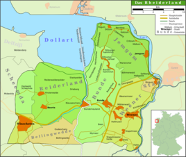
Map of the Rheiderland
|
|
|
Reformed Church in Hatzum
|
|
Hatzum in Rheiderland is a village in the municipality of Jemgum in the district of Leer in Lower Saxony in East Frisia .
The place is largely agricultural, occupies an area of 9.79 km² and has 160 inhabitants.
history
The local area of Hatzum has been settled since the early days. When raw materials were extracted for the brick industry in 1962, the remains of a settlement from the younger Bronze Age to the Hallstatt Age came to light in Boomborg , which the German Research Foundation (DFG) had investigated from 1963 to 1969 in a research project lasting several years. The archaeologists were able to uncover ten to 14 house floor plans in five settlement horizons. Most of them were three-aisled hall houses, some with associated courtyards and floor plans of storage tanks. There were also relics from craftsmen's houses. This settlement lasted until the 4th century BC. After that, the residents gave it up due to rising sea levels. Around the birth of Christ began the repopulation of the place, which was given up again 400 years later due to increased flooding.
Today's place was first built in the 8th century on the ground floor. In the course of the century, Lang threw was raised, on which the inhabitants of that time set up a trading settlement. The houses of the merchants and craftsmen stood to the right and left of the street that led over the Warfkrone. Hatzum is thus a typical Wiksiedlung . In the Middle Ages, Hatzum was the seat of a provost in the diocese of Münster until 1467 (presumably from around 1270) . The Church of St. Sebastian was probably built on a second terp towards the end of the 13th century. A chieftain's castle stood on this terp from the late Middle Ages to the beginning of the 19th century. The current place name is first mentioned in 1401 as Hartzum . It is probably a combination of the nickname Hart (e) and -um (= home).
Hatzum has belonged to the Jemgum municipality since the municipality reform that came into force on January 1, 1973.
Personalities
- Georg Schnedermann (1818–1881), chemist
literature
- Helmut Anneessen (ed.): The families of the parish Hatzum (1702–1900) . Upstalsboom-Gesellschaft, Aurich 2007, ISBN 3-934508-29-4 (Ostfriesland Ortssippenbücher, vol. 79; German Ortssippenbücher, vol. A 449).
Individual evidence
- ↑ Jemgum.de: structural data , accessed on April 14, 2018.
- ^ Federal Statistical Office (ed.): Historical municipality directory for the Federal Republic of Germany. Name, border and key number changes in municipalities, counties and administrative districts from May 27, 1970 to December 31, 1982 . W. Kohlhammer GmbH, Stuttgart / Mainz 1983, ISBN 3-17-003263-1 , p. 263 .


