Ord River (Cambridge Gulf)
| Ord River | ||
|
Ord River at Kununurra |
||
| Data | ||
| location | Western Australia , Australia | |
| River system | Ord River (Cambridge Gulf) | |
| Drain over | Ord River → Timor Sea | |
| source | Mount Wells (King Leopold Ranges) 17 ° 25 ′ 0 ″ S , 127 ° 20 ′ 45 ″ E |
|
| Source height | 531 m | |
| muzzle |
Cambridge Gulf ( Timor Sea ) east of Wyndham Coordinates: 15 ° 2 ′ 33 " S , 128 ° 8 ′ 13" E, 15 ° 2 ′ 33 " S , 128 ° 8 ′ 13" E |
|
| Mouth height | 0 m | |
| Height difference | 531 m | |
| Bottom slope | 0.87 ‰ | |
| length | 613 km | |
| Catchment area | 46,100 km² | |
| Drain |
MQ |
122,716.89 m³ / s |
| Left tributaries | Cattle Creek, Foal Creek, Survey Creek, Spring Creek, Fletcher Creek, Frank River , Piccaninny Creek, Osmand Creek, Horse Creek, Jones Creek, Padanus Creek, Lagoon Creek Bow River , Dunham River , Valentine Creek, Spring Creek | |
| Right tributaries | Sandy Creek, Reedy Creek, Wills Creek, Black Rock Creek, Panton River , Nicholson River , Linnekar Creek, Forrest Creek, White Mountain Creek, Negri River , Red Butte Creek, Spring Creek, Dry Creek, Dicks Creek, Cooee Creek, Behn River , Stockade Creek, Soda Creek, Stonewall Creek | |
| Reservoirs flowed through | Lake Argyle , Lake Kununurra | |
| Medium-sized cities | Kununurra | |
| Small towns | Old Ord River, Malangan, New Ord River, Darlu Darlu, Lake Argyle Village | |
| Communities | Argyle | |
| Navigable | north of Lake Argyle | |
|
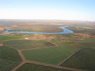
Sandalwood plantations on the Ord River |
||
The Ord River is a river in the Kimberley region in the northeast of the Australian state of Western Australia .
geography
River course
The river has its source in the sandstone mountains below Mount Wells in the eastern part of the King Leopold Ranges , about 70 km northeast of Halls Creek . Two other major rivers of the Kimberleys, namely the Fitzroy River and the Pentecost River, have their source in this area .
First, the river flows east and crosses the Great Northern Highway at the junction of the Spring Creek Track , a difficult four-wheel drive into the Bungle Bungle Range . The Ord River then flows through the southern savannas of the Purnululu National Park , forms its eastern border in the further course and finally turns north. A 100 m high dam built in 1971 has dammed its waters to Lake Argyle , the largest reservoir in Australia.
55 km further north, it had already been dammed up ten years earlier to the - much smaller - Lake Kununurra in order to make its water usable for agriculture. In the course of this ambitious Ord River Irrigation Scheme (ORIS), today's Kununurra tourist resort was created in 1961 .
The lower Ord River northwest of Kununurra flows through flat alluvial land, the Ord River Nature Reserve . In an over 50 km long estuary , em East Arm , it reaches the Cambridge Gulf , a deeply cut bay of the Joseph Bonaparte Gulf in the Timor Sea ( Indian Ocean ).
Tributaries with mouth heights
- Cattle Creek - 480 m
- Foal Creek - 396 m
- Survey Creek - 328 m
- Sandy Creek - 317 m
- Reedy Creek - 283 m
- Spring Creek - 279 m
- Fletcher Creek - 269 m
- Wills Creek - 262 m
- Black Rock Creek - 242 m
- Frank River - 224 m
- Panton River - 176 m
- Piccaninny Creek - 172 m
- Nicholson River - 167 m
- Linnekar Creek - 158 m
- Forrest Creek - 147 m
- White Mountain Creek - 133 m
- Osmand Creek - 129 m
- Negri River - 119 m
- Red Butte Creek - 109 m
- Horse Creek - 106 m
- Jones Creek - 101 m
- Padanus Creek - 98 m
- Spring Creek - 95 m
- Dry Creek - 92 m
- Lagoon Creek - 90 m
- Dicks Creek - 90 m
- Bow River - 87 m
- Cooee Creek - 87 m
- Behn River - 87 m
- Stockade Creek - 87 m
- Soda Creek - 87 m
- Stonewall Creek - 43 m
- Dunham River - 30 m
- Valentine Creek - 24 m
- Spring Creek - 17 m
Reservoirs flowed through
- Lake Argyle - 87 m
- Lake Kununurra - 40 m
Geology and landscapes
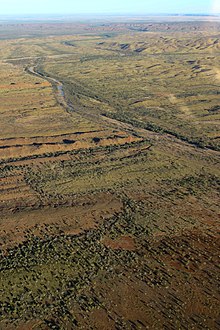
The upper course flows through sandstone mountain formations and savannah bushland; towards the end of the dry season it has no water at all or - in the outskirts of the Purnululu National Park - only sporadically in places. During the rainy season , however, it can carry so much water in the area of the junction with the Great Northern Highway that it was impassable in the past before the Jarlalu Bridge was built.
The Ord River Dam regulates the outflow to the north from Lake Argyle in such a way that the water level of the approx. 50 km long section between this and the Diversion Dam near Kununurra can be kept as constant as possible. The river, which winds through the sandstone cliffs of the Carr Boyd Ranges, offers a habitat for freshwater crocodiles as well as a rich bird life, for example the white-bellied sea eagle , various species of herons and darter .
A sophisticated system of pumping stations and canals irrigates an agriculturally usable area of 14,000 ha (since 2008, a gradual expansion to up to 72,000 ha is planned). Agriculture in these dimensions is unique to the Kimberleys. In 2010, one third of this zone is dedicated to the cultivation of sandalwood . The sandalwood plant is a parasite and needs the roots of other trees to survive, for example river eucalyptus and paper bark trees. Tall specimens of it are found in the thicket of the bank vegetation.
The lower reaches of the Ord River to its confluence with the Cambridge Gulf are under conservation alluvial land. Together with the Parry Lagoons Nature Reserve to the southwest , the area is also known as the Ord River Floodplains . The fresh water on the southern edge of this flood plain gradually changes into salt water; the savannah landscape gradually gives way to the mangroves , and both freshwater and marine fish live in the river. Over 200 species of birds have been documented in this area, which is home to the saltwater crocodile . Special protective measures are being taken to decimate undesirable species of animals (especially the cane toad and feral domestic animals) that threaten the natural landscape.
The nature reserve also includes the Emu Creek delta and other smaller rivers in the far north of the Cambridge Gulf ; Since the deeply cut Cambridge Gulf looks like an "extension" of the Ord River on the map, this upper delta is also popularly known as the False Ord River Mouths .
Infrastructure
Road links
There are no roads or paths along the Ord River, with the exception of Kununurra and its immediate vicinity. There the Victoria Highway crosses the river on Diversion Dam. The Great Northern Highway crosses the Ord River west of Purnululu National Park on the Jarlalu Bridge.
East of the Ord River, on the border with the Northern Territory , runs the Duncan Road , which connects Halls Creek with the Victoria Highway and crosses some tributaries, such as the Negri River and the Behn River. It also connects the few settlements near the river, such as Old Ord River , New Ord River, and Malangan east of Purnululu National Park, and Darlu Darlu north of it.
Shipping
On the section between the two dams - d. H. Between Lake Argyle and Lake Kununurra - in the dry season, tourist excursion boats operate on which the irrigation project and the local flora and fauna are explained.
Origin of name
The Aborigines of the region named the river Goonoonoorrang. He was later named after Harry Ord , governor of that state in the years 1877-1880.
See also
literature
- Janine Günther, Jens Mohr: Western Australia and the top end . 1st edition (2005). ISBN 3-9809763-0-0
Web links
- Agricultural Study Ord River Irrigation Scheme (PDF file; 166 kB)
Individual evidence
- ↑ a b c d e Map of Ord River, WA . Bonzle.com
- ↑ Technology in Australia - Ord River catchment regeneration project . 2008. Retrieved November 27, 2008.
- ^ Australian Natural Resources Atlas - Surface Water Management Area: Ord River (WA) . 2007. Archived from the original on July 28, 2008. Info: The archive link was automatically inserted and not yet checked. Please check the original and archive link according to the instructions and then remove this notice. Retrieved November 27, 2008.
- ^ A b Steve Parish: Australian Touring Atlas . Steve Parish Publishing Pty. Ltd. Archerfield QLD (2007). ISBN 978174193232-4 . P. 89
- ↑ Ord River Irrigation Scheme. Retrieved May 4, 2020 .


