Penzing (district of Vienna)
| Penzing | |
|---|---|
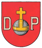
| coat of arms | map |
 |

|
From 1849 on, Penzing was an independent municipality, which from 1892 was part of the 13th district of Vienna , Hietzing , and in 1938 came to the 14th district, Penzing . Penzing is one of the 89 Viennese cadastral communities .
geography
Penzing is located in the south-east of the 14th district. It borders on the Baumgarten district to the west and the Breitensee district to the north . To the east of Penzing lies Rudolfsheim in the 15th district of Rudolfsheim-Fünfhaus and to the south, across the Wien River , the 13th district, Hietzing. The cadastral municipality of Penzing covers an area of 192.71 hectares . Since the demarcation between the 13th and 14th district was drawn strictly on the right bank of the Wien River, regardless of the previously existing borders between the cadastral communities, a strip of the cadastral community is still in the 13th district. This concerns z. B. the Schönbrunn Palace Bridge , which is divided by the district border, but belongs entirely to the Penzing cadastral community.
history
A settlement was founded here at the ford through the Wien River around 800. The name Penzing is derived from the name Benzo , the settlement is first mentioned in 1130 as Pencingen .
The center developed along the Penzinger road , first between the Einwanggasse and Nisselgasse . At the time of incorporation into the City of Vienna in 1891, the area between Wienfluss and Linzer Straße from Schlossallee to Ameisgasse was already a closed town center, which is also due to its proximity to Schönbrunn Palace . Business settlements followed, and Penzing also developed into a popular summer retreat.
Until the regulation of the Vienna River, which in this area did not take place until 1895, Penzing was repeatedly affected by floods. The Turkish sieges also caused great damage. Penzing gives its name to the 14th district of Vienna today. Originally Penzing belonged to the 13th district (Hietzing), in 1938 the Hietzing district parts north of the Vienna River were assigned to the new 14th district of Greater Vienna ; today's district boundaries were established in 1946.
Attractions
The Roman Catholic parish church of Penzing was first mentioned in a document in 1267. It was badly damaged in the course of the two Turkish sieges in 1529 and 1683, and in 1758 a fundamental baroque renovation took place. In 1945, towards the end of the Second World War, the tower roof was destroyed, after the reconstruction in 1945/46 a wedge roof was erected instead of the onion roof. Opposite the church is the Penzinger light column , a late Gothic tabernacle pillar from the 15th century.
The Penzing District Museum is located in the old office building built in 1873 . The Töpfelhaus residential building was built around 1740 and is named after its long-time owner, Johann Töpfel.
The Palais Cumberland was created around 1760 by converting an older palace. The palace was later changed again and partially removed. In 1867 it was converted with a neighboring house into the residence of King George V of Hanover (who lived in exile in Austria under the title Duke of Cumberland). For years the palace housed the family's art collections, including the famous Welf Treasure . Today one part of the palace is the seat of the Max Reinhardt Seminar , another part houses the Czech Embassy.
The Evangelical Kreuzkirche , which was built in 1930/31, is located on Cumberlandstrasse .
Personalities
- Natalie Bauer-Lechner (1858–1921), violist
- Eugen Fassbender (1854–1923), architect and urban planner
- Eduard von Haerdtl (1861–1897), astronomer
- Ernst August von Hannover (1887–1953), last ruling Duke of Braunschweig
- Franz Conrad von Hötzendorf (1852–1925), field marshal, chief of the general staff for the entire armed power of Austria-Hungary
- Alfred von Kremer (1828–1889), orientalist and politician
- Jörg Lanz von Liebenfels (1874–1954), clergyman, occultist, impostor, racial theorist and anti-Semite
- Johann Soelch (1883–1951), geographer, rector of the University of Vienna
- Otto Wagner (1841–1918), one of the most prominent architects in Vienna
literature
- Hertha Wohlrab: Penzing: History of the 14th district of Vienna and its old places . Jugend und Volk, Vienna 1985, ISBN 3-224-16209-0
Web links
- Virtual walk through the center of Penzing
- District Museum Penzing - History of the 14th district of Vienna
Coordinates: 48 ° 11 ' N , 16 ° 18' E


