
Qishan (Kaohsiung)
|
Qishan 旗山 區 |
|||
.svg) Location of the Qishan District in Kaohsiung |
|||
| State : |
|
||
| Coordinates : | 22 ° 52 ' N , 120 ° 28' E | ||
| Area : | 94.6122 km² | ||
| Residents : | 36,391 (Aug 2019) | ||
| Population density : | 385 inhabitants per km² | ||
| Time zone : | UTC + 8 (Chungyuan time) | ||
| Telephone code : | (+886) (0) 7 | ||
| Postal code : | 842 | ||
| ISO 3166-2 : | TW-KHH | ||
| Community type : | Municipality of Kaohsiung | ||
| Structure : | 21 districts (里) | ||
| Website : | |||
|
|||

Qishan or Cishan ( Chinese 旗山 區 , Pinyin Qíshān Qū , Tongyong Pinyin Císhan Cyu ), formerly also Chishan , is a district of Kaohsiung in the Republic of China (Taiwan) .
Location description
Qishan has an elongated, approximately pointed wedge-shaped shape, with the tip pointing north-northeast. The longitudinal extension is 25 kilometers and the maximum transverse extension is 7.5 kilometers. The neighboring counties in Kaohsiung are Dashu in the south, Yanchao and Tianliao in the southwest, Neimen in the northwest, Shanlin in the northeast, and Meinong in the east. To the southeast, Qishan borders Ligang in Pingtung County . In almost its entire length, Qishan is traversed by the small river or brook Nanzixian ( 楠梓仙溪 , Nánzǐxiān Xī , also Quishan 旗山溪 , Qíshān Xī ), which in the southeastern section forms the border to the neighboring district of Ligang and flows into the Gaoping River .
history
An older name of Qishan is Fanshu ( 蕃薯 寮 , Fānshǔ liáo - "sweet potato hut"). According to tradition, the name goes back to an old man who sold sweet potato paste here . From 1920 Shanlin was a 'village' ( 庄 , Zhuāng ) in Takao Prefecture and received the name Qishan , after the highest point, the 318 m high Qiweishan ( 旗尾 山 , ). After the island of Taiwan was taken over by the Republic of China in 1945, the prefecture became Kaohsiung County and Qishan was reorganized as a 'township' ( 鎮 , Zhèn ) in April 1946 . On December 25, 2010, the county was incorporated into Kaohsiung City and Qishan became a municipality ( 區 , Qū ) of Kaohsiung.
![]()
population
At the end of 2017, 61 people belonged to the indigenous peoples of Taiwan (approx. 0.4%). Hakka's share was around 60%.
| Outline of Qishans |

|
Administrative division
Qishan is further subdivided into 21 districts (里, Li ):
1 Dalin ( 大林 里 )
2 Zhongzheng ( 中正 里 )
3 Yuanfu ( 圓 富 里 )
4 Dongping ( 東 平 里 )
5 Yonghe ( 永和 里 )
6 Ruiji ( 瑞吉 里 )
7 Zhufeng ( 竹 峰 里 )
8 Meizhou ( 湄洲 里 )
9 Taiping ( 太平 里 )
10 Dade ( 大 德里 )
11 Sanxie ( 三 協 里 )
12 Dongchang ( 東昌 里 )
13 Guangfu ( 廣 福 里 )
14 Kunzhou ( 鯤 洲 里 )
15 Shangzhou ( 上 洲 里 )
16 Dashan ( 大 山里 )
17 Zhongzhou ( 中洲 里 )
18 Nanzhou ( 南 洲 里 )
19 Xinguang ( 新光 里 )
20 Nansheng ( 南 勝 里 )
21 Zhongliao ( 中寮 里 )
economy
Agricultural products are (with harvest times): bananas (April - June), papaya (April - June), lychee (June), longan (July), coconut (July - September) and ginger (December - February).
traffic
Provincial road 29 runs largely along the longitudinal axis of Qishan in a north-north-east direction. In the middle section, it is crossed by provincial roads 21 (west-east direction) and 3 (north-west-south-east direction). In the southern section, highway 10 runs in two sections and highway 3 in the southwest over the area of Qishan.
Landmarks, tourism
The "old street" in the district of Zhongshan was built in the 1920s during the Japanese colonial era in a kind of historicizing neo-baroque style. The Tianhou Temple ( 天 后宮 , Tiānhòu gōng , ) in the district of Meizhou goes back to the reign of Jiaqing in the 19th century. Mainly the sea goddess Mazu is worshiped here. The old sugar factory ( 旗山 糖廠 , Qíshān tángchǎng , ) was in operation from 1909 to 2002 and the area was then partially converted into an amusement park.
![]()
![]()

"Old Street" in Qishan

Tianhou Temple
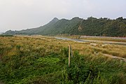
Qiweishan


Web links
Individual evidence
- ↑ 歷史 沿革 ("Historical Development"). Qishan's website, September 16, 2019, accessed September 18, 2019 (Traditional Chinese).
- ↑ About Cishan. Qishan's website, July 26, 2019, accessed September 18, 2019 .
- ↑ 原住民 戶數 及 人數 Households and Persons of Indigenous People. (xls) Taiwan Ministry of the Interior, accessed August 4, 2018 (Chinese, English).
- ↑ 楊文 山 (Yang Wenshan): 全國 客家 人口 基礎 資料 調查 研究 ("Basic data survey on the national Hakka population") . 2004, ISBN 957-01-9320-4 , Appendix: 鄉鎮 市區 臺灣 客家 人口 數 及 比例 (“Number and Proportion of the Taiwanese Hakka Population in Towns and Cities”) (Chinese (traditional), online ).
- ↑ 行政 區域 ("administration area"). Qishan's website, July 26, 2019, accessed September 18, 2019 .
- ↑ Travel Information. Qishan's website, September 20, 2019, accessed September 20, 2019 .
- ^ Cishan (Qishan) Old Street Commercial District. Kaohsiung City Tourism Office (khh.travel), September 23, 2019, accessed on September 23, 2019 .
- ↑ Jhongshan Old Street. Kaohsiung City website, July 26, 2019, accessed September 23, 2019 .
- ^ Cishan Tianhou Temple. Kaohsiung City website, July 26, 2019, accessed September 23, 2019 .
- ↑ 旗山 糖廠 冰 品 部 ("Ice Cream Section of Qishan Sugar Factory"). Taisugar, Retrieved September 23, 2019 (Traditional Chinese).

Core city: Nanzi | Zuoying | Gushan | Sanmin | Yancheng | Qianjin | Xinxing | Lingya | Qianzhen | Qijin | Xiaogang
Outer city: Fengshan | Daliao | Niaosong | Linyuan | Renwu | Dashu | Dashe | Gangshan | Luzhu | Qiaotou | Ziguan | Mituo | Yong'an | Yanchao | Tianliao | Alian | Qieding | Hunei | Qishan | Meinong | Neimen | Shanlin | Jiaxian | Liugui