Röthenbach (Pegnitz)
| Roethenbach | ||
|
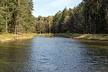
The Röthenbach in the Rumpelbach Gorge |
||
| Data | ||
| Water code | DE : 24228 | |
| location | Bavaria | |
| River system | Rhine | |
| Drain over | Pegnitz → Regnitz → Main → Rhine → North Sea | |
| source | in the Fürstenschlag northeast of Altdorf near Nuremberg 49 ° 23 '52 " N , 11 ° 22' 28" E |
|
| Source height | approx. 435 m above sea level NHN | |
| muzzle | at Röthenbach an der Pegnitz from the left into the Pegnitz Coordinates: 49 ° 29 '11 " N , 11 ° 14' 4" E 49 ° 29 '11 " N , 11 ° 14' 4" E |
|
| Mouth height | below 315 m above sea level NHN | |
| Height difference | approx. 120 m | |
| Bottom slope | approx. 5.6 ‰ | |
| length | approx. 21.5 km | |
| Catchment area | approx. 79 km² | |
The Röthenbach is a 21 km long river in the district of Nürnberger Land , which initially runs roughly west, later roughly northwest and flows in Röthenbach an der Pegnitz from the left and finally almost south into the Pegnitz, which flows almost west there .
geography
course
The Röthenbach arises just under two kilometers northeast of Altdorf near Nuremberg in the Fürstenschlag forest and runs from here to the west. After about half a kilometer it leaves the forest at a golf driving range and soon takes a small tributary from the outskirts of Altdorf from the left, divides the Ziegelhütte district and then crosses the larger Röthenbach near Altdorf (!) To the western edge of the town, where it then bends to the northwest. While still on the outskirts, it enters the large Winkelhaid state forest and first passes through the small Rumpelbach gorge , also known as Röthenbach gorge. After the valley has widened again, it is crossed by the A 6 , then the valley and stream run westwards again. The Röthenbach feeds a small chain of ponds in the closed forest, after which the corridor opens to the right of the course around the Winkelhaid district of Ungelstetten , which the small river touches in the south, then bends continuously to the northwest along its edge and rejoins the Winkelhaid state forest .
In it and in the adjoining state forest of Brunn , two smaller streams flow one after the other from the left, which have sources at the Kalten Brunnen and the Hühnerbrünnlein . Then again flow from the left to 350.6 m above sea level. NN close to the eponymous car park at the A 3 the larger Luder ditch and further downstream of the back shorter clean ditch before from right and east and 339.8 m above sea level. NN the largest tributary Haidelbach flows in, which can be compared to the Röthenbach upper reaches in terms of length and catchment area. Near the Nuremberg motorway junction , the Röthenbach passes the ponds Großer Birkensee and Kleiner Birkensee on the left, beyond a ridge , two quarry ponds created during sand mining and fed by the groundwater. It then crosses under the A 9 at the northeast leg of the junction and then runs out of the forest, which is now part of the municipality of Röthenbach an der Pegnitz, and, in sections, through an industrial zone south of its mouth. He then enters the western settlement area under a bridge on the Nuremberg – Schwandorf railway line . After a tight curve to the right of almost 180 ° around the Schnackenhof, the Röthenbach flows into the floodplain of the river from the left and finally, almost against its inflow direction, southerly course at the waterworks of Röthenbach an der Pegnitz into the Pegnitz .
Chain of ponds near Ungelstetten
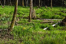
To the southeast of the Winkelhaid district of Ungelstetten lies a chain of ponds about one kilometer long . The ponds are fed or flowed through by the Röthenbach. The chain includes eight larger ponds and a few smaller fish rearing tanks. The still waters were created between 1970 and 1986 and leased to the Altdorf fishing association. They have been dredged several times over the years. The easternmost pond is partly silted up. East of the chain of ponds, the floodplain is narrower and swampy.
Beavers that have settled in the area since the 2010s continue to damage the dams. They had already been broken in several places and had to be completely rebuilt.
Tributaries
From the source to the mouth.
- (Inflow from the north of Altdorf), from the left in front of Ziegelhütte .
- (Inflow from the Waldgewann Vogelherd ), from the left in the Winkelhaid State Forest.
-
 Runs through a chain of ponds.
 - (Inflow from the Kalten Brunnen ), from the left in the Winkelhaid state forest on the northwest tip of the cleared island around Ungelstetten .
- (Inflow from the Hühnerbrünnlein ), from the left in the Winkelhaid state forest.
- Ludergraben , from the left to 350.6 m above sea level. NN in the state forest Brunn at the parking Luder Burrowing A 3 .
- Trench , from the left shortly afterwards in the state forest of Brunn.
- Haidelbach , from the right to 339.8 m above sea level. NN in the Staatsforst Brunn between the A3 on the left and a sand pit on the right edge.
-
 Großer Birkensee , left at 333.7 m above sea level. NN next to the run near the motorway junction Nuremberg , approx. 5.7 ha. Bathing lake.
 -
 Kleiner Birkensee , left at the motorway junction, approx. 2.0 ha.
 - Finstergraben , from the right before crossing under the A 9 .
- Geißgraben , from the right just before the forest exit into the industrial zone.
- (Inflow), from the left just before the railway bridge.
Localities
and settlement sites on the course from the source to the mouth. Only the deepest nesting locations are adjacent to water.
- City of Altdorf near Nuremberg
- Brick hut (village)
- Röthenbach near Altdorf (village, mostly on the right)
- Winkelhaid area free of parish
- (settlement-free state forest)
- Winkelhaid municipality
- Ungelstetten (village, right)
- Brunn area free of parishes
- (settlement-free state forest)
- City of Röthenbach an der Pegnitz
- (settlement-free community exclave around the birch lakes)
- Brunn area free of parishes
- (state forest free of settlement, very briefly left)
-
Haimendorfer Forest
- (settlement-free forest, very short)
- City of Röthenbach an der Pegnitz
- Commercial zone near Grünthal
- Röthenbach (central city)
- Schnackenhof (settlement area, left)
history
In the Middle Ages there were building attempts to divert the Röthenbach into the Fischbach . The remains of the failed attempt at the Lined Trench are still clearly visible today .
See also
literature
- Johann Kaspar Bundschuh : Röthenbach . In: Geographical Statistical-Topographical Lexicon of Franconia . tape 4 : Ni-R . Verlag der Stettinische Buchhandlung, Ulm 1801, DNB 790364301 , OCLC 833753101 , Sp. 573 ( digitized version ).
Web links
- Course of the Röthenbach on the BayernAtlas
Individual evidence
- ↑ a b According to the contour line image on the BayernAtlas of the Bavarian State Government ( notes )
- ↑ Measured on the BayernAtlas of the Bavarian State Government ( notes )
- ↑ Measured according to watercourses and contour lines on the BayernAtlas of the Bavarian State Government ( notes )
- ↑ BayernAtlas, time travel around 1969 (accessed June 17, 2019)
- ↑ BayernAtlas, time travel around 1985 (accessed June 17, 2019)
- ↑ www.fischereiverein-altdorf, history of the association (accessed on June 17, 2019)
- ↑ a b Measured on the BayernAtlas of the Bavarian State Government ( notes )


