
Ludergraben (Röthenbach)
| Ludergraben | ||
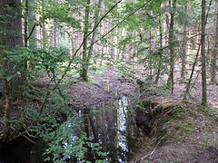
 Ludergraben spring pot |
||
| Data | ||
| Water code | DE : 242282 | |
| location | Germany | |
| River system | Rhine | |
| Drain over | Röthenbach → Pegnitz → Regnitz → Main → Rhine → North Sea | |
| source | south of Birnthon in the Winkelhaid state forest 49 ° 24 ′ 20 ″ N , 11 ° 15 ′ 39 ″ E |
|
| Source height | 405 m above sea level NHN | |
| muzzle | east of Brunn (Nuremberg) at the A3 car park in Röthenbach Coordinates: 49 ° 26 ′ 12 ″ N , 11 ° 16 ′ 22 ″ E 49 ° 26 ′ 12 ″ N , 11 ° 16 ′ 22 ″ E |
|
| Mouth height | 351 m above sea level NHN | |
| Height difference | 54 m | |
| Bottom slope | approx. 11 ‰ | |
| length | approx. 4.7 km | |
| Catchment area | 7.08 km² | |
| Right tributaries | Chicken well | |
The Ludergraben is an approximately 5 km long left tributary of the Röthenbach in the Lorenzer Reichswald south-east of Nuremberg . It flows through the areas of the three inhabited Nuremberg exclaves Brunn , Birnthon and Netzstall , which belong to statistical district 97 , in the Lorenzer Reichswald, which is otherwise mostly divided into community-free state forests. It is one of the Nuremberg ditches and is a 3rd order flowing water .
geography
River course
The upper reaches of the Ludergraben arise from numerous source streams southwest and south of Birnthon, whose sources are in the Fischbach state forest or in the Winkelhaider forest on the northern slope of up to 434 m above sea level. NHN high hill ridge Geißleite at heights of 405 m above sea level. Arise from NHN . Just before the southwest corner of the clearing island of Birnthon, these tributaries have all combined into one body of water and now flow northeast into the Nuremberg exclave, which is congruent with the clearing. A little before the stream touches the settlement area of the village, it flows from the right to only about 382 m above sea level. NHN the Hühnerbrunngraben, which rises in a very similar position and height as the other source streams southeast in the Winkelhaider Forest. The Ludergraben then flows along the western edge of the village and, after leaving the village, passes under the previously roughly parallel local road Birnthon , then at a constant distance from the village the district road Nürnberg – Altdorf (LAU 13). After passing a waterworks on the left bank, the brook re-enters the forest of the community-free Fischbach area on the northern edge of the corridor.
On its northern course, the stream crosses a forest path bridge, immediately afterwards two side arms of greater length run towards it near a forest path crossing from the left and right. The stream does not flow into the open corridor around Netzstall, which begins further north, but passes it close in now in a north-easterly direction, changing into the forest corridor of Brunn , which belongs to the city of Nuremberg. It crosses under Mooskammstrasse , beyond which the clearing island around Brunn itself lies in the northwest, and runs alongside it northeast towards the A3 . Shortly before he passes under this at the southern edge of the Ludergraben / Fuchsmühle parking lot , he enters the Winkelhaider area again. On the other side, it soon leaves the area wedge that encompasses the motorway at the crossing under the local connecting road Ungelstetten –Brunn and then flows straight to 351 m above sea level. NHN in the community-free Brunner Staatsforst from the left into the Röthenbach .
Catchment area
It covers about 7 km² and is mostly forested. The watershed in the north runs from the summit of Brunner Berg ( 438 m above sea level ) on the northwest corner of the catchment area to the mouth ( 351 m above sea level ) on the northeast corner, the area behind drains further down into the Röthenbach. Behind the eastern watershed there is also the catchment area of the Röthenbach, here above the mouth of the Ludergraben. Around the southern watershed, the A 6 runs westward on the ridge of up to 434 m above sea level. NHN high Geißleite , on the other side of which the Gauchsbach discharges the precipitation roughly southwest into the Schwarzach . The remaining western watershed between western Geißleite and Brunner Berg is 395 m above sea level on Netzstaller tendrils , on which it extends slightly to the west . Intermediate high reaching NHN ; The catchment area of the Fischbach , which drains westward over the Goldbach to the Pegnitz in Nuremberg, borders along its entire length .
The two highest peaks are the Brunner Berg and the Geißleite.
Tributaries
- Hühnerbrunngraben (right)
- Two tributaries at a forest path crossing (left and right)
Pegnitz river system
nature
The bitch trench flows through the in the range Birnthon conservation area Birnthon ( LSG-00536.12 ), and in the northern part of the landscape reserve Brunn-Netzstall (LSG-00536.11).
particularities
To the south of Netzstall, east of Ludergraben, runs an approximately one-and-a-half kilometer-long section of the Gefütterten Graben . This still preserved section begins near the Röthenbach and runs in an almost straight line to the west and would have crossed the Ludergraben had it never been further built.
A parking lot opened in August 2011 on the A3 was named after Ludergraben. In the area of this parking lot it runs underground.
Picture gallery

Ludergraben headwaters

Chicken well

Ludergraben near Netzstall
Ludergraben near Netzstall

A3 Ludergraben car park exit sign

Ludergraben just before the mouth


_kurz_vor_der_M%C3%BCndung_2015-06-06_19.02.34.jpg)
See also
Individual evidence
- ↑ a b BayernAtlas of the Bavarian State Government ( notes )
- ↑ a b List of brook and river areas in Bavaria - Main river area, page 45 of the Bavarian State Office for the Environment, as of 2016 (PDF; 3.3 MB)
- ↑ World Database on Protected Areas - LSG Birnthon (English)
- ↑ World Database on Protected Areas - LSG Brunn – Netzstall (English)
- ↑ nordbayern.de:Opening of the park on the A3 accompanied by protests
Web links
- Map of the course and catchment area of the Ludergraben on: BayernAtlas of the Bavarian State Government ( information )
- Map of the course and catchment area of the Ludergraben on: Map service water management, FGN Bavarian State Office for the Environment ( information )
- Map service water management, FGN Bavarian State Office for the Environment ( information )
- Map service system of the Bavarian State Office for the Environment (LfU)