Radlseehütte
| Radlseehütte AVS hut category I |
||
|---|---|---|
|
Radlseehütte in summer |
||
| location | East of the Königsangerspitze on the Radlsee; South Tyrol , Italy | |
| Mountain range | Sarntal Alps | |
| Geographical location: | 46 ° 42 '28.5 " N , 11 ° 34' 48.4" E | |
| Altitude | 2284 m slm | |
|
|
||
| owner | Brixen section of the AVS | |
| Built | First hut in 1912, new building in 1956 | |
| Construction type | hut | |
| Usual opening times | Mid-May to late October | |
| accommodation | 24 beds, 26 camps | |
| Winter room | 6 bearings | |
| Web link | Radlseehütte | |
| Hut directory | ÖAV DAV | |
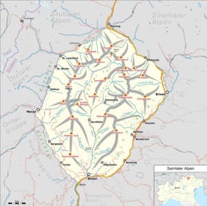
The Radlseehütte ( Italian: Rifugio Lago Rodella ) is a refuge in the Sarntal Alps in South Tyrol . It is located at an altitude of 2284 m slm east of the Königsangerspitze near the Radlsee , which is located in a hollow between Hundskopf and Königsangerspitze. The Radlsee is located above the Eisack Valley at an altitude of 2250 m .
history

The first hut at Radlsee was built in 1912 as a private building by the first landlord, Anton Mayr from Brixen . From July 1913 it was managed. Due to the large number of ski tourers , the first Radlseehaus was also open in winter. Even after Anton Mayr fell in World War I, his family continued to run the house until 1940. The Radlseehütte came into the possession of the "Ente Nazionale per le Tre Venezie", a fascist organization for the economic Italianization of South Tyrol. However, the house was neglected, looted and ultimately burned down.
In 1950 the Alpine Association of South Tyrol took the decision to rebuild and acquired the land from the municipality of Brixen. Construction began in 1954 with the support of the military and was completed in two years for 2 million lire. The new hut was opened on July 29, 1956. In 1965 the first major renovation was necessary, in 1973 a material ropeway was built to supply the hut. In 1982 an extension added to the old stone building with additional bedrooms, living rooms and sanitary rooms. In 2001 the hut received the environmental seal of approval for Alpine Club huts .
Increase opportunities
The following climbs to the Radlseehütte are common:
- From the east, from the Perlungerhof in Gereuth ( 1380 m ) in a walking time of 2½ hours.
- From the southeast, from Oberschnauders ( 1227 m ) in a walking time of 2 hours.
- From the south, from Garner Wetterkreuz ( 1411 m ) in a walking time of 2 hours.
Tour possibilities
The most popular tour from the Radlseehütte is the ascent of the Königsangerspitze ( 2439 m ), which can be reached in just 30 minutes from the hut. The ascent to the Hundskopf ( 2354 m ) to the east of the hut is even shorter and can be reached in just 15 minutes.
The following transitions to other huts are possible:
- To the Klausner hut ( 1919 m ) in a walking time of 2 hours.
- To the Latzfonser Kreuz shelter ( 2305 m ) in a walking time of 2½ hours.
- To the Flaggerschartenhütte ( 2481 m ) in a walking time of 5 to 6 hours.
Literature and maps
- Hanspaul Menara : South Tyrolean summit hikes . Athesia, Bozen 2001, ISBN 88-8266-013-3
- Karl Felix Wolff : The Radlseehaus in the Sarntal Alps and its surroundings: a guide for mountain hikers . Bolzano 1912
- Freytag & Berndt-Verlag Vienna, hiking map 1: 50,000, sheet WKS 4, Sterzing - Brixen , ISBN 3-85084-794-2
- Topographic hiking map, Bressanone / Brixen , sheet 030, 1: 25,000, Casa Editrice Tabacco, ISBN 88-8315-030-9
Web links
Individual evidence
- ^ Hanspaul Menara: South Tyrolean refuges . A picture book. Athesia, Bozen 1983, ISBN 88-7014-017-2 , p. 142-143 .
- ^ The "environmental seal of approval" , alpenverein.de

