Flaggerschartenhütte
| Flaggerschartenhütte Rifugio Forcella Vallaga |
||
|---|---|---|
|
Flaggerschartenhütte from the north, summit on the left in the background: Jakobsspitze |
||
| location | North-east of the Flaggerscharte at the Flaggersee; South Tyrol , Italy ; Valley location: Durnholz | |
| Mountain range | Sarntal Alps | |
| Geographical location: | 46 ° 46 ′ 17.9 " N , 11 ° 29 ′ 15" E | |
| Altitude | 2481 m slm | |
|
|
||
| owner | Autonomous Province of Bolzano - South Tyrol | |
| Built | 1913/1914 | |
| Construction type | hut | |
| Usual opening times | Early June to late October | |
| accommodation | 16 beds, 24 camps | |
| Winter room | 4 bearings | |
| Hut directory | ÖAV DAV | |
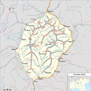
The Flaggerschartenhütte ( Italian Rifugio Forcella Vallaga , also Marburger Hütte or Marburg-Siegener Hütte ) is a refuge in the eastern ridge of the Sarntal Alps in South Tyrol . It is located northeast of the Flaggerscharte at the Flaggersee.
history
In 1910 the construction of the hut was decided by the Marburg and Siegerland sections of the German and Austrian Alpine Club . The concrete implementation should be supported by the Brixen section. Construction began in 1913 and the hut was completed in 1914. From July 1, 1914, it was managed, but the opening ceremony planned for August 9 no longer took place due to the outbreak of the First World War. In 1923 the Italian state expropriated the hut, which had meanwhile been badly damaged, and handed it over to the Brixen section of the Club Alpino Italiano (CAI). The hut had to close several times due to low visitor numbers. In 1975 the Franzensfeste section took over the hut and expanded it with an extension.
Together with 24 other shelters expropriated by the state, the Flaggerschartenhütte became the property of the Autonomous Province of Bolzano - South Tyrol in 1999; At the end of 2010, the license for their management by the CAI expired. Since 2015, the state of South Tyrol has been supported in the management of the hut (assignment to tenants, supervision of management, renovation measures) by a joint commission, in which the AVS and CAI are represented in addition to the public sector .
Increase opportunities
The hut can be reached from the west, from the Sarner side, and from the east, from Mittewald in the Wipptal . The shortest westerly climb leads from Lake Durnholz through the Seebach valley and takes about 2½ to 3 hours. The ascent from the east is much longer, it leads through the Flaggertal and takes a good 5 hours.
Tour possibilities
The most popular summit tours from the hut are as follows:
- Jakobsspitze ( 2741 m ), just under 1 hour
- Tagewaldhorn ( 2708 m ), about 1½ hours
- Hörtlanerspitze ( 2660 m ), just under 1 hour
The following transitions to other huts are possible:
- Alpenrosenhof on the Penser Joch ( 2211 m ), 4 hours
- Klausner Hut ( 1923 m ), 4–5 hours
- Latzfonser Kreuz mountain hut ( 2311 m ), 4–5 hours
- Radlseehütte ( 2284 m ), 5–6 hours
The hut is the base of the Sarntal Horseshoe Tour , which crosses the east and west ridge of the Sarntal Alps in six to seven days.
Literature and maps
- Hanspaul Menara : South Tyrolean summit hikes . Athesia, Bozen 2001, ISBN 88-8266-013-3
- Hiking map 1: 50,000, sheet WKS 4, Sterzing - Brixen . Freytag & Berndt-Verlag Vienna, ISBN 3-85084-794-2
- Tabacco card sheet 40 Sarntal Alps , ISBN 978-8883150548
Web links
- Homepage of the Flaggerschartenhütte
- Flaggerschartenhütte in the historical Alpine archive of the Alpine clubs in Germany, Austria and South Tyrol (temporarily offline)
Individual evidence
- ^ Hanspaul Menara: South Tyrolean refuges . 2nd Edition. Athesia, Bozen 1983, ISBN 88-7014-017-2 , p. 142 .
- ↑ Transition of the refuges: basis laid for leadership body. Autonomous Province of Bolzano - South Tyrol, press releases, October 2, 2009, accessed on January 30, 2012 .
- ↑ refuges. Autonomous Province of Bolzano - South Tyrol, Asset Management Department, accessed on January 30, 2012 .
- ^ Refuge: Agreement signed between Land, CAI and AVS. Autonomous Province of Bolzano - South Tyrol, press releases, July 8, 2015, accessed on July 8, 2015 .

