
Rehetobel
| Rehetobel | |
|---|---|
 |
|
| State : |
|
| Canton : |
|
| District : | former district of Vorderland |
| BFS no. : | 3034 |
| Postal code : | 9038 |
| Coordinates : | 754 221 / 254848 |
| Height : | 953 m above sea level M. |
| Height range : | 615–1122 m above sea level M. |
| Area : | 6.72 km² |
| Residents: | 1747 (December 31, 2018) |
| Population density : | 260 inhabitants per km² |
|
Proportion of foreigners : (residents without citizenship ) |
10.6% (December 31, 2,014) |
| Website: | www.rehetobel.ch |
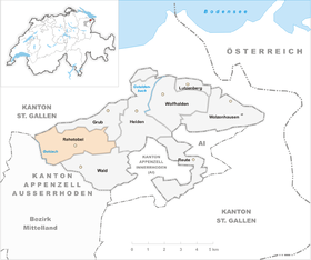
 Rehetobel |
|
| Location of the municipality | |
  |
|
Rehetobel ( Alemannic Rechtobel ) is a municipality in the foothills of the canton of Appenzell Ausserrhoden in Switzerland .
Geography and traffic
Rehetobel is the third highest municipality in the canton after Schwellbrunn and Wald . The place lies between St. Gallen (from there about 20 minutes by car) and Heiden, which are connected by a post bus line. Forest and troughs lie further south . The lowest point is the Achmüli at 610 m above sea level. M., the highest point is the Kaienspitz at 1120 m above sea level. M.
population
The 1,732 residents of Rehetobel are made up as follows (as of December 31, 2014):
Denominations:
- Protestant Reformed: 49.5%
- Roman Catholic: 26.4%
- other / without: 24.1%
Gender:
- female: 51%
- male: 49%
| Population development | |
|---|---|
| year | Residents |
| 1980 | 1363 |
| 2000 | 1742 |
| 2004 | 1786 |
| 2010 | 1703 |
| 2020 | 2163 |
history
Church building
On August 29, 1669, the Rehetobler Church was completed after a construction period of two and a half years. The construction of the church made Rehetobel independent of the parishes in Trogen and Herisau .
Village fire in 1796
The pastor who was resident there at the time, Johannes Lutz, did not - contrary to his custom - mention the village fire in any report in the books he updated. Only the following sentence remained: "In the afternoon of April 9th in 1796, a terrible conflagration broke out in a bakery up in the village because all the houses in the church were burned down and the church was saved as if by a miracle of God."
Later investigations found out that at the time of the fire a “relatively strong” earthquake raged and damaged the oven of the bakery. A strong northwest wind helped the fire quickly attack surrounding homes. A total of eleven houses and nine outbuildings went up in flames.
Village fire in 1890
On June 21, 1890, after 6 p.m., fire broke out in the two assembled houses of Leonhard Rohner and Konrad Tanner in the village, which was immediately transferred to the rectory opposite, to the house of the widow Egger and the syringe house due to the strong southwest wind.
A short time later, the fire spread to the church, which was soon blazing and the tower, which had been renovated only four years earlier, soon caught fire. At 9 p.m. the tower collapsed and only the walls and the four-year-old building remained standing thanks to the iron belfry. However, the bells became unusable and had to be re-cast.
Names
The name Rehetobel appears relatively late in the documents compared to the communities in the area, in 1463 in a letter of foundation from the church in Trogen. The document mentions goods that come into contact with the forest, the Reh Tobel and the Troger Tobel. Another good on the nose is also adjacent to the Deer Tobel.
The name Rehetobel originally only referred to the Waldtobel below the Rechberg, the Moosbachtobel. This was named from the Rechberg and Rehetobel is therefore an abbreviation from Rechbergtobel. In the still common vernacular form of Rechtobel , the Old High German animal name Réh has been changed to rech in front of the subsequent consonant , similar to Rechberg or Rechstein. It is believed that Rehetobel was settled between 1000 and 1300.
Gastronomy and economy


You can dine in the Gupf (on a hill, the Gupf northeast of the village) and in other restaurants.
Attractions
A collection of historical bicycles with objects from two centuries, from the beginning of the bicycle age to the present day, can be viewed in the Rehetobel Velomuseum. The Velomuseum is also an adventure museum; Small and large tours can be undertaken with the antique bicycles.
photos

Rehetobel from the northeast, July 2019

Rehetobel

Catholic Church

Parish hall

Schoolhouse village

Sägholzstrasse


literature
- Eugen Steinmann: The art monuments of the canton of Appenzell Ausserrhoden, Volume 3: The district of Vorderland. Birkhäuser, Basel 1981, ISBN 3-7643-1251-3 . (= The Art Monuments of Switzerland , Volume 72.) P. 23–70.
Web links
- Official website of the municipality of Rehetobel
- Thomas Fuchs: Rehetobel. In: Historical Lexicon of Switzerland .
Individual evidence
- ↑ Permanent and non-permanent resident population by year, canton, district, municipality, population type and gender (permanent resident population). In: bfs. admin.ch . Federal Statistical Office (FSO), August 31, 2019, accessed on December 22, 2019 .
- ↑ a b community in numbers. Retrieved November 11, 2015 .
Buhler | Gais | Grub | Pagans | Herisau | Hundwil | Lutzenberg | Rehetobel | Tail | Schönengrund | Schwellbrunn | Memory | Stone | Teufen | Trogen | Urnaesch | Forest | Waldstatt | Walzenhausen | Wolf heaps
Canton of Appenzell Ausserrhoden | Districts of Switzerland | Municipalities of the canton of Appenzell Ausserrhoden