Schönengrund
| Schönengrund | |
|---|---|
| State : |
|
| Canton : |
|
| District : | former Hinterland district |
| BFS no. : | 3003 |
| Postal code : | 9105 |
| UN / LOCODE : | CH SHB |
| Coordinates : | 735 134 / 243 229 |
| Height : | 841 m above sea level M. |
| Height range : | 787–1275 m above sea level M. |
| Area : | 5.19 km² |
| Residents: | 532 (December 31, 2018) |
| Population density : | 103 inhabitants per km² |
| Website: | www.schoenengrund.ch |
|
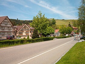
In Schönengrund, May 2004 |
|
| Location of the municipality | |
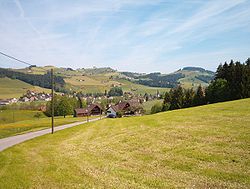
Schönengrund is a municipality in the Hinterland district of the canton of Appenzell Ausserrhoden in Switzerland . Schönengrund and Wald SG form the village of Schönengrund-Wald.
Schönengrund lies between Schwellbrunn and St. Peterzell or Hemberg .
population
| Population development | |
|---|---|
| year | Residents |
| 1980 | 404 |
| 2000 | 459 |
| 2010 | 496 |
Sightseeing and tourism
The village has a small ski lift and two cross-country trails.
The Hochhamm (1275 m) is Schönengrund's local mountain, about an hour's walk from the village - until 1992 a chairlift led up. To the west of the summit is the Hochhamm mountain restaurant (1211 m).

Aerial photo from 100 m by Walter Mittelholzer from 1920
|
See also
Web links
Commons : Schönengrund - collection of images, videos and audio files
- Official website of the community of Schönengrund
- Thomas Fuchs: Schönengrund. In: Historical Lexicon of Switzerland .
Individual evidence
- ↑ Permanent and non-permanent resident population by year, canton, district, municipality, population type and gender (permanent resident population). In: bfs. admin.ch . Federal Statistical Office (FSO), August 31, 2019, accessed on December 22, 2019 .


