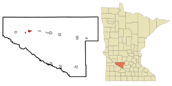
Renville
| Renville | |
|---|---|
|
Location in Minnesota
|
|
| Basic data | |
| Foundation : | 1878 (created) 1906 (incorporated) |
| State : | United States |
| State : | Minnesota |
| County : | Renville County |
| Coordinates : | 44 ° 47 ′ N , 95 ° 13 ′ W |
| Time zone : | Central ( UTC − 6 / −5 ) |
| Residents : | 1,287 (as of 2010) |
| Population density : | 357.5 inhabitants per km 2 |
| Area : | 3.6 km 2 (approx. 1 mi 2 ) |
| Height : | 327 m |
| Postal code : | 56284 |
| Area code : | +1 320 |
| FIPS : | 27-53890 |
| GNIS ID : | 649934 |
| Website : | www.ci.renville.mn.us |
| Mayor : | Janette Wertish |
Renville is a small town (with the status " City ") in Renville County in the US -amerikanischen State Minnesota . In 2010 Renville had 1287 residents.
geography
Renville is located in central southwest Minnesota at 44 ° 47'21 "north latitude and 95 ° 12'42" west longitude. The city extends over an area of 3.6 km².
Neighboring towns to Renville are Prinsburg (18.1 km north), Danube (9.4 km east), Sacred Heart (11.3 km west), and Clara City (30.2 km northwest).
The nearest major cities are Minneapolis (173 km east), Minnesota's capital Saint Paul (186 km in the same direction), Rochester (281 km east-southeast), Iowa's capital Des Moines (487 km south-southeast), Omaha , Nebraska (466 km south) , Sioux Falls , South Dakota, 219 km southwest, and Fargo , North Dakota, 304 km northwest.
traffic
The US Highway 212 leads in west-east direction as the main road through Renville. All other roads are subordinate country roads, partly unpaved roads or inner-city connecting roads.
In a west-east direction, a railway line of the Twin Cities and Western Railroad runs through the urban area of Renville.
The Olivia Regional Airport is a small airfield located 14.4 km to the east. The nearest major airport is Minneapolis-Saint Paul International Airport (171 km east).
history
| Population development | |||
|---|---|---|---|
| Census | Residents | ± in% | |
| 1890 | 413 | - | |
| 1900 | 1075 | 160.3% | |
| 1910 | 1182 | 10% | |
| 1920 | 1142 | -3.4% | |
| 1930 | 1064 | -6.8% | |
| 1940 | 1256 | 18% | |
| 1950 | 1323 | 5.3% | |
| 1960 | 1373 | 3.8% | |
| 1970 | 1252 | -8.8% | |
| 1980 | 1493 | 19.2% | |
| 1990 | 1315 | -11.9% | |
| 2000 | 1323 | 0.6% | |
| 2010 | 1287 | -2.7% | |
| 1890-2000 2010 | |||
Renville was created in 1878 with the construction of the railroad. The population grew rapidly, so that in 1906 the place was incorporated. The city and county were named after Joseph Renville , a pioneer with French and Indian ancestors.
The processing of agricultural products still dominates Renville's economy today. One of the largest sugar beet factories in the world was built in Renville.
Demographic data
According to the 2010 census , Renville had 1,287 people in 538 households. The population density was 357.5 inhabitants per square kilometer. Statistically, 2.31 people lived in each of the 538 households.
The racial the population was composed of 96.8 percent white, 0.1 percent African American, 0.2 percent Native American, 0.2 percent Asian and 1.9 percent from other ethnic groups; 0.7 percent were descended from two or more races. Hispanic or Latino of any race was 18.2 percent of the population regardless of ethnicity.
24.9 percent of the population were under 18 years old, 51.2 percent were between 18 and 64 and 23.9 percent were 65 years or older. 51.0 percent of the population was female.
The average annual income for a household was 44,861 USD . The per capita income was $ 21,140. 11.7 percent of the population lived below the poverty line.
Individual evidence
- ↑ a b c American Fact Finder. Retrieved June 15, 2013
- ↑ Distance information according to Google Maps. Accessed June 15, 2013
- ^ US Decennial Census. Retrieved June 15, 2013
- ^ History of Renville
