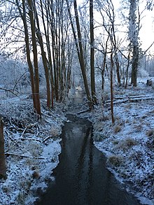
Rohne (helmets)
| Raw | ||
|
|
||
| Data | ||
| Water code | DE : 56488 | |
| location | Mansfeld-Südharz district , confluence with the Kyffhäuserkreis | |
| River system | Saale | |
| Drain over | Helme → Unstrut → Saale → Elbe → North Sea | |
| source |
Klosterrode 51 ° 29 ′ 51 ″ N , 11 ° 26 ′ 31 ″ E |
|
| Source height | 286 m above sea level NN | |
| muzzle | in Mönchpfiffel-Nikolausrieth in the Helme Coordinates: 51 ° 22 '52 " N , 11 ° 21' 49" E 51 ° 22 '52 " N , 11 ° 21' 49" E |
|
| Mouth height | 120.5 m above sea level NN | |
| Height difference | 140 m | |
| Bottom slope | 6.2 ‰ | |
| length | 22.8 km (with the Ackerstalgraben stream ) | |
| Catchment area | 129.5 km² | |
| Communities | Blankenheim , Eisleben , Allstedt , Mönchpfiffel-Nikolausrieth | |
The Rohne is an approx. 19 km long tributary of the Helme in the Saxon-Anhalt district of Mansfeld-Südharz and in the Thuringian Kyffhäuserkreis .
course
It rises in Klosterrode, southeast of Blankenheim, as Ackerstalgraben. From the village pond of Klosterrode the water constantly carries water and at the latest at the mouth of the Kuhfassgraben (from left) it is traditionally called Rohne. From Bornstedt it was used to operate mills. At Osterhausen the river bends from the south-east to the south-west. In addition, the Rainbach flows in from the east at this point . South of Osterhausen, the federal motorway 38 crosses the river, which now flows through the so-called Rohneniederung , past the villages of Einsdorf and Mittelhausen , then it touches Wolferstedt , where the Westerbach, coming from the north, flows into it . The valley of the Rohne deepens to the west of the estuary and borders the Pfalz Allstedt on one side. Next, the only town, Allstedt, is crossed. In the so-called Diamantenen Aue it flows opposite the Dammmühle in Mönchpfiffel-Nikolausrieth at 120.5 m above sea level. NHN from the left into the helmets, 200 m south of the Thuringian border.
