
Wolferstedt
|
Wolferstedt
City of Allstedt
Coordinates: 51 ° 25 ′ 36 ″ N , 11 ° 26 ′ 2 ″ E
|
|
|---|---|
| Height : | 149 m above sea level NHN |
| Area : | 15 km² |
| Residents : | 686 (Jul 30, 2013) |
| Population density : | 46 inhabitants / km² |
| Incorporation : | January 1, 2010 |
| Postal code : | 06542 |
| Area code : | 034652 |
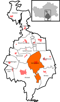  Location of Wolferstedt in Allstedt
|
|

Wolferstedt is a district of the city of Allstedt in the district of Mansfeld-Südharz in Saxony-Anhalt .
geography
Wolferstedt is located between Sangerhausen and Querfurt in the Saale-Unstrut-Triasland conservation area around 4 km northeast of Allstedt. South of Wolferstedt, the Westerbach, coming from the north, flows into the Rohne .
history
In a register of the tithe of the Hersfeld monastery , which was created between 881 and 899, Wolferstedt is mentioned for the first time in a document as the place of Uuolfheresstedi im Friesenfeld, which is subject to a tenancy fee . The place belonged to the Allstedt office .
On January 1, 2010 the previously independent municipality of Wolferstedt was incorporated into the city of Allstedt together with the municipalities of Beyernaumburg , Emseloh , Holdenstedt , Katharinenrieth , Liedersdorf , Mittelhausen , Niederröblingen (Helme) , Nienstedt , Pölsfeld and Sotterhausen .
Culture and sights
- Vitus Church, with a Romanesque portal on the south wall, built in 1180.
Economy and Infrastructure
traffic
The federal highway 180 runs from Querfurt to Eisleben to the east of the village . The federal motorway 38 , which leads from Halle (Saale) to Göttingen , is north of Wolferstedt. The “Rohnetal” motorway tank and rest area, which opened in spring 2011, is located in the municipality of Wolferstedt.
Web links
Individual evidence
- ↑ Area and population of the districts of Allstedt ( Memento of the original from December 18, 2014 in the Internet Archive ) Info: The archive link was inserted automatically and has not yet been checked. Please check the original and archive link according to the instructions and then remove this notice.
- ↑ StBA: Area changes from January 01 to December 31, 2010

Allstedt | Beyernaumburg | Einsdorf | Singling | Emseloh | Holdenstedt | Katharinenrieth | Liedersdorf | Mittelhausen | Niederröblingen (helmets) | Nienstedt | Othal | Pölsfeld | Sotterhausen | Angle | Wolferstedt