
Katharinenrieth
|
Katharinenrieth
City of Allstedt
Coordinates: 51 ° 24 ′ 29 ″ N , 11 ° 21 ′ 1 ″ E
|
|
|---|---|
| Height : | 124 m above sea level NHN |
| Area : | 5.7 km² |
| Residents : | 211 (Jul 30, 2013) |
| Population density : | 37 inhabitants / km² |
| Incorporation : | January 1, 2010 |
| Postal code : | 06542 |
| Area code : | 034652 |
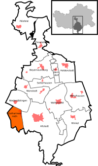  Location of Katharinenrieth in Allstedt
|
|
Katharinenrieth is a district of the city of Allstedt in the district of Mansfeld-Südharz in Saxony-Anhalt .
geography
Katharinenrieth lies between Sangerhausen and Querfurt on the Helme .
history
It was first mentioned in a document in 1184.
For more than 16 years from April 1, 1974 to May 5, 1990, Katharinenrieth belonged to the Allstedt community .
On January 1, 2010, the previously independent municipality of Katharinenrieth was incorporated into the city of Allstedt together with the municipalities of Beyernaumburg , Emseloh , Holdenstedt , Liedersdorf , Mittelhausen , Niederröblingen (Helme) , Nienstedt , Pölsfeld , Sotterhausen and Wolferstedt .
Economy and Infrastructure
traffic
The federal road 86 , Sangerhausen to Weißensee, runs west of Katharinenrieth . The A 38 motorway which leads from Halle (Saale) to Göttingen is north of Katharinenrieth.
Web links
Individual evidence
- ↑ Area and population of the districts of Allstedt ( Memento of the original from December 18, 2014 in the Internet Archive ) Info: The archive link was inserted automatically and has not yet been checked. Please check the original and archive link according to the instructions and then remove this notice.
- ↑ Municipalities 1994 and their changes since January 1, 1948 in the new federal states , Metzler-Poeschel publishing house, Stuttgart, 1995, ISBN 3-8246-0321-7 , publisher: Federal Statistical Office
- ↑ StBA: Area changes from January 01 to December 31, 2010

Allstedt | Beyernaumburg | Einsdorf | Singling | Emseloh | Holdenstedt | Katharinenrieth | Liedersdorf | Mittelhausen | Niederröblingen (helmets) | Nienstedt | Othal | Pölsfeld | Sotterhausen | Angle | Wolferstedt