
Reichenbach (Aare)
|
Reichenbach Rychenbach |
||
 Reichenbach near Rosenlaui with Wellhorn |
||
| Data | ||
| Water code | CH : 1874 | |
| location |
Bernese Alps
|
|
| River system | Rhine | |
| Drain over | Aare → Rhine → North Sea | |
| source | at the Grosse Scheidegg 46 ° 39 '8 " N , 8 ° 6' 29" E |
|
| Source height | ca 1950 m | |
| muzzle | near Meiringen in the Aare Coordinates: 46 ° 43 '23 " N , 8 ° 10' 50" E ; CH1903: 656.72 thousand / 174 919 46 ° 43 '23 " N , 8 ° 10' 50" O |
|
| Mouth height | 594 m | |
| Height difference | 1356 m | |
| Bottom slope | 11% | |
| length | 12 km | |
| Catchment area | 52.59 km² | |
| Discharge A Eo : 52.59 km² at the mouth |
MQ Mq |
2.83 m³ / s 53.8 l / (s km²) |
| Left tributaries | Geissbach, Pfannibach, Schiisbach, Seilibach | |
| Right tributaries | Hengstera, creek in the Rosenlaui glacier gorge | |
The Reichenbach , also called Rychenbach , is an approximately twelve kilometers long, south-southwest and left tributary of the Aare in the canton of Bern . The Reichenbachtal between the Grosse Scheidegg and Meiringen in the municipality of Schattenhalb is named after him.
The stream is known for the 300 meter high Reichenbachfall cascade .
geography
Source area
The Reichenbach arises at an altitude of about 1950 m above sea level. M. near Rinderstutz in a high mountain landscape in the Schwarzhorn hunting banned area southeast of the Grosse Scheidegg ( 1962 m above sea level ).

|

|
|
|
A source arm of the Reichenbach rises from a small glacier at the foot of the Wetterhorn .
|
Source on the glacier.
|
course

The Reichenbach first flows in a north-easterly direction, then turns more to the north and then on its right side takes on the three Hengstera streams that feed the water of the Hengsteren glacier. A little further down the stream it flows into the Uf Teiffenmatten corridor on the other side of the Geissbach .
Shortly afterwards it changes its direction to the northeast and is then fed from the left by the Pfannibach not far from the Chalet-Hotel Schwarzwaldalp . A good kilometer later, near the small village of Rosenlaui , the Rosenlauibach flows into the Rosenlaui Glacier from the right . The Reichenbachtal is also called the Rosenlauital after this place .
The stream now runs north-northeast through its narrow valley and then takes the Schiissbach south of Gschwantenmad on the left side . A good two kilometers later, the Seilibach flows into it on the same side .

Above Zwirgi, the stream is dammed in a small Zwirgi basin to draw water for electricity generation. Then the stream falls as Reichenbachfall , a 300 meter high cascade of seven waterfalls, down the steep south side of the Aare valley. In the flat valley floor, the brook flows to the northwest and takes in the underwater channel of the Schattenhalb power station from the right .
The Reichenbach finally flows west of Schattenhalb near Meiringen at an altitude of 594 m above sea level. M. from the left and south-southwest into the Aare coming from the east.
Its approximately twelve-kilometer run ends approximately 1356 meters below its source, so it has an average bottom gradient of around 11%.
Catchment area
The 52.59 km² catchment area of the Reichenbach lies in the Bernese Alps and is drained via the Aare and the Rhine to the North Sea.
It consists of 19.8% wooded area , 31.8% agricultural area , 0.6% settlement area , 16.4% glacier / firn, 0.8% water area and 30.6% from unproductive areas.

The mean height of the catchment area is 2088 m above sea level. M. , the minimum height is 593 m above sea level. M. and the maximum altitude at 3700 m above sea level. M.
Tributaries
The largest tributaries of the Reichenbach include the Weissenbach , Geissbach , Pfannibach , Rosenlauibach , Rufenhubelbach and Seilbach .
Inflows from the source to the mouth, with name, orographic direction , length in km, catchment area in km², discharge data ( MQ ) in liters per second (l / s). The names according to the GIS of the canton of Bern, data also according to swisstopo .
- Zylewenggräbleni ( left ), 1.0 km
- Outer Hengsterenbach ( right ), 1.6 km
- Mittlere Hengsterenbach ( right ), 1.1 km, 1.7 km²
- Leibrengräbli ( left ), 1.9 km, 0.89 km²
- Inner Hengsterenbach ( right ), 2.4 km
- Ganzenlouwinengraben ( right ), 0.8 km
- Geissbach ( left ), 2.9 km, 6.2 km², 0.36 m³ / s
- Sagigräbli ( left ), 1.8 km
- Sattelbächli ( right ), 1.6 km
- Pfannibach ( left ), 5.2 km, 6.93 km², 0.39 m³ / s
- Schihittenbächli ( left ), 0.4 miles
- Spychergraben ( right ), 1.1 km
- Scheenenbielbächli ( right ), 0.4 miles
- Rosenlauialpbach ( right ), 0.7 km
- Rosenlauibach ( right ), 4.3 km, 10.64 km²
- Rufenenbach ( left ), 1.5 miles
- Rossweidgraben ( right ), 0.3 km
- Schiissbach ( left ), 3.2 km, 2.03 km²
- Spächtgraben ( right ), 1.2 km, 1.04 km²
- Schwendelibächli ( left ), 1.5 km,
- Eyeltigraben ( right ), 0.6 km
- Chalbergraben ( right ), 0.7 km
- Roteflüöbächli ( left ), 1.6 km, 1.23 km²
- Schwandgraben ( right ), 0.7 km
- Fruttlibächli ( right ), 1.0 km, 0.74 km²
- Hinders Sytenbächli ( right ), 0.3 km
- Front Sytenbächli ( right ), 0.5 km
- Seilibach ( left ), 2.7 km, 1.82 km²
- Leimerlibächli ( left ), 1.1 km
- Underwater canal EW Rychenbach ( right ), 0.4 km
Hydrology
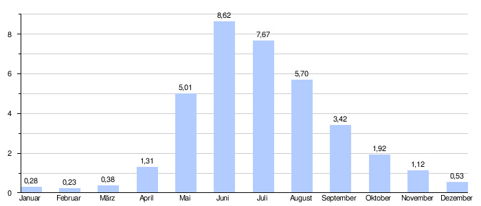
At the confluence of the Reichenbach into the Aare, the modeled mean flow rate (MQ) is 2.83 m³ / s. The discharge regime type is a-glacio-nival and the discharge variability is 13.
use
Around the middle of the 19th century, the water from the lower Reichenbach Falls was used by the Reichenbach saw to operate its water wheel.
Today, BKW Energie operates the Schattenhalb power plant on the Reichenbach .
Web links
Individual evidence
- ↑ a b c Geoserver of the Swiss Federal Administration ( information )
- ↑ a b c d e Topographical catchment areas of Swiss waters: sub-catchment areas 2 km². Retrieved January 25, 2020 .
- ↑ http://www.erdwissen.ch/tag/haslital/
- ↑ Divides into three arms that flow into the Reichenbach
- ↑ "Hidden behind the mean values" - the variability of the discharge regime , p. 7
- ↑ The discharge variability describes the extent of the fluctuations in the mean discharge of individual years around the long-term mean discharge value.