Südstrasse (Heilbronn)
| Südstrasse | |
|---|---|
| Street in Heilbronn | |
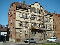
| Südstrasse 125/127 | |
| Basic data | |
| place | Heilbronn |
| District | Heilbronn |
| Cross streets | including Rosenbergstrasse, Bergstrasse, Wilhelmstrasse , Urbanstrasse, Solothurner Strasse, Uhlandstrasse, Schellingstrasse, Ludwig-Pfau-Strasse, Gabelsberger Strasse, Mönchseestrasse |
| Numbering system | Orientation numbering |
| Buildings | see section Buildings and Companies |
| use | |
| User groups | Car traffic , foot traffic |
The South Street is a major thoroughfare in the south of Heilbronn .
history
The Südstraße was designed by government master builder Louis Heuss, but goes back to the general building plan by Reinhard Baumeister from 1873. It got its name from Baumeister and it indicates that the street runs in the extreme south of the former development of Heilbronn. Together with West-, East- and Nordstraße, the Südstraße was to form a ring road (“Riesenstraße”) as the main thoroughfare around the city of Heilbronn.
The problem with the realization of the Ringstrasse was that it was easy to plan and build in the south, east and north, but that further bridges would have to be built in order to develop the suburb of the train station west of the Neckar, namely on Rosenberg in the southwest and in the port area in the north-west of the city, where the ring road would also cross the railway facilities near the port basin. In the south-west, Heuss was already planning a bridge on Rosenberg to connect Südstrasse and Weststrasse. A model of this bridge was shown at the trade exhibition in 1897. However, it was not built until further notice, as the strong growth of the city had already made the general building plan of 1873 invalid and the streets named after the cardinal points no longer marked the extent of the settlement.
From 1897, line 2 of the Heilbronn tram ran between Südstrasse and Dammstrasse.
The Rosenberg Bridge over the Neckar was only built shortly before the Second World War . In 1938 the plans for the bridge between Südstrasse and Weststrasse (then Gustloffstrasse) were approved. That of Willy Stöhr planned and Wayss & Freytag built bridge was blown up during the retreat of the Wehrmacht in 1945 and rebuilt in 1950.
Because the Neckar Canal had also been built west of the Altneckar in the meantime, the Otto-Konz Bridge, built from 1950 at the end of Karlsruher Strasse, the western extension of Südstrasse, was another bridge structure.
The “giant street” made up of south, west, north and east streets was ultimately never realized. The Südstrasse and the Oststrasse gained lasting importance as thoroughfares. The relatively short Weststrasse from Karlsruher Strasse to the main train station is important for developing the inner city. However, Nordstrasse has only become a subordinate residential street. A bottleneck always remained the situation northwest of the old town, where the Neckar, Wilhelmskanal and railway systems only allowed the construction of the comparatively narrow and winding Kranenstrasse. In order to bypass this bottleneck, the main traffic routing for bypassing the inner city is now much more extensive in the northwest than the old ring road concept envisaged: With the construction of the Rosenberg and Otto Konz bridges, the flow of traffic from Südstraße is switched to Neckartalstraße steered, runs on this for a while through the Böckingen district west of the Neckar, then returns to the east over the Neckar to the B 39 (Kalistraße, Mannheimer Straße and Weinsberger Straße) in the city center and then meets the Oststraße again, which finally returns leads to Südstrasse.
course
The Südstraße runs from its western end at the Rosenbergbrücke to the intersection with Wilhelmstraße in a south-easterly direction. On this section it forms part of the federal highway 293 .
From the Wilhelmstrasse intersection, it continues in a more easterly direction to Silcherplatz, where another thoroughfare joins with Oststrasse and Stuttgarter Strasse. This part of Südstraße belongs to the B 27 .
Buildings and companies
On Rosenberg and in the industrial and workers' residential area around Heilbronn Südbahnhof , a relatively large number of old buildings have been preserved despite the air raids on Heilbronn in World War II, which destroyed the entire old town. Some buildings in Südstrasse are now under monument protection.
- Südstrasse 21, 23, 25 and 29 were properties owned by Heilbronn wine growers. After the Second World War, No. 21 belonged to the wine grower Hermann Zapf, No. 23 to Ernst Stahl, No. 25 to Albert Öhler and No. 29 to Karl Klemm.
- In 1950 Ilse Hammel's grocery store was in Südstrasse 31.
- The Ulmer Hof was once located at Südstrasse 35, and its host was the wine wholesaler Otto Kneer. In 1950 there were only apartments at this address.
- The Assenheimer-Mulfinger car dealership is located at Südstraße 40. The company was founded in 1911 and was located in the old Assenheimer building on the corner of Südstrasse and Stuttgarter Strasse from 1961 to 1989 .
- At the corner of Rosenbergstrasse / Südstrasse is the Rosenberg high-rise , built in 1973 , which, with 24 floors, is one of the tallest buildings in Heilbronn.
- The Rosenau School , built in 1900, is on the corner of Bergstrasse and Südstrasse .
- The Schmidt bakery at Südstrasse 41 has existed for several decades.
- The residential and commercial building at Südstrasse 43 dates from 1897 and is in the style of the German Renaissance. There was originally a butcher's shop and restaurant on the ground floor. The Klumpp butcher's shop, now in its fourth generation, moved from Südstrasse 43 to Wilhelmstrasse 40 in 1969. After the Second World War, the warehouse of the Karl Ruffler furniture store was located at Südstrasse 43/1.
- The people's mission of resolute Christians was located at Südstrasse 45.
- Kozel's daughter boarding school was once located on the corner of Wilhelmstrasse, Südstrasse 49. A Werkbundhaus planned in 1931 was not built. In 1950 at Südstrasse 49 there was August Steiner's paper and bookbinding shop, the Stolz-Meny clothing and trousseau store, and a milk and grocery store owned by Karl Löffelhardt.
- The Hagelauer Auto Center, founded in 1927, has been located at Südstrasse 50–54 since 1948.
- Südstrasse 61 once belonged to the coffee company Seelig & Diller, whose other properties extended along Wilhelmstrasse . After the Second World War, the main fire station of the Heilbronn volunteer fire brigade was on this property.
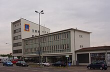
- Heinrich Taxis' building materials wholesaler was located at Südstrasse 63 and 65. A building by Kurt Marohn was demolished at this point at the beginning of the 21st century to make way for a Lidl branch.
- The semi-detached house at Südstraße 80/82 was designed by Emil Beutinger and Adolf Steiner and once contained small three-room apartments without a bathroom. The house, built in 1910/11, has neo-baroque decorative elements.
- Nos. 85, 87, 89 and 91 were apartment buildings. The master confectioner Eugen Romann lived in No. 87, whose family ran a pastry shop in Heilbronn with a tradition of more than 300 years.
- The City-Süd-Center is now located at Südstrasse 88 and 90.
- No. 95 was a single-family house built in 1926 that the architects Adolf Mössinger and Hermann Beil had planned. The ruins were rebuilt for Rudolf Mayer from 1950.
- Südstrasse 100 and 102 were residential and commercial buildings. In 1950 the haulier Martin Klaiber had his business in No. 100, and in No. 102 there was an office of the New World Insurance and Collection Agency.
- In 1950, Otto Köchner's bookstore and the Lehner household and gift shop were located in Südstraße 113.
- In Südstraße 115 there was a food branch of Gustav Lichdi AG , in house 115/1 was Wilhelm Müller's glassworks.
- Südstraße 116–118 is the Christ Church , consecrated in 1963 as the successor to a wooden church, with its associated kindergarten.
- Master carpenter Walter Wedel had his workshop in Südstrasse 117/1.
- The building in Südstrasse 119/1 belonged to the wine grower Ernst Braun, who also ran a broom farm there. In 1946 Braun moved to Einsteinstrasse, and the optician Martin Fickartz then used his building on Südstrasse.
- The semi-detached house at Südstraße 125/127 was built in 1908 and is decorated with neo-baroque and art nouveau elements.
- The house at Südstrasse 129/131 was designed by the client Wilhelm Kuhnle himself. It was built in 1902. In 1934, the Roth & Hopfensitz coffee, tea and cocoa wholesaler was founded at Südstrasse 129, which at the time belonged to the retired engine driver August Hopfensitz.
- In 1950 Otto Sinn's fruit, vegetable and tropical fruit store was located at Südstrasse 136.
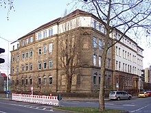
- The apartment buildings at Südstrasse 142 , 144 and 146 were built by Rudolf Seitz in 1910 and have lavish facade decorations. At the houses No. 144 and 146 you can find, among other things, figurative representations of the four seasons. No. 142 once belonged to the Jewish doctor Ludwig Essinger ; in the restitution proceedings after the war it was awarded to Essinger's will according to the heiress Friedericke Burkhardt. The hairdresser Karl Pröbstel lived in the house from 1923 to 1934. There was also a hairdressing salon that Karl Hoppenworth ran in 1950. No. 144 was Gottlob Düringer's medical supply store, and No. 146 was a curtain store and a shoemaker.
- In 1950, Carl Deeg's saddlery and upholstery wholesaler was located at Südstrasse 148, and shortly afterwards it moved to Villa Zapf .
- The buildings at Südstrasse 150, 150/1, 152/1, 154/1, 156/1 and 158 were mainly used for residential purposes.
- The parish hall of the southern parish, which was separated from the Friedenskirche in 1911, was once located at Südstrasse 156 .
- At the western end of Südstrasse, on the corner of Silcherplatz, there is a building called Silcherplatz 6, a house built in 1891 based on plans by August Dederer . On the opposite side, on the corner of Stuttgarter Straße, is the former Assenheimer commercial building , which was built in 1961 according to plans by Julius Hoffmann .
literature
- Julius Fekete et al., Monument Topography Baden-Württemberg. Volume I.5 Stadtkreis Heilbronn , Konrad Theiss Verlag, Stuttgart 2007, ISBN 978-3-8062-1988-3 , p. 128 f. and 114 f.
- Gerhard Schwinghammer, Reiner Makowski, The Heilbronner Street Names , Silberburg-Verlag Tübingen 2005, ISBN 978-3-87407-677-7 , p. 195
- City of Heilbronn (ed.): Address book of the city of Heilbronn 1950 , Heilbronn 1950.
Web links
Individual evidence
- ^ Willi Zimmermann: The first city plans as the basis for the city expansion of Heilbronn in the 19th century , in: Historischer Verein Heilbronn. 22 publication , Heilbronn 1957, pp 193-199.
- ↑ Construction drawing Wilhelmstrasse 36a / Südstrasse 49
Coordinates: 49 ° 8 ′ 4.5 ″ N , 9 ° 13 ′ 6.5 ″ E


