
Sool (Somalia)
| صول Sool
|
|
|---|---|
  |
|
| Basic data | |
| Country | Somalia |
| Capital | Las anod |
| surface | 25,036 km² |
| Residents | 327,428 (2013) |
| density | 13 inhabitants per km² |
| ISO 3166-2 | SO SO |
Coordinates: 8 ° 27 ' N , 47 ° 16' E
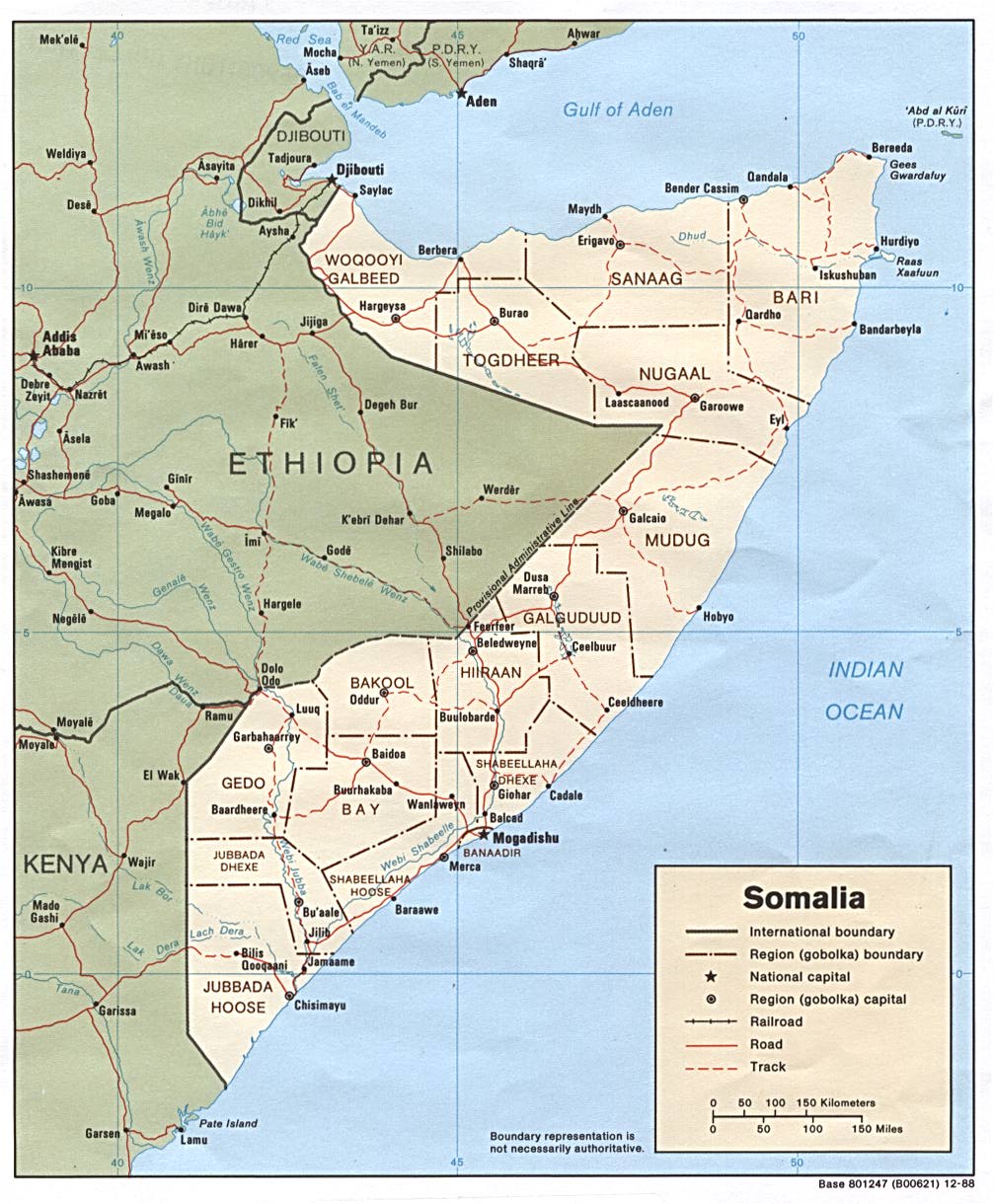
Sool ( Arabic صول, DMG Ṣaul ) is a region in northern Somalia . It is controversial between the internationally not recognized, de facto independent Somaliland and the self-proclaimed Somali state of Puntland . In 2007 there was fighting between the two sides. Its capital is Las Anod .
The neighboring regions are Togdheer in the west , Sanaag in the north, Bari in the northeast and Nugaal in the east . Sool borders the Somali region in Ethiopia in the south and has no access to the sea. The region used to be part of Nugaal.
The most important clan in the region is the Dhulbahante subclan of the Harti- Darod . The Fort Taleh (Taleex) of the rebels against the British colonial power under Mohammed Abdullah Hassan was in Sool .
Individual evidence
- ↑ population estimation survey 2014 ( UNFPA ) table A3
- ^ UNHCR: Somalia Country Information
- ^ CIA map of Somalia's administrative divisions, 1988
Bakool | Banaadir | Bay | Galguduud | Gedo | Hiiraan | Jubbada Dhexe | Jubbada Hoose | Shabeellaha Dhexe | Shabeellaha Hoose
Puntland Bari / Karkaar | Mudug | Nugaal
Somaliland Awdal | Sanaag | Sool | Togdheer | Woqooyi Galbeed (Maroodi Jeex) | Saaxil