
Nugaal (region)
| نوغال Nugaal
|
|
|---|---|
  |
|
| Basic data | |
| Country | Somalia |
| Capital | Garoowe |
| surface | 26,180 km² |
| Residents | 392,697 (2013 calculation) |
| density | 15 inhabitants per km² |
| ISO 3166-2 | SUN-NU |
Coordinates: 8 ° 24 ' N , 48 ° 29' E
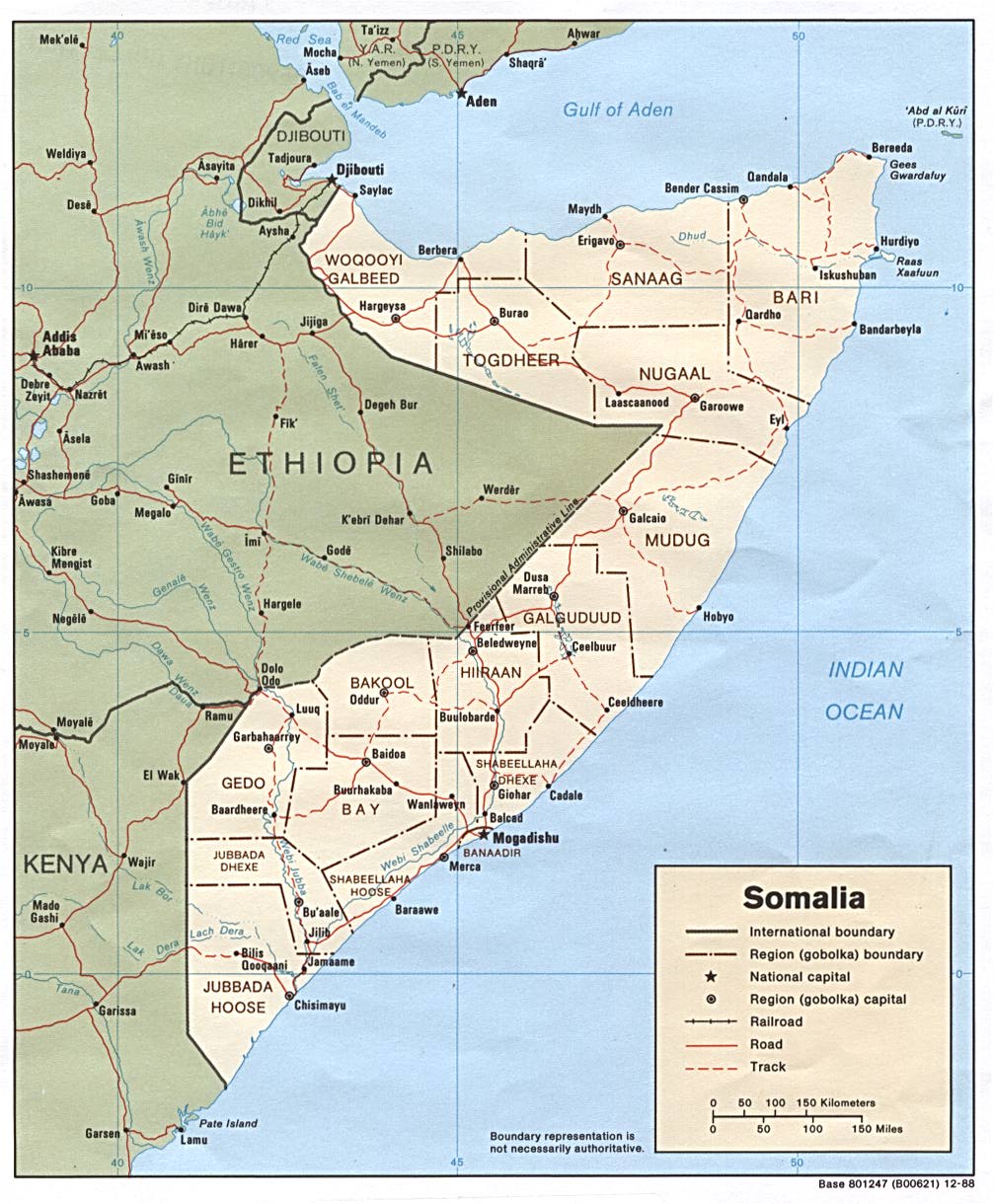
Nugaal (also spelled Nogal ; Arabic نوغال Nūghāl ) is a region in central Somalia and part of the de facto autonomous, internationally not recognized Puntland . Their capital is Garoowe .
Another city is Eyl . The southern neighboring region is called Mudug , to the north of Nugaal is Bari and to the west is Sool , which used to be part of Nugaal. In the southwest, Nugaal borders Ethiopia and in the east lies the Indian Ocean . The coast of Nugaal was hit by the tsunami on December 26, 2004 .
Nugaal takes its name from the river Nugaal or Nogal, in whose valley (Nugaaleed valley or Nogal valley) the region lies.
Web links
Individual evidence
- ↑ population estimation survey 2014 ( UNFPA ) table A3
- ^ UNHCR: Somalia Country Information
- ^ CIA map of Somalia's administrative divisions, 1988
Bakool | Banaadir | Bay | Galguduud | Gedo | Hiiraan | Jubbada Dhexe | Jubbada Hoose | Shabeellaha Dhexe | Shabeellaha Hoose
Puntland Bari / Karkaar | Mudug | Nugaal
Somaliland Awdal | Sanaag | Sool | Togdheer | Woqooyi Galbeed (Maroodi Jeex) | Saaxil
| Colonial times |
|
||||||
| After the Second World War |
|
||||||
|
From independence to civil war |
|
||||||
|
Civil war period, collapse of the central state (claims to recognition) |
|
||||||
| New constitution from 2012 |
|