Sand Point and Middle Hope
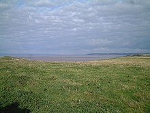
Sand Point in Somerset , England , is the peninsula that extends into the Bristol Channel from Middle Hope . The area is a combined biological and geological Site of Special Scientific Interest covering 84.1 hectares (208 acres). The sanctuary is north of Kewstoke and off the Sand Bay coast north of Weston-super-Mare . On a clear day you have a good view of Flat Holm , South Wales , Clevedon , the Second Severn Crossing and the Severn Bridge . If you draw a line from Sand Point to Lavernock Point in South Wales you get the border between the Severn Estuary and the Bristol Channel.
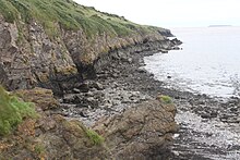
Middle Hope is a hill made of limestone from the Carboniferous Age with unusual geological formations, including a cliff from the Pleistocene with a large number of fossils and has therefore been declared a Regionally Important Geological Site . The geological stratification and soil conditions are favorable to a number of rare plants. Human settlement is through a bowl barrow (tumulus) and a disc barrow from the late Neolithic or the Bronze Age and the remains of a moth (motte-and-bailey castle). Woodspring Priory , a former Augustinian priory , which was founded in the early 13th century, stands immediately south of the rock formations. The Priory and the surrounding land are owned by the National Trust and are a popular local recreation destination.
geology
At Middle Hope there is a limestone rock, which also contains thick layers of volcanic tuffs and lava and can thus be dated to the Tournaisian era. In addition, a fossil cliff and a coastal platform have been created since the Pleistocene . These landscape formations led to the designation of Middle Hope as a Regionally Important Geological Site (RIGS).
The raised beach terraces made of platforms formed by waves were created by fluctuations in sea level in the Bristol Channel since the Quaternary . The stratification of volcanic and sedimentary rocks, including the Black Rock Limestone , enables the events of 350 mio. Years. The benches were folded and compressed in the course of varicose orogenesis .
flora
Various rare plant species can be found on the chalky and sandy locations, including Ranunculus parviflorus (smallflower buttercup), blue-green fibrous umbrella (Trinia glauca, honewort), whitefly (Dianthus gratianopolitanus, Cheddar pink) and Somerset hair grass (Koeleria vallesiana) calcareous soils are of Festuca types, and Dactylis glomerata dominates, while the bush zones in the west mainly from hawthorn (hawthorn, Crataegus monogyna ) and blackthorn (blackthorn, Prunus spinosa ) are formed and the east gorse (common gorse, Ulex europaeus ) and blackberries ( Blackberry / bramble, Rubus fruticosus agg ) dominate.
history

Two barrows (bowl barrow & disc barrow) from the late Neolithic or the Bronze Age on the hill give evidence of early human settlement . The Bowl Barrow measures 10 m in diameter and is approximately 0.5 m high. A little further to the west is the Disc Barrow, which is surrounded by a wall and moat that encircles an area approximately 8 m in diameter. This facility is located at the highest point where Ordnance Survey has installed a trigonometric point .
A moth was likely erected after the Norman conquest of England . The place is known as Castle Mound (Castle Batch) and can be perceived as a 2 m high hill with a diameter of about 30 m and a moat on the landward slope. The hill was damaged by the construction of a building during World War II . Medieval dating is not entirely certain as some sources consider the hill to be the remains of a 16th century watchtower. The walls of the sheepfold were built by prisoners of the Napoleonic Wars . Hope Cove on the north coast had a reputation as a smugglers' hideout as it was "well away from the men of HM Customs and Excise".
Woodspring Priory was an Augustinian priory. It was founded by William de Courtney in the early 13th century and dedicated to Thomas Becket . The small community built a church and residential buildings over the next hundred years. The community were Victorine Canons ( regular canons ), who were influenced by the teachings of the Cistercians and placed emphasis on manual labor and self-sufficiency. For this reason, the order members worked both in agriculture and as clerics in the surrounding churches. The priory was not particularly prosperous until the 15th century when other buildings, including the current church, hospital (infirmary) and granary, were erected in the vicinity of some estates. the monastery was dissolved as early as 1536 and became the property of local nobles and was leased to farmers. In 1969 the Landmark Trust took over the Priory and spent 20 years restoring it. The farmhouse has been rented out as a holiday home since the 1990s. The remaining buildings are the Priory Church, a replacement for the old church from the 13th century, Infirmary, Barn (granary) and Prior's Lodging from the 16th century, which was converted into a farmhouse. The whole area was around a central cross passage arranged (cloister), of which only the east wall and the West wall of the chapter house have survived (chapter house). The sacristy , refectory , chapter house, lady chapel and parlor (vestibule) were demolished.
Due to the biological and geological importance of the area, the area was designated as a Site of Special Scientific Interest in 1952 . In 1968, Middle Hope Priory and surrounding land was acquired by the National Trust for Places of Historic Interest or Natural Beauty as part of Project Neptune .
During the Second World War, weapons were tested in Sand Point, in combination with the Birnbeck Pier military base, which was commissioned as "HMS Birnbeck" by the Admiralty as part of the Department of Miscellaneous Weapons Development (DMWD - department for the development of various weapons) for research purposes. For this purpose, buildings were constructed at St Thomas Head , east of Middle Hope. Some of them have since been demolished and the site is now used by QinetiQ as a test site for explosives and as a demolition test site.
Individual evidence
- ↑ Hugh Prudden: Somerset Geology - A Good Rock Guide. University of Bath, Bath Geological Society March 8, 2015
- ↑ a b c Middle Hope. SSSI citation sheet, English Nature PDF.
- ↑ TJ Faulkner: The early Carboniferous (Courceyan) Middle Hope volcanics of Weston-super-Mare: development and demise of an offshore volcanic high. In: Proceedings of the Geologists' Association . Volume 1001, 1989, pp. 93-106, doi : 10.1016 / S0016-7878 (89) 80068-9 .
- ^ North Somerset Landscape Character Assessment. ( Memento of the original from July 15, 2014 in the Internet Archive ) Info: The archive link was inserted automatically and has not yet been checked. Please check the original and archive link according to the instructions and then remove this notice. North Somerset Council 2015.
- ↑ a b RIGS of the Month - March Middle Hope, Kewstoke, Somerset. Avon RIGS group 2015.
- ^ Severn Estuary. Severn boating.
- ↑ Somerset. ( Memento of the original from March 29, 2014 in the Internet Archive ) Info: The archive link was inserted automatically and has not yet been checked. Please check the original and archive link according to the instructions and then remove this notice. Natural England.
- ↑ Middle Hope, Kewstoke, Somerset. Avon RIGS Group.
- ↑ OGU field trip to Middle Hope. University of Bristol. 2015.
- ↑ Ian P. Green, Rupert J. Higgins, Mark A. R. Kitchen, C. Kitchen; Sarah L. Myles (ed.): The Flora of the Bristol Region. Pisces Publications 2000: 66, 161. ISBN 978-1874357186
- ^ Search engine Bing uses Somerset's iconic Sandpoint on homepage. ( Memento of the original from April 2, 2015 in the Internet Archive ) Info: The archive link was inserted automatically and has not yet been checked. Please check the original and archive link according to the instructions and then remove this notice. Cheddar Valley Gazette, October 12, 2013.
- ↑ Bowl barrow and disc barrow 600 m NNW of Sandpoint Farm. National Heritage List for England, English Heritage 2015.
- ↑ Motte and bailey castle 650 m NNW of Sandpoint Farm. National Heritage List for England, English Heritage 2014.
- ↑ Monument No. 192646. ( Memento of the original from April 2, 2015 in the Internet Archive ) Info: The archive link was inserted automatically and has not yet been checked. Please check the original and archive link according to the instructions and then remove this notice. Pastscape, English Heritage 2015.
- ^ Castle Mound (Castle Batch), Sand Point and Middle Hope. Archeology Data Service 2015.
- ^ A b Sand Point & Middlehope, Somerset. National Trust (PDF) 2014.
- ^ A b Sand Point and Middle Hope. ( Memento of the original from December 15, 2013 in the Internet Archive ) Info: The archive link was inserted automatically and has not yet been checked. Please check the original and archive link according to the instructions and then remove this notice. National Trust 2014.
- ^ Geoff Body, Roy Gallop: Any Muddy Bottom: A History of Somerset's Waterborne Trade. History Press 2015: 85th ISBN 978-0750961639
- ↑ Woodspring Priory and associated fishponds and field system. National Heritage List for England, English Heritage 2014.
- ↑ Local History. Kewstoke Village 2014.
- ^ Charles Greenwood: Famous Houses of the West Country. Kingsmead Press, Bath 1977: 109-111. ISBN 978-0901571878 .
- ↑ Arthur Geoffrey Dickens: The English Reformation. BT Batsford, London 1989. ISBN 978-0271028682
- ↑ Woodspring Priory - Restoration. ( Memento of the original from July 18, 2014 in the Internet Archive ) Info: The archive link was inserted automatically and has not yet been checked. Please check the original and archive link according to the instructions and then remove this notice. Landmark Trust 2014.
- ^ East Cloister Wall. National Heritage List for England. English Heritage 2014.
- ^ West Wall of Chapter House Range. National Heritage List for England. English Heritage 2014.
- ^ Infirmary. National Heritage List for England. English Heritage 2014.
- ↑ David John Tomalin, Christopher Crook: Woodspring Priory. The Landmark Trust 2007.
- ^ Tim Longman: Archaeological Watching Brief at Woodspring Priory. Archeology Data Services, Bristol and Region Archaeological Services March 16, 2010 (PDF).
- ^ Ted Johnson: Weston Super Mare & The Airplane. Amberley Publishing 2013. ISBN 978-1445632148
- ^ St Thomas Head Weapons Testing Site. Pastscape, Historic England 2015.
Web links
Coordinates: 51 ° 23 '21.1 " N , 2 ° 58' 17.4" W.

