Shawla
|
Shavla Shavla |
||
|
The Shawla above the confluence of the Jeschtykol |
||
| Data | ||
| Water code | RU : 13010100312115100004950 | |
| location | Altai Republic ( Russia ) | |
| River system | If | |
| Drain over | Argut → Katun → Ob → Arctic Ocean | |
| source | Upper Shawlasee in the northern Chuja ridge of the Altai 50 ° 4 ′ 47 ″ N , 87 ° 26 ′ 29 ″ E |
|
| Source height | 2164 m | |
| muzzle |
Argut coordinates: 50 ° 9 ′ 22 " N , 86 ° 50 ′ 22" E 50 ° 9 ′ 22 " N , 86 ° 50 ′ 22" E |
|
| Mouth height | 873 m | |
| Height difference | 1291 m | |
| Bottom slope | 22 ‰ | |
| length | 58 km | |
| Catchment area | 882 km² | |
| Right tributaries | Yeshtykol | |
| Flowing lakes | Middle Shawla Lake, Lower Shawla Lake |
|
|
Upper Schawlasee with the peaks of the northern Chuja ridge |
||
|
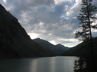
Middle Schawlasee, view to the north |
||
|
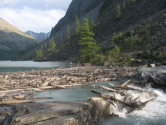
Outflow of the Middle Schawlasees |
||
|
Lower Schawlasee |
||
The Shawla ( Russian Шавла ) is a 58 km long right tributary of the Argut in the central part of the Altai in southwest Siberia ( Russia ). It is not to be confused with the right and significantly shorter tributary of the Chulyshman in the eastern Altai of the same name .
course
The Schawla entfließt at 2164 m altitude the Upper Schawla Lake (Russian Верхнее Шавлинское озеро / Werchneje Schawlinskoje Ozero ), which in turn is fed by a number of smaller streams that originate in the glaciers of the northwest flank of here over 3700 m high northern Tschuja- Comb ( Severo-Tschuisker comb ) have. Some sources also refer to the south-eastern tributary of the lake as "Shawla", which flows from a small Karsee 1.3 km away at an altitude of exactly 2400 m .
After a good two kilometers, partly invisible under stones and blocks , the Shawla reaches the Middle Shawla Lake , located at 1984 m altitude (Russian Среднее Шавлинское озеро / Sredneje Schawlinskoje osero ; ⊙ ). With a length of about 1.5 km and a width of up to 300 m, it is the largest of the Shawla lakes and is therefore sometimes only called Shawla Lake , but on the other hand also Lower Shawla Lake , neglecting the significantly smaller actual lake with this name further downstream . The western shore of the lake is steep, the eastern flat and partly forested.
After leaving the Middle Shawla Lake, the Shawla still flows a good ten kilometers in a north-westerly direction and crosses about halfway through the small (about 300 m diameter) at 1785 m altitude, Lower Shawla Lake (Russian: Нижнее Шавлинское озеро / Nischneje Schawlinskoje oseroje oseroje ; ⊙ ). Then the Shawla takes its largest tributary Jeschtykol from the right , turns abruptly in approximately westward direction, which it maintains after another 50 km until it flows into the Argut . On this section, on the left (southern) side of the valley, the north-western foothills of the northern Chuja ridge , called the Shawla ridge after the river, rise . This side of the valley is somewhat flatter near the river and mostly forested, while the right bank is rocky and bare.
Up to just above the Middle Shawla Lake, as well as further down the river up to an altitude of around 2200 m , the valley of the Shawla is predominantly overgrown by larch forest with isolated Siberian stone pines . In protected locations, such as on the east bank of the Middle Shawla Lake, the undergrowth is relatively dense; Lingonberries and blueberries grow in many places . The most conspicuous animal of the forests is the common Burunduk , while above the tree line the Altai Pika ( Ochotona alpina ) is not uncommon .
The name of the river is derived from the Altaic name shaala ( шаала ) for "small trees".
Hydrography
The catchment area of the Shawla covers 882 km². To a large extent it is fed by glaciers, which gives the water a gray-green color ( glacial milk ). The annual mean runoff at the mouth is 16 m³ / s.
At the mouth, the Shawla is about 25 meters wide and up to two meters deep; the flow velocity here is 2.0 m / s.
Infrastructure
The Shawla is not navigable. It flows along its entire length through uninhabited area; there is no infrastructure in the form of streets or driveways.
Tourist importance
The valley of the Shawla is a popular destination for trekking and canoe tours , mainly in the summer months .
The upper reaches of the river with the picturesque Schawla lakes are particularly interesting for trekking tours and mountain sports. The most popular, approximately 40-kilometer-long access route begins at the village of Chibit , located on the Katun tributary Chuja and the M52 trunk road . There, the Tschuja can be crossed over a bridge at a height of 1100 m , followed by a steep ascent to the 2230 m high Oroi Pass , over which the watershed between Tschuja and Shawla runs. The Shawla tributary of the same name has its origin on the slightly lower Jeschtykol plateau directly on the other side of the pass, which the path follows - on this side significantly flatter - to the confluence with the Shawla; from there on the right side of the valley up to the Shawla lakes. The lakes are the starting point for high-altitude tours in the valleys of the neighboring rivers Kurandu (flows into the Jungur , this into the Argut), Maaschei (flows into the Tschuja) or Karagem on the other side of the main ridge, as well as for the ascent of the glaciers , which are up to 3764 m high Summit with the unofficial names Metschta, Skaska and Krassawiza (Russian for "dream", "fairy tale" and "the beautiful").
Canoe tours usually start at the confluence of the Shawla and Jeschtykol rivers. The river has practically no calm sections on the approximately 50 km to the mouth and is in parts classified in Russian difficulty category 5 (corresponding to IV – V according to the ICF's international white water difficulty scale ). What makes it more difficult is that the boats have to be carried over 40 km due to the lack of access to the starting point. From the mouth, however, you can continue to drive via Argut and Katun to Inja, 60 kilometers below, on the M52.
literature
- GM Egorov (ed.): Altajskij kraj . Profizdat, Moscow 1987 ( The Altai region ; Turističeskie rajony series (tourist areas of the USSR) ; Russian).
- VV Kinjaev, VV Mazurov, MI Paršichov: Vodnye maršruty Altaja i Sajan . Tula 1994 ( water hiking tours in the Altai and Sajan ; Russian).


