Sebeș (river)
|
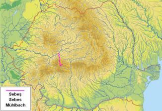
Sebeș Mühlbach Sebes |
||
|
The Sebeş in Romania |
||
| Data | ||
| location | Transylvania ( Romania ) | |
| River system | Danube | |
| Drain over | Mureș → Tisza → Danube → Black Sea | |
| source | in the Zibins Mountains | |
| Source height | approx. 2000 m | |
| muzzle | at Oarda in the Mureș coordinates: 46 ° 2 '24 " N , 23 ° 33' 31" E 46 ° 2 '24 " N , 23 ° 33' 31" E |
|
| Mouth height | 220 m | |
| Height difference | approx. 1780 m | |
| Bottom slope | approx. 19 ‰ | |
| length | 95 km | |
| Catchment area | 1289 km² | |
| Drain |
MQ |
9.03 m³ / s |
| Left tributaries | Prigoana , Gâlceag , Mărtinia et al | |
| Right tributaries | Bistra , Dobra , Secaș and others | |
| Reservoirs flowed through | Oașa , Tău-Bistra and others | |
| Medium-sized cities | Sebeș | |
| Communities | Petreşti , Săsciori , Șugag | |
|
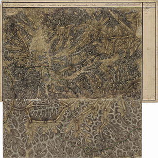
The upper reaches of the Sebeş ( Ruu Fromosza ), in the Josephine land survey from 1769–1773. |
||
|
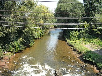
View of the Sebeş |
||
|
View of Lake Oașa, in the background the Pătru summit of the Șureanu Mountains |
||
|
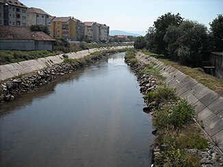
View of the Sebeş river near the small town of Sebeş ( Mühlbach ) |
||
The Sebeș ( German Mühlbach , Hungarian Sebes ) is a left tributary of the Mureș ( Mieresch ) in the southwest of the Transylvanian Basin in Romania .
River course
Between the Zibins Mountains ( Munții Cibin ) in the east and the Șureanu Mountains ( Mühlbacher Mountains ) in the west, the Sebeş flows predominantly in a northerly direction in the southwest of the Sibiu district and in the south of the Alba district . It flows into the Mureș near Oarda - an incorporated village in the city of Alba Iulia .
South of the highest peak of the Zibins Mountains - the Cindrel ( 45 ° 35 ′ N , 23 ° 48 ′ E , 2244 m ) - is the headwaters of the Sebeș, which is the Frumoasa Bach (English: about the beautiful ). In its upper reaches - up to the Tău reservoir (approx. 800 m ) - the Sebeş is a raging mountain river. The actual millstream begins about 16 kilometers south of the tau lake at oasa -Stausee ( 45 ° 34 ' N , 23 ° 37' O , 1255 m ). The middle reaches of the Sebeș from the Tău reservoir to Săsciori has a length of about 26 kilometers. From here to the mouth of the Mureș there are still 18 kilometers (as the crow flies).
The average annual runoff of the Sebeş near Petreşti is 9.03 m³ / s (measured from 1975-2005). In the cold season (November – March), a discharge between 5.35–6.15 m³ / s; 7.64–14.5 m³ / s registered in the warm season (April – October).
Places and tributaries
places
The Sebeş flows through the places Tău Bistra ( Prenzendorf ), Șugag ( Schugag ), Mărtinie (Hungarian Martiniatelep ), Căpâlna ( Kapellendorf ), Laz ( Laas ), Săsciori ( Schweis ), Sebeşel (Hungarian Sebeshely ), Petreşti ( Petersdorf ), Sebeș ( Mühlbach ), Lancrăm ( Langendorf ) and Oarda ( Unter-Wardein ).
The European route 81 runs along the Sebeş in a north-south direction from the village of Oarda to the small town of Sebeş . From Sebeș, the national road ( drum național ) DN 67C - the so-called Transalpina - runs along the river to about seven kilometers after the Oașa reservoir, after which the Frumoasa stream turns east. The Transalpina or "Drumul Regelui" ( King's Path ) from Sebeş to Novaci ( Kr. Gorj ) is the highest national road in Romania at Pasul Urdele ( 2145 m ).
Tributaries
Other of the smaller right tributaries of the Sebeş are the Curpăt (empties into Lake Oașa), Hurdubelu , Ciban , Gardu , Tomnatecu , Valea Mierlii , Șipoțelu , Nedeiu (empties into Lake Obreja de Căpâlna) and others; some of the left tributaries are the Sălănele and the Diudiu ( flowing into Lake Oaşa), the Balele , Miraş ( flowing into Lake Tău-Bistra), Purcaru , Groşeşti u. a.
Economical meaning
The use of reservoirs to generate electricity began on Sebeş in 1931 near Petreşti. Complex studies on the construction of larger hydropower plants were carried out from 1965 onwards. It was planned that five hydropower plants with a total output of around 360 MW would achieve a standard work capacity of around 650 GWh per year.
In the villages along the Sebeş, the main occupation of the population is sheep breeding, forest work (formerly also rafting), less cattle or agriculture.
Reservoirs and hydropower plants
The reservoirs with the hydropower plants along the Sebeş have a total average standard energy capacity of more than 606 GWh per year. The reservoirs with the hydropower plants are:
- The Oaşa reservoir - the largest and highest situated reservoir of the Sebeş - with a 92 meter high dam wall, has a volume of over 130 million m³ and a surface of about 4.6 km². Equipped with two vertical Francis turbines , the Gâlceag hydropower plant , which went into operation for the first time in 1980, has an output of 150 MW (two turbines of 75 MW each) and a standard energy capacity of around 260 GWh per year. The three largest tributaries of the lake are the Frumoasa , the Curpăt and the Oașa Fetița stream. The Frumoasa stream has by far the largest catchment area, 91 km² in size, and a flow rate of 2.18 m³ / s. In addition to the natural tributaries of the Oașa reservoir, the power plant is stored by a network of underground passages totaling 11 kilometers in length (starting from Lake Ciban ) and around 3.5 kilometers in length (starting from Lake Cucir ).
- The Tău reservoir ( 45 ° 41 ′ N , 23 ° 37 ′ E , 790 m ), with a 78 meter high arch dam , was built in 1984. The lake has a surface of 81 hectares, a volume of about 21 million m³, and extends to the Gâlceag hydroelectric power station. The Tău-Șugag hydropower plant - like the Gâlceag hydropower plant - has a power plant output of 150 MW and a standard energy capacity of around 260 GWh per year.
- The Obreja de Căpâlna reservoir ( 45 ° 49 ′ N , 23 ° 37 ′ E , 409 m ) has a total volume of 3.92 million m³, a useful volume of 1.80 million m³ and an area of approx. 35 hectares . The hydropower plant has two Francis turbines with a total output of 42 MW and a standard energy capacity of 81 GWh per year.
- The Petrești reservoir ( 45 ° 54 ′ N , 23 ° 34 ′ E , 294 m ) is the smallest lake on the Sebeş and, in addition to operating the Petreşti hydropower plant, also serves to supply the small town of Sebeş ( Mühlbach ) and Petreşti with drinking water , the industrial area of Mühlbach . The lake was created by a 22 m high dam, has a total volume of 1.35 million m³ and an area of approx. 25 hectares. The Petrești hydropower plant is equipped with two turbines of 2 MW each and has a standard energy capacity of around 6 GWh per year.
Risks of the Sebeş valley from the reservoirs
Even if the Sebeș valley should be protected against flooding by the reservoirs, these are possible due to:
- Spring floods, caused by sudden melt and heavy rainfall.
- Flooding in summer, caused by torrential rainfall, with cut down tree trunks forming barriers if they are not removed from the river bed in time. One such flood took place in Săsciori in 1994.
In a hypothetical assumption of a total destruction of the highest and largest dam in the Sebeş Valley, the Oașa, it was calculated that, for example, the town of Tău Bistra at a distance of 14.4 km, in 10 minutes at a speed of 86, 4 km would overrun h of a 46 meter high water wave / that a location Sugag at a distance of 28.1 km, in 22 minutes at a speed of 76.2 / h km a 34 meter high water wave would roll; that Săsciori would be hit by a 20-meter-high water wave at a distance of 44.6 km in 39 minutes at a speed of 68.4 km / h; that a 12-meter-high water wave would hit Petreşti at a distance of 50.2 km in 47 minutes at a speed of 64 km / h; that in the small town of Sebeş ( Mühlbach ) at a distance of 53.5 km, in 52 minutes at a speed of 61.7 km / h, a nine meter high water wave would occur and that the place Lancrăm at a distance of 57.5 km , in 59 minutes with a speed of 59.4 km / h, would be flooded by a 6.5 meter high water wave.
See also
Web links
Individual evidence
- ↑ a b c d e f g h Ioan Iulian Ștef: Study of the reservoirs of the Sebeş catchment area (PDF; 4.68 MB, Romanian)
- ↑ a b Map of the Zibins Mountains
- ↑ Map of the Șureanu Mountains
- ↑ The hydropower plants in Sebeş generate 606 GWh per year (2006), on www.mediauno.ro (Romanian)
- ↑ Website of the Șugag municipality, accessed on February 20, 2011
- ↑ Information on the Tău-Bistra reservoir at www.baraje.ro, accessed on February 20, 2011 (Romanian)
- ↑ View of the Căpâlna dam, on panoramio.com


