Shobara
| Shōbara-shi 庄 原 市 |
||
|---|---|---|
| Geographical location in Japan | ||
|
|
||
| Region : | Chūgoku | |
| Prefecture : | Hiroshima | |
| Coordinates : | 34 ° 51 ' N , 133 ° 1' E | |
| Basic data | ||
| Surface: | 1,246.60 km² | |
| Residents : | 34,432 (June 1, 2019) |
|
| Population density : | 28 inhabitants per km² | |
| Community key : | 34210-6 | |
| Symbols | ||
| Flag / coat of arms: | ||
| Tree : | jaw | |
| Flower : | Cherry blossom , azalea | |
| town hall | ||
| Address : |
Shobara City Hall 1 - 10 - 1 , Nakahon-machi Shobara -shi Hiroshima 727-8501 |
|
| Website URL: | http://www.city.shobara.hiroshima.jp | |
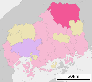
| Location of Shobaras in Hiroshima Prefecture | ||
Shōbara ( Japanese 庄 原 市 ) is a city in Hiroshima Prefecture in Japan .
history
The city of Shōbara was founded on March 31, 1954.
geography
Shōbara is northeast of Hiroshima and north of Fukuyama .
Attractions
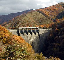
The Kōbo Dam ( 高 暮 ダ ム , Kōbo-damu ) is located in the urban area .
traffic
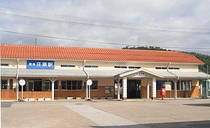
Shōbara is on the Chūgoku Expressway and National Roads 182, 183, 314, and 432. The city's train station is on the JR Geibi Line to Niimi and Miyoshi and the JR Kisuki Line to Matsue .
Town twinning
-
 Guangyuan , since 1990
sons and daughters of the town
- Kurata Hyakuzō (1891-1943), writer and literary critic
- Ikuo Kamei (1933–2019), politician
Neighboring cities and communities
Shōbara borders on Fuchu , Miyoshi , Niimi , Takahashi and Unnan .
Web links
Commons : Shōbara - collection of images, videos and audio files


