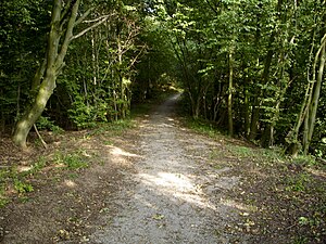
Silver hollow
|
Silberhohl nature reserve
|
||
| location | near Seesen , Goslar district , Lower Saxony | |
| surface | 2.3 ha | |
| Identifier | NSG Br 013 | |
| WDPA ID | 82590 | |
| Geographical location | 51 ° 54 ' N , 10 ° 11' E | |
|
|
||
| Sea level | from 187 m to 201 m | |
| Setup date | June 2nd 1977 | |
| administration | NLWKN | |
The Silberhohl nature reserve is located north of the town of Seesen in the Goslar district in Lower Saxony . It is located west of the river Schildau and includes a funnel-shaped, by salt leaching in Zechstein 5000 years ago formed sinkhole , which is a 11 meters thick mud houses. In addition to peat moss - swinging lawns and ear willow bushes, other plants and animals in need of protection, which are adapted to the specific conditions in the moor (extreme nutrient deficiency and constant humidity), have settled here. These include, for example, the fever clover , which is highly endangered in Lower Saxony , the common cranberry and the Gagelstrauch , which is probably its southernmost occurrence in Lower Saxony.
The district of Goslar, as the lower nature conservation authority, carries out regular maintenance measures in the nature reserve designated on June 2, 1977 in accordance with an ordinance of May 5, 1977 to prevent encroachment due to eutrophication from outside.
Web links
- "Silberhohl" nature reserve in the database of the Lower Saxony State Office for Water Management, Coastal and Nature Conservation (NLWKN)
Individual evidence
- ^ District of Goslar: Ordinance NSG Silberhohl


