
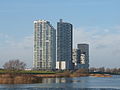
Spijkenisse
 flag |
 coat of arms |
| province |
|
| local community |
|
|
Area - land - water |
30.24 km 2 26.03 km 2 4.21 km 2 |
| Residents | 73,075 (Jan. 1, 2017) |
| Coordinates | 51 ° 50 ′ N , 4 ° 19 ′ E |
| Important traffic route |
|
| prefix | 0181 |
| Postcodes | 2913, 3028, 3066, 3191-3193, 3201 |
 |
|

Spijkenisse ( ) is a city in the Netherlands . It is located in the province of South Holland on the island of Voorne-Putten. It has a total area of 30.24 km². In 2017 its population was 73,075. The town also includes the villages of Hekelingen, Den Hoek and Beerenplaat. On January 1, 2015, Spijkenisse was incorporated into the municipality of Nissewaard .
Location and economy
Spijkenisse is a suburb of Rotterdam . The city is about 12 km southwest of downtown Rotterdam, on several land and waterways (including the Hartel Canal, the Spui River and the Oude Maas ). Spijkenisse does not have a train station, but the center and central station of Rotterdam can be reached by metro in 25 to 30 minutes. It is a little more difficult for motorists, as the mainland can only be reached from the island via two bridges, which become a bottleneck during rush hour.
There are many companies in Spijkenisse which are mainly active in trading, repairs and other services. The service sector is the main economic power of the municipality.
The city has u. a. a hospital and a theater as well as several schools and churches.
history
The area of Spijkenisse was founded around 2200 BC. First settled by hunters of the Neolithic Age. The Romans also left traces of their presence. A Roman tomb was excavated in the city park. In the Middle Ages , the village of Spijkenisse was built around a dike and a church. It remained a small village until 1900, the inhabitants of which made wooden rings for barrels. In 1958 the town , which at that time had 3,000 souls, was designated by the government as a "growing community" and Spijkenisse quickly grew into a suburb of Rotterdam. Since January 1, 2015, Spijkenisse has belonged to the municipality of Nissewaard.
economy
The city is a typical commuter city in the Rotterdam area. Most of the people living in Spijkenisse have higher educational qualifications and hold management positions in Rotterdam.
Districts
- De Akkers (with neighborhoods Gaard, Dreef, Kreek, Voorde, Donk and Akkers center)
- Center (city center)
- De elements
- Gildenwijk
- Groenewoud
- De Hoek
- Hoogwerf (Spijkenisse-Nort)
- Landgoed
- Maaswijk
- Rietvelden
- leg
- Schiekamp (Spijkenisse-Nort)
- Staalmeesters
- Staalmeesters-Noord
- Sterrenkwartier
- Vierambachten
- Vogelenzang-Nort
- Vogelenzang-Süd
- Vriesland
- De Waaijer
- Waterland
Educational institutions
Gymnasium, secondary and secondary schools
| Roman Catholic | General Christian | Public |
|---|---|---|
| Nova College Charles de Foucauld | Penta College CSG Scala Molenwatering | OSG De Eilanden |
| Penta College CSG Scala Rietvelden | OSG De Ring van Putten | |
| Penta College De Oude Maas |
Elementary schools
| Roman Catholic | General Christian | Public | Calvinist Reformed |
|---|---|---|---|
| De Akkers | Het anchor | Annie MG Schmidt | De Morgenster |
| De clinker | Het beacons | De Horst | |
| De Maasoever | De Bron | Jan Campert | |
| Monseigneur Bekkersschool | De Duif | De Kooy | |
| De Wegwijzer | De Hoeksteen | De Krullevaar | |
| Holy Pausing John | De marimba | De Meander | |
| De Rank | De Montessori | ||
| De Schakel | De Nachtegaal | ||
| De Piramide | |||
| De Rietgors | |||
| De Veenvlinder | |||
| De Vogelenzang |
Special schools
| General Christian | Public | secondary schools |
|---|---|---|
| De branding | De tandem | De Gaard |
| De Sluis |
Churches

Roman Catholic
- St. Felicitaskerk
Reformed
- Dorpskerk
- Michaëlkerk
- Ontmoetingskerk
- Dorpskerk Hekelingen
Attractions
Sights are:
- The village church from the 15th century in the town center
- The natural areas in the area where herons and other water birds live.
- The replicas of the bridges that are shown on the euro bills .
politics
Distribution of seats in the municipal council

| Political party | Seats | |||
|---|---|---|---|---|
| 1998 | 2002 | 2006 | 2010 | |
| Onafhankelijk Nieuw Spijkenisse | 11 | 15th | 17th | 16 |
| PvdA | 7th | 5 | 9 | 5 |
| VVD | 8th | 4th | 3 | 5 |
| Trots op Nederland | - | - | - | 2 |
| CDA | 3 | 3 | 2 | 2 |
| SP | - | - | - | 1 |
| D66 | 2 | 1 | 0 | 1 |
| ChristenUnie / SGP | - | 1 | 1 | 1 |
| Local Politieke Federatie | - | - | 2 | 1 |
| GroenLinks | 1 | 2 | 1 | 1 |
| Nederland Mobiel | 2 | 2 | 0 | - |
| Politieke Partij seed | - | - | 0 | - |
| Spijkenisse Leeft | - | 2 | - | - |
| SGP / GPV / RPF | 1 | - | - | - |
| Burger issues Spijkenisse | 0 | - | - | - |
| total | 35 | 35 | 35 | 35 |
Town twinning
Personalities
- Rolf Habben Jansen (* 1966), CEO of Hapag-Lloyd since 2014
- Patrick van Luijk (* 1984), athlete
- Afrojack (born 1987), DJ
- Miquel Nelom (* 1990), football player
- Duncan Laurence (* 1994), singer
photos
Maasboulevard

Metro Spijkenisse

Mill

Bridge: Spijkenisserbrug

Library: "De Boekenberg"


Web links
Individual evidence
- ↑ a b Kerncijfers wijken en buurten 2017 Centraal Bureau voor de Statistiek , accessed on June 7, 2018 (Dutch)
- ^ Leo van den Berg: "European Cities in the Knowledge Economy." Ashgate Publishing 2005 ISBN 0-7546-4521-5 p. 262
- ↑ Rotterdam is rebuilding the "Euro" bridges . FICTION BECOMES REALITY. In: The Standard . 4th July 2011.
- ↑ in the residential area 'de elements', online ( memento of the original dated August 14, 2016 in the Internet Archive ) Info: The archive link was automatically inserted and not yet checked. Please check the original and archive link according to the instructions and then remove this notice. (PDF, 6 MB)
- ↑ Allocation of seats in the municipal council: 1998–2002 2006 2010 , accessed on June 7, 2018 (Dutch)
- ↑ biography