
Spratzbach
| Spratzbach | ||
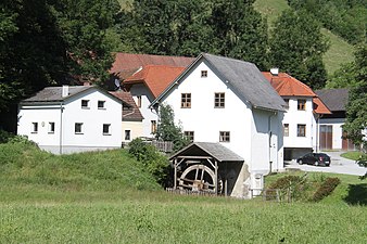
.jpg) The Spratzbach in the local area of Spratzau |
||
| Data | ||
| location | Austria | |
| River system | Danube | |
| Drain over | Rabnitz → Danube → Black Sea | |
| origin | Kaltenberg, (municipality of Lichtenegg ) 47 ° 36 ′ 51 ″ N , 16 ° 10 ′ 41 ″ E |
|
| Source height | 810 m above sea level A. | |
| muzzle | near Blumau ( Hollenthon municipality ) in Rabnitz coordinates: 47 ° 32 '40 " N , 16 ° 18' 35" E 47 ° 32 '40 " N , 16 ° 18' 35" E |
|
| Mouth height | 418 m above sea level A. | |
| Height difference | 492 m | |
| Bottom slope | 45 ‰ | |
| length | 11 km | |
| Catchment area | 44.9 km² | |
| Communities | Lichtenegg , Hollenthon , Wiesmath | |
.jpg) After heavy rainfall, the Spratzbach (here in the local area of Blumau) repeatedly overflows its banks due to the large catchment area |
||
The Spratzbach , formerly Spratzah , is a body of water in the Bucklige Welt in Lower Austria .
location
It rises in the immediate vicinity of the Maria Schnee pilgrimage church in the local area of Kaltenberg (municipality of Lichtenegg ) at an altitude of 850 m above sea level. A. In the village of Blumau (municipality of Hollenthon ) it unites with the Thalbach and forms the Rabnitz from there . The catchment area is 37.14 square kilometers, the length 11.2 kilometers.
Due to its large catchment area, but also because of its exposed location, the Spratzbach is repeatedly the scene of floods . The otherwise harmless channel is one of the most endangered rivers in Austria both at genoa lows and when the snow melts and during thunderstorms .
From Spratzau, the Spratzbach forms the border between the municipalities of Lichtenegg and Hollenthon before entering the municipality of Hollenthon at Fahrnermühle . From the village of Neumühle ( Wiesmath municipality ) to Kohlgraben , it forms the border between the Hollenthon and Wiesmath municipalities. From the Kohlgraben to the origin of the Rabnitz, the Spratzbach is the border between the communities Hollenthon and Markt St. Martin . In addition, it is the border between the political districts Wiener Neustadt-Land and Oberpullendorf as well as between the federal states of Lower Austria and Burgenland .
The Spratzbach is the namesake of the localities Spratzau and Spratzeck , which consist of individual scattered houses. One of the most important feeders is the Hirschauer Bach , which has its origin in the Rotte Geretschlag . The Spratzbach is accompanied in the upper course by the state road 4104 and in the lower course by the state road 149 .
history
The Spratz valley was first mentioned in 830 in a deed of donation from the Frankish king to the imperial monastery Kremsmünster . Until after the turn of the first millennium, the Spratz valley formed the border between the areas of influence of the bishops of Passau and Salzburg . After that it forms the border of the settlement area of the Avars to the west at the time of the County of Pitten .
The Spratzbach is known for the Spratztal, which is also called the "Valley of the Seven Mills". In the 17th century, several farmers and wage mills typical of the region were built there, of which only the so-called Dopler mill built in 1827 has survived . Towards the end of the 20th century, the other mills fell victim to the technical and economic innovations. The Doppler mill was equipped with a new mill wheel by the municipality of Lichtenegg in 2001 and has been open to visitors as a foam mill since then. The mill is equipped with a transmission system extending over three floors , with which the water power is transmitted to the millstones and roller mills . the hydropower is also used for elevators that transport the grain and ground products from the basement to the top floor.
photos
The Strobl or Fahrnermühle is the last intact mill in the "Valley of the Seven Mills"

It was built in 1850

Place name sign of the Rotte Spratzau

Place name sign of the hilltop settlement Spratzeck
.jpg)
.jpg)
.jpg)
.jpg)
literature
- Gneist, Gerald: The water mills on Spratzbach, Thalbach and the upper Rabnitz with special consideration of the Geißmühle . [Illustr.] - (Vienna 1991.) 132 BI. 4 Vienna, Univ., Dipl.-Arb., 1991
Web links
- Lichtenegg municipality: Spratzbach
- Burgenland water portal: Spratzbach - flow rates at St. Martin market, Blumau district
Individual evidence
- ↑ a b c d Federal Ministry of Agriculture and Forestry: Event documentation 2010 ( page no longer available , search in web archives ) Info: The link was automatically marked as defective. Please check the link according to the instructions and then remove this notice. , P. 69ff (PDF document, 9.52 MB)
- ↑ BMLFUW (ed.) : List of areas of the river areas: Leitha, Rabnitz and Raab areas. In: Contributions to Austria's Hydrography Issue No. 63, Vienna 2014, p. 1/17. PDF download , accessed July 7, 2018.
- ↑ Wiesmath, SPÖ: Popular excursion destinations in the Bucklige Welt
- ↑ University of Natural Resources and Life Sciences Vienna 2006: Floods & Climate Change - Scenarios of regional effects of climate change on future flood events in Austria p. 13ff (PDF document, 3.85 MB)
- ↑ Franz Schweickhardt, Ritter von Sickingen in representation of the Archduchy of Austria under the Ens, Volume 6, Part 2 : Spratzeck , pages 136-137
- ↑ Lichtenegg community: History of the Doppler mill
- ^ Municipality of Lichtenegg: Dopplermühle
- ^ The European Library: The water mills on Spratzbach, Thalbach and the upper Rabnitz with special consideration of the Geißmühle