List of municipalities in the urban region of Ried im Innkreis
The urban region of Ried im Innkreis is an Austrian agglomeration in Upper Austria . The region consists of the core zone (code: SR301) and the outer zone (code: SR302) .
History of the classification
The delimitation of the urban regions (urban centers) was carried out by Statistics Austria for 1971 to 2001 every 10 years. For the reference date October 31, 2013, delimitation was carried out for the first time according to the urban-rural typology developed by Statistics Austria for statistical purposes , which integrates the delimitation of the city regions.
List of municipalities according to the 2001 delimitation
- The population figures in the lists are from January 1, 2020.
Core zone Ried im Innkreis
| local community | location | Ew | km² | Ew / km² | Judicial district | region | Type
|
photo | Metadata |
|---|---|---|---|---|---|---|---|---|---|
Ried im Innkreis
|

|
12,220 | 6.77 | 1805 | Ried im Innkreis | urban community
|

|
According to code: 41225 |
|
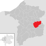
Hohenzell
|
|
2,267 | 22.52 | 101 | Ried im Innkreis | local community
|

|
According to code: 41209 |
|
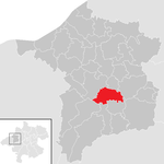
Neuhofen im Innkreis
|
|
2,467 | 15.6 | 158 | Ried im Innkreis | local community
|

|
According to code: 41218 |
|
Tumeltsham
|

|
1,599 | 9.11 | 176 | Ried im Innkreis | local community
|

|
According to code: 41232 |
Outer zone Ried im Innkreis
| local community | location | Ew | km² | Ew / km² | Judicial district | region | Type
|
photo | Metadata |
|---|---|---|---|---|---|---|---|---|---|
Andrichsfurt
|

|
781 | 12.35 | 63 | Ried im Innkreis | local community
|

|
Acc. To code: 41201 |
|
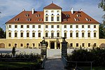
Aurolzmünster
|

|
3,097 | 15.97 | 194 | Ried im Innkreis | market community
|
|
According to code: 41203 |
|
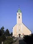
Eitzing
|

|
855 | 8.56 | 100 | Ried im Innkreis | local community
|
|
According to code: 41205 |
|
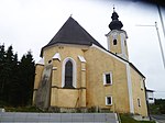
Geiersberg
|

|
509 | 5.45 | 93 | Ried im Innkreis | local community
|
|
According to code: 41206 |
|
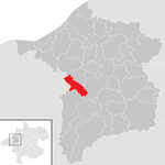
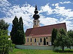
Kirchheim im Innkreis
|
|
724 | 10.24 | 71 | Ried im Innkreis | local community
|
|
According to code: 41211 |
|
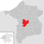
Mehrnbach
|
|
2,361 | 22.21 | 106 | Ried im Innkreis | local community
|

|
According to code: 41214 |
|
Pattigham
|

|
996 | 11.3 | 88 | Ried im Innkreis | local community
|
|
According to code: 41221 |
|
Peterskirchen
|
|
690 | 10.24 | 67 | Ried im Innkreis | local community
|

|
According to code: 41222 |
|
Schildorn
|

|
1,209 | 13.26 | 91 | Ried im Innkreis | local community
|

|
According to code: 41229 |
|
St. Marienkirchen am Hausruck
|
|
877 | 10.93 | 80 | Ried im Innkreis | local community
|

|
According to code: 41227 |
|
Wippenham
|

|
565 | 8.08 | 70 | Ried im Innkreis | local community
|

|
According to code: 41236 |
See also
Web links
Individual evidence
- ↑ Classifications according to urban and rural areas . STATISTICS AUSTRIA. Retrieved July 18, 2019.