Sulgenbach (river)
| Sulgenbach | ||
|
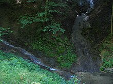
Sulgenbach in a 250-meter-long artificial stream bed on the municipality border Köniz-Bern |
||
| Data | ||
| Water code | CH : 1423 | |
| location |
Mittelland
|
|
| River system | Rhine | |
| Drain over | Aare → Rhine → North Sea | |
| source | near the Gummersloch or near Kühlewil (municipality of Wald ) 46 ° 53 ′ 48 ″ N , 7 ° 27 ′ 10 ″ E |
|
| Source height | approx. 815 m above sea level M. | |
| muzzle | In Bern in the Marziliquartier coordinates: 46 ° 56 '28 " N , 7 ° 26' 41" E ; CH1903: 600 461 / 198877 46 ° 56 '28 " N , 7 ° 26' 41" O |
|
| Mouth height | 510 m | |
| Height difference | approx. 305 m | |
The Sulgenbach , in the upper part also "Könizbach", is a brook in the area of the Swiss municipalities of Köniz and Bern .
Surname
Its name is probably derived from Old High German * sulaga or * solaga 'Lache, Pfütze'.
geography
course
The Sulgenbach rises near the Gummersloch or near Kühlewil (municipality of Wald ) at 815 m above sea level. M. and flows freely in a north-westerly direction through the Gurten or Köniz valley to the Köniz cemetery (about 600 m above sea level ). From there it is canalised to the point where it flows into the Aare and mostly flows underground.
In the village of Köniz it takes up the village stream, whose farthest source is near Herzwil . It then flows between the Könizsstrasse and the S-Bahn line and reaches the city of Bern at Holligen Castle . At Loryplatz , before it was diverted through Bern's old town, it took up the Stadtbach . Later there was a fabric printing shop by the stream. It then flows roughly over Konsumstrasse and Philosophenweg in two arms to Eigerplatz and over Eigerstrasse at the lowest point between the city center and the rising Gurten under the current Titanic II building of the Federal Office for Information Technology and Telecommunications through to the area that existed until 2005, today built over Scheuerrains . There it flows over the edge of the terrain into the Marziliquartier (from 521 to 503 m above sea level ) and again in several arms into the Aare.
The Sulgenbach becomes visible on the surface in the Weissenstein-Neumatt settlement in the border area between Köniz and Bern. During the day it is pumped up from its underground canal into an artificial stream bed and flows 250 meters exactly on the municipality boundary.
- Impressions from the Sulgenbach
Tributaries
- Allmitbach ( left ), 0.7 km
- Looslibach ( left ), 1.1 km
- Trottebüelbach ( right ), 0.7 km
- Rossacherbach ( right ), 0.4 km
- Schliernbergbach ( left ), 0.3 km
- Jennershusbach ( right ), 0.4 km
- Margelbach ( left ), 2.3 km, 1.32 km²
- Dammbach ( right ), 0.2 km
- Holebach ( right ), 0.4 km
- Bachtelebach ( left ), 1.0 km
- Dorfbach ( left ), 2.0 km
history
The village of Sulgen , today the Sulgenbach district of the city of Bern , stood on the creek between today's Eigerplatz and today's Monbijoustrasse . The Sulgenbach was previously used commercially. In the house at Sulgenbachstrasse 18 near Eigerplatz, for example, there was a parquet factory until 1955 on a canal derived from the Sulgenbach, which drove a water wheel. Today the BFF Bern vocational, technical and advanced training school is located in the building. In the area now occupied by the Titanic II building , there were various commercial buildings on Giessereiweg, and various businesses in Marzili also benefited from the streams of the brook.
In order to operate a mill and an oil mill at Köniz Castle, the Sulgenbach used to be brought up in a canal from the Köniz Valley with a slight gradient next to the old cemetery. In the new cemetery, this part of the Sulgenbach is only visible at the communal grave and north of the funeral hall.
The Sulgenbach was mentioned in the title by the Bernese author Martin Bieri in his literary work Henzi Sulgenbach because the men of the Henzi conspiracy met there in 1749 , to be precise at Giessereiweg 22.
literature
- Mattenhof-Sulgenbach Chronicle . With pen drawings by Ms. Brechbühl. Bern undated (approx. 1955).
Web links
- The course of the Sulgenbach on a map from 1858
- The course of the Sulgenbach and the location of the former village of Sulgenbach on a map from 1905
Individual evidence
- ↑ Berner Zeitung, April 30, 2012
- ↑ Werk, Bauen + Wohnen, Volume 4, 2009 (PDF)
- ↑ Otto Büssard: Köniz, pictures from the past, local history contribution to the village history of Köniz . Ed .: Local association Köniz. Köniz 1979, p. 11 .
- ↑ Martin Bieri - Henzi Sulgenbach. In: abendschein.ch. Retrieved February 26, 2020 .
- ^ Berchtold Weber: Giessereiweg. In: Historisch-Topographisches Lexikon der Stadt Bern, Bern, 2016. Retrieved on February 26, 2020 .
- ↑ Alexander Sury: A Forgotten Conspirator . In: The Bund . February 17, 2020, ISSN 0774-6156 ( derbund.ch [accessed February 26, 2020]).


