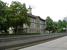
Bern-Sulgenbach
|
Sulgenbach Common quarter of Bern |
|
|---|---|
| Coordinates | 599670 / 198506 |
| height | 510- 550 m |
| surface | 0.48864 km² |
| Residents | 6131 (2019) |
| Population density | 12,547 inhabitants / km² |
| Proportion of foreigners | 20% (2019) |
| Quarter number | 308 |
| Post Code | 3007 |
| Statistical district | Weissenbühl |
| district | Mattenhof-Weissenbühl |
Sulgenbach is a common quarter in the statistical district 16 Weissenbühl of the district III ( Mattenhof-Weissenbühl ). It borders on the quarters Steinhölzli / Weissenbühl , Mattenhof , Monbijou , Marzili and Sandrain / Schönau . In the southwest it forms the city limits from Bern to Wabern .
In 2019, 6131 residents, 4906 Swiss and 1225 foreigners, were registered.
Surname
The area is named after the Sulgenbach , which - coming from the Köniz or Gurtental - ran here at the lowest point between the city center of Bern and the rising Gurten, roughly where today's Eigerstrasse is .
The name of the stream and the village is probably derived from the Old High German sulaga or solaga , which means something like pool, puddle . The brook is now channeled into the urban area. On the bank of the brook between today's Eigerplatz and the Sulgeneck was the village of Sulgen with the parts of Ober- and Untersulgen , incorporated into municipal law in 1346 and also called Sulden in the 18th century . The street names Sulgenauweg , Sulgenbachstrasse , Sulgeneckstrasse , Sulgenheimweg and Sulgenrain still remind of the Sulgenbach .
Development and nature of the quarter
Today the area is characterized by buildings from the 19th and 20th centuries (including the Sulgenbach schoolhouse from 1867) and the busy Eigerstrasse , which leads in a west-east direction from the Mattenhof district to the Monbijou bridge over the Aare to the Kirchenfeld district , and Monbijoustrasse , which runs north-south from Bern railway station to Wabern . The Bernmobil bus line 28 leads over the Eigerstrasse, the bus route 19 and the tram line 9 over the Monbijoustrasse . For the construction of the Monbijoustrasse in the Giessereiweg area, a group of remaining houses in the old village on Sulgenbach, including the Stockmühle , was demolished in 1911 . At the intersection of Monbijoustrasse and Eigerstrasse, the Titanic II building was constructed between 1992 and 1997 for the Federal Office for Information Technology and Telecommunications .
literature
- Fritz Brechbühl: Mattenhof - Sulgenbach Chronik , Bern 1956.
- Michael Stettler: Sulgenbach , Bern 1992. ISBN 3-7272-9715-8
Individual evidence
- ↑ Interactive city map of the city of Bern (selection under "Topics")
- ↑ Resident population 2019 (PDF; 4.3 MB) City of Bern, March 2020, p. 14 , accessed on March 29, 2020 .
- ↑ Photos on the architects' website
Web links
- The former village of Sulgenbach on a map from 1858
- The former village of Sulgenbach on a map from 1905
- Sulgenbach on g26.ch ( Memento from June 24, 2008 in the Internet Archive )


