
Bern-Mattenhof
|
Statistical District of Bern |
|
|---|---|
 |
|
| Coordinates | 599010 / 199076 |
| height | 523- 564 m |
| surface | 0.6098 km² |
| Residents | 7009 (2019) |
| Population density | 11'494 inhabitants / km² |
| Proportion of foreigners | 23.3% (2019) |
| Unemployment rate | 2.4% (2016) |
| BFS no. | 351014 |
| Post Code | 3007, 3008, 3010 |
| district | Mattenhof-Weissenbühl |
|
Common quarter in Bern |
|
|---|---|
 |
|
| Coordinates | 598996 / 199010 |
| height | 523- 564 m |
| surface | 0.52808 km² |
| Residents | 6678 (2019) |
| Population density | 12,646 inhabitants / km² |
| Proportion of foreigners | 23.5% (2019) |
| Quarter number | 309 |
| Post Code | 3007, 3008 |
| Statistical district | Mattenhof |
| district | Mattenhof-Weissenbühl |
The Mattenhof (also: Mattehof ) is a Bernese statistical district (14) and at the same time a smaller common quarter in the district III Mattenhof-Weissenbühl . In addition to Mattenhof, the statistical district also includes a children's clinic / women's hospital . Adjacent statistical districts are Weissenstein in the south, Holligen in the west and north-west, Monbijou in the north-east and east, and Weissenbühl in the south-east.
7009 inhabitants (5377 Swiss, 1632 foreigners) live on 61 hectares (2019). 6,678 inhabitants, 5,212 Swiss and 1,566 foreigners (2019) live in the smaller common quarter. The quarter is at an altitude of around 530 to 550 meters above sea level.
The main traffic arteries that also delimit the quarter are Schwarzenburgstrasse in the southeast, Weissensteinstrasse in the south, Könizstrasse in the west and Effingerstrasse in the north. Other important streets are Schwarztorstrasse , Belpstrasse and Zieglerstrasse . The main square is the Eigerplatz . The connection to public transport is ensured by the Bernmobil lines 3, 6, 10, 13, 14, 17 and 28, with line 6 to the Fischermätteli having almost all stops on its route in the Mattenhof.
The Bernese Friedenskirche is located in the Mattenhof .
history
"Mattenhof" has been the name of the area between Hirschengraben , Eigerplatz and Brunnmattstrasse since the middle of the 19th century . Until the 1840s, the Mattenhof district was a rural area that was traversed by watercourses. Between the Sulgenbach in the south and the Villette in the north, an overall loose and inconsistent settlement structure began to develop after 1850, which still largely characterizes the Mattenhof today.
photos
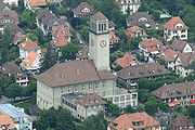
Friedenskirche in Mattenhof

Mattenhof post office around 1920

Web links
Individual evidence
- ↑ Interactive city map of the city of Bern (selection under "Topics")
- ↑ Resident population 2019 (PDF, 4.3 MB) City of Bern, March 2020, pp. 5 and 14 , accessed on March 29, 2020 .
- ↑ 2010 yearbook (PDF; 6.5 MB) page 36.
