Bern-Oberbottigen
|
Oberbottigen Statistical District of Bern |
|
|---|---|
| Coordinates | 592 358 / 198217 |
| height | 510– 661 m |
| surface | 12.7856 km² |
| Residents | 1405 (2019) |
| Population density | 110 inhabitants / km² |
| Proportion of foreigners | 8% (2019) |
| Unemployment rate | 1.1% (20) |
| BFS no. | 351030 |
| Post Code | 3018,3019,3020,3027 |
| district | Bümpliz-Oberbottigen |
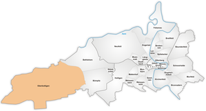
Oberbottigen is a village and statistical district (30) in the VI Bümpliz-Oberbottigen . The common quarters of Oberbottigen-Riedbach , Niederbottigen and parts of Riedern south of Murtenstrasse belong to it .
The resident population in 2019 was 1,405, of which 1,292 were Swiss and 113 were foreigners.
The name comes from a hamlet Oberbottigen. The villages and hamlets Niederbottigen, Matzenried, Buech and Chäs and Brot also belong to the westernmost statistical district or quarter of Bern .
history
As a dependent place (often also referred to as a hamlet), Oberbottigen used to belong to the independent municipality of Bümpliz and was incorporated into Bern in 1919 . Despite belonging to a town, it was able to keep its village character and in its main features remained a farming village.
Web links
literature
The Bern-Bümpliz West 1983 inventory is located in the archive of the preservation of monuments of the city of Bern , created by Bernhard Hegi and Jakob Meyer in collaboration with the municipal preservation of monuments.
Individual evidence
- ↑ Interactive city map of the city of Bern (selection under "Topics")
- ↑ Resident population 2019 report p. 5 on bern.ch
- ^ Anne-Marie Dubler : Bümpliz. In: Historical Lexicon of Switzerland .


