
Thames path
| Thames Path | |
|---|---|
 Footbridge over the Thames |
|
| Data | |
| length | 294 km |
| location | southern England |
| Markers | stylized upright white acorn on a brown background |
| Starting point | Themes source at Cricklade and Kemble 51 ° 38 ′ 0 ″ N , 1 ° 57 ′ 0 ″ W. |
| Target point |
Thames Barrier in London 51 ° 29 ′ 49.9 " N , 0 ° 2 ′ 12.7" E |
| Type | Long-distance hiking trail |
| Level of difficulty | medium |
| season | all year round |
| particularities | Follow the Thames Valley . |
The Thames Path is a 296 kilometer (184 mi ) long hiking trail in England that follows the course of the Thames . It runs from the Themsprelle at Kemble (Gloucestershire) to the barrage of the river at Woolwich in south-east London . A continuation on the south bank of the Thames for approximately 16 km (10 miles) is possible to Crayford Ness . The stages are between 7 and 20 km (4.5 and 12.5 miles) long.
Established in 1996, the trail is managed as a National Trail by Natural England , a government agency, and follows the course of the old towpath as much as possible .
Photographs

Railway bridge at Windsor

On the upper reaches of the river

Signpost at Thames Barrier
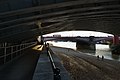
Thames Path under the Blackfriars Railway Bridge


Web links
Commons : Themsepfad - collection of images, videos and audio files
- Thames Path directions in stages