
Yorkshire Wolds Way
| Yorkshire Wolds Way | |
|---|---|
 Away at Bratt Wood |
|
| Data | |
| length | 127 km |
| location | northern England |
| Markers | stylized upright white acorn on a brown background |
| Starting point |
Hessle 53 ° 43 ′ 0 ″ N , 0 ° 26 ′ 0 ″ W. |
| Target point |
Filey 54 ° 13 ′ 0 ″ N , 0 ° 17 ′ 0 ″ W. |
| Type | Long-distance hiking trail |
| Height difference | 215 m |
| The highest point | Near Thixendale, 215 m |
| Lowest point | Filey , sea level |
| Level of difficulty | light |
| season | all year round |
| Viewpoints | Humber Bridge |
The Yorkshire Wolds Way is a walking route in England . It was inaugurated on October 2, 1982 as the national trail in the country and leads from Hessle near Hull in the East Riding of Yorkshire to the north and northeast over the Yorkshire Wolds to Filey , a small town on the North Sea coast in North Yorkshire . The path is 127 km long.
Photographs
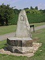
Marking for the starting point
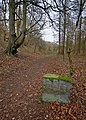
Path and landmark in East Dale
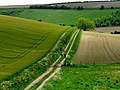
Path at North Newbald

signpost


literature
- David Clensy: Walking the Wolds Way. Yorkshire on foot, from Hull to Filey & five East Yorkshire tales. Self-published, sl 2007, ISBN 978-1-4303-1019-8 .
Web links
Commons : Yorkshire Wolds Way - collection of pictures, videos and audio files