
The Ridgeway
| The Ridgeway | |
|---|---|
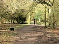
 At Grim's Ditch |
|
| Data | |
| length | 139 km |
| location | central england |
| Markers | stylized upright white acorn on a brown background |
| Starting point | Overton Hill ( Wiltshire ) 51 ° 25 '0 " N , 1 ° 50' 0" W |
| Target point |
Ivinghoe Beacon 51 ° 50 ′ 31 ″ N , 0 ° 36 ′ 29 ″ W. |
| Type | Long-distance hiking trail |
| The highest point | Liddington Castle , 276 m |
| Level of difficulty | light |
| season | all year round |
| Viewpoints | Ivinghoe Beacon , Liddington Castle , Uffington Castle |
| particularities | Follows the ridge of the North Wessex Downs and the Chiltern Hills |
The Ridgeway , English for ridge and path , is an old street in southern England . The road extends over a length of 135 km, starts in Overton Hill ( Wiltshire ) in the west and ends in Ivinghoe Beacon ( Buckinghamshire ) to the east.
Today the route is designated as The Ridgeway National Trail . There are a number of Stone Age , Bronze Age, and Iron Age attractions along this route , including Grim's Ditch and Liddington Castle, as well as the Uffington White Horse and Uffington Castle . 5000 years ago, The Ridgeway may have been part of a route that ran from the Dorset coast to The Wash in Norfolk .
Photographs

The trail at Ivinghoe Beacon

signpost

Between Ludwell and Win Green
At Moneybury Hill


literature
- Anthony Burton: The Ridgeway (= National Trail Guide. ). Aurum Press, London 2005, ISBN 1-84513-063-4 .
- National Trails Office: Ridgeway Information Pack - Set of leaflets about the history, geology and wildlife of The Ridgeway.
- John RL Anderson, Fay Godwin: The Oldest Road. An Exploration of the Ridgeway. Whittet Books Ltd, London 1987, ISBN 0-905483-52-9 .
Web links
Commons : Ridgeway National Trail - collection of pictures, videos and audio files
- The Ridgeway National Trail
- The Pegasus Archive: The Ridgeway
- BBC: The Ridgeway
- The friends of the Ridgeway
- Imogen Herrad : On foot into the Stone Age: The Ridgeway long-distance hiking trail. Recording of a contribution in the broadcast radioReisen auf Bayern 2 from minute 35:33, broadcast information ( memento from February 15, 2017 in the Internet Archive )