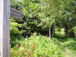
Cotswold Way
| Cotswold Way | |
|---|---|
 Away at Lansdown |
|
| map | |

|
|
| Data | |
| length | 164 km |
| location | southwestern Britain |
| Markers | stylized upright white acorn on a brown background |
| Starting point |
Bath 51 ° 23 ′ 0 ″ N , 2 ° 22 ′ 0 ″ W. |
| Target point | Chipping Camden 52 ° 3 ′ 14.4 " N , 1 ° 46 ′ 22.8" W. |
| Type | Long-distance hiking trail |
| The highest point | Cleeve Hill, 330 m |
| Level of difficulty | light |
| season | all year round |
| Viewpoints | Cleeve Hill, Broadway Tower |
| particularities | Follows the ridge of the Cotswolds ridge . |
The Cotswold Way is a 164 km (102 mile) long distance hiking trail along the Cotswold Edge escarpment of the Cotswold Hills , England . It was officially inaugurated as the National Trail on May 24, 2007 after several new rights of way were created.
Attractions
The trail runs northeast from Bath to Chipping Campden , past the following towns: Old Sodbury at Chipping Sodbury , Wotton-under-Edge , Dursley , Stroud , Painswick , Cranham , Leckhampton , Cheltenham , Winchcombe , Stanway and Broadway .
It gives access to several attractions including the Battle of Lansdowne Battlefield , Somerset Monument , Tyndale Monument , Sudeley Castle , Cleeve Hill , Hailes Abbey , and Broadway Tower . With the exception of a small stretch at Broadway, which is in Worcestershire , the entire path runs in Gloucestershire including South Gloucestershire and Somerset including Bath and North East Somerset .
Web links
Individual evidence
- ^ Cotswold Way - About this trail . In: National Trail . Retrieved June 30, 2007.


