Theodore Roosevelt Island
| Theodore Roosevelt Island | ||
|---|---|---|
| Mason House in a 19th century photograph | ||
| Waters | Potomac River | |
| Geographical location | 38 ° 53 '50 " N , 77 ° 3' 51" W | |
|
|
||
| length | 1.1 km | |
| width | 500 m | |
| surface | 35.81 ha | |
| Residents | uninhabited | |
| main place | Mason House (historic) | |
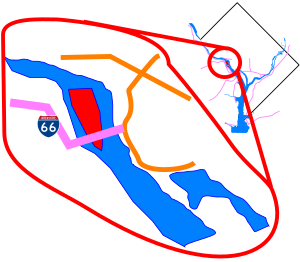
| Map sketch | ||
Theodore Roosevelt Island , formerly known as My Lord's Island , Barbadoes Island , Mason's Island , Analostan Island , and Anacostine Island , is a national memorial located in the Potomac River in Washington, DC . It divides the Potomac into the wider Georgetown Channel on the left and the Little River on the right . It was given to the American people by the Theodore Roosevelt Association in memory of the 26th US President Theodore Roosevelt . The area of the monument consists of the square with the statue of Roosevelt and two ornamental fountains, the area around is a natural park. The island is north of Columbia Island and can be accessed via a footbridge that leads to a paved footpath. The bridge connects the island to the banks of the Potomac in Virginia . At the southern end of the island is the small island of Little Island . The John F. Kennedy Center for the Performing Arts can be seen from the east bank of the island .
history
The Nacotchtank Indians, who used to live in what is now Anacostia , temporarily moved to the island in 1668 and gave it the first known name "Anacostine". In 1682, Captain Randolph Brandt registered the island under the name Anacostine Island. After his death in 1698/1699 he bequeathed it to his daughter Margaret Hammersley. George Mason bought the island in 1724. John Mason, son of George Mason, acquired the island in 1792 and owned it until 1833. At the beginning of the 19th century, Mason built a house and laid out a garden. When a dam dammed the river, the Masons left the island in 1831.
With the exception of a brief period in the Civil War when Union forces were stationed there, the island has been uninhabited since the Masons' departure. Until the monument was built, the island was called "Mason's Island" by the locals. Around 1906 a fire broke out on the island and severely damaged the house. Parts of the foundation walls are the only things that can still be seen today. From 1913 to 1931 the island was owned by the Washington Gas Light Company, which let the island overgrown uncontrollably.
memorial
The Theodore Roosevelt Memorial Association bought the 35.81 acre wooded island from the Washington Gas Light Company in 1931 to build a memorial in the tradition of the Presidential Memorials in honor of Roosevelt. The Congress approved the monument on May 21, 1932. 1960 approved the Congress funds for the monument, which was inaugurated on October 27, 1967th The memorial, which was designed by Eric Gugler , includes a five meter high statue by sculptor Paul Manship . The memorial also includes four large stone monoliths with some famous Roosevelt quotes and two large fountains. The island is now maintained by the National Park Service as part of the George Washington Memorial Parkway . On October 15, 1966, the National Memorial, like all historic sites administered by the National Park Service, was registered on the National Register of Historic Places .
Public access
Although part of the District of Columbia, the island is only accessible from the George Washington Memorial Parkway in Arlington County . Cars and bicycles are prohibited on the island.
You can only park in the parking lots between the George Washington Memorial Parkway and the Potomac. The closest station on the Washington Metro is Rosslyn Station.
Web links
- Official NPS Website: Theodore Roosevelt Island
- Theodore Roosevelt Association
- General John Mason House information on the house.
Individual evidence
- ^ Theodore Roosevelt Island . US Geographic Survey: Geographic Names Information System. Retrieved January 13, 2009.
- ↑ a b c d e Curry, Mary E .: Theodore Roosevelt Island: A Broken Link to Early Washington, DC History . In: Records of the Columbia Historical Society of Washington, DC . 1971-1972.
- ↑ James W. Foster, "Potomac River Maps of 1737 by Robert Brooke and Others," William and Mary College Quarterly Historical Magazine 2nd Ser., Vol. 18, no. 4. (October 1938), 410.
- ↑ National Park Service: Listing of area as of 09/30/2005 . Archived from the original on October 14, 2006. Info: The archive link was inserted automatically and has not yet been checked. Please check the original and archive link according to the instructions and then remove this notice. Retrieved May 5, 2006.
- ^ The National Parks: Index 2001-2003 . Washington: US Department of the Interior .
- ^ NPS: Theodore Roosevelt Island . Retrieved February 25, 2011.


