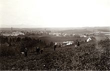
Trzciniec (Bogatynia)
| Trzciniec | ||
|---|---|---|
 Help on coat of arms |
|
|
| Basic data | ||
| State : | Poland | |
| Voivodeship : | Lower Silesia | |
| Powiat : | Zgorzelec | |
| Gmina : | Bogatynia | |
| Geographic location : | 50 ° 57 ' N , 14 ° 54' E | |
| Residents : | ||
| Telephone code : | (+48) 75 | |
| License plate : | DZG | |
| Economy and Transport | ||
| Next international airport : | Dresden | |
| Wroclaw | ||
Trzciniec (German Rohnau ) is a district of Bogatynia in Poland .
Geographical location
Trzciniec is located on a plateau above the deeply cut valley of the Lausitzer Neisse opposite the Zittau district of Rosenthal and the Kemlitz estuary . The Turów power plant is located in the southeast of Trzcieniec . To the south, the vineyard joins the towns of Trzciniec Dolny and Turoszów in the Miedzianka valley .
history
Ronaw was built in the 15th century in the corridors of the forecourt of the destroyed Ronow Castle . In 1494 the city of Zittau acquired Rohnau together with parts of the village of Hirschfelde . With the exception of a brief loss of property due to the Upper Lusatian Pönfall , Rohnau remained a council village of the city of Zittau.
In 1804, Gottlieb Apelt set up a bleaching facility on the community meadows in the south of Rohnau, around which a settlement - the keeper - arose. The village thus experienced an expansion to the south and in 1853 also to the south-west when the houses were built in the Grund on the Neisse, opposite the machine flat spinning mill from HC Müller . At this point a footbridge led over the Neisse to the factory.
The factor Carl August Frenzel laid the foundations for his successful company in Rohnau in the second half of the 19th century, for which more than 300 house weavers worked in the surrounding villages. Frenzel later set up the mechanical weaving mill CA Frenzel & Sohn in Hirschfelde, which existed until 1930.
With the construction of the Neißetalbahn , which passed Rohnau from 1875, the need for a stop grew, which was finally created in 1882 in the Neißetal near Hältern opposite the flax spinning mill HC Müller. During this time, Rohnau also became the starting point for day-trippers who climbed the Holderberg, visited the forester's lodge Rohnau in the castle ruins, or hiked through the Neisse valley to the St. Marienthal monastery and got back on the train in Rusdorf .
In 1871 the village, including the district of Hältern, had 604 inhabitants; in 1943, 482 people lived in the village.
After the end of the Second World War , Rohnau became Polish. The stop at the Neißetalbahn was closed in 1946. In 1957 a branch from the Neisse Valley Railway to the Turów mine and on to Bogatynia was built in Trzcieniec . A stop for the passenger trains running there was not re-established in Trzcieniec. In 1962, the Turów lignite power station was built in the southeast of the village . In the 1970s Trzciniec was incorporated into Bogatynia.
Attractions
- There are numerous Upper Lusatian half-timbered houses in Trzciniec .
- Ruins of Rohnau Castle
- Neisse Valley
literature
- Tilo Böhmer / Marita Wolff: Im Zittauer Zipfel, Lusatia-Verlag Bautzen, ISBN 3-929091-85-2
- Hermann Knothe : History of the villages Rohnau, Rosenthal and Scharre, near Hirschfelde in the Koenig. Saxon Upper Lusatia . Zittau 1857 (Reprint: Ostritz 2003). ( Digitized original edition )
- Cornelius Gurlitt : Rohnau. In: Descriptive representation of the older architectural and art monuments of the Kingdom of Saxony. 29. Issue: Amtshauptmannschaft Zittau (Land) . CC Meinhold, Dresden 1906, p. 225.
Web links
- Rohnau in the Digital Historical Directory of Saxony
Individual evidence
- ^ Website of the city of Bogatynia, O gminie - Historia , accessed on September 26, 2010


