Kurt-Schumacher-Platz underground station
The Kurt-Schumacher-Platz U-Bahn station is a station on the U6 line of the Berlin U-Bahn . It is located in the Berlin district of Reinickendorf in the district of the same name . At the operator Berliner Verkehrsbetriebe (BVG), it is run internally under the abbreviation Sch .
The underground station is located on Kurt-Schumacher-Platz in the north of Berlin, roughly in the middle under the Kurt-Schumacher-Damm that flows into it. Due to its proximity to Tegel Airport, it is an important transport hub in the north of the city as a transfer point between the U6 line and the bus lines to the airport and to the surrounding city quarters.
history
From May 3, 1956 to May 31, 1958, the station was the end point of the first new section of the Berlin subway after the end of World War II (the Battle of Berlin ).
Construction of the line was 30 October 1953. On 3 May 1956, the extension between the stations was Seestraße and Kurt Schumacher Platz-opened. The underground station was named after the square of the same name, the one after the Social Democrat Kurt Schumacher, who, based on his experiences, represented a strict rejection of German National Socialism .
The northern extension of the so-called “Müllerstrasse U-Bahn” is now an extension of the old line C (from 1966: line 6, from 1984: U6) to Tegel . It initially extended over a length of around 2.4 kilometers and included three stations. The expansion of the line was proposed in April 1929 by the then City Councilor for Transport, Ernst Reuter . Construction work began in July 1929, but had to be canceled again in autumn 1930 due to the financial crisis in the city of Berlin. Up until then, around 400 meters of tunnel and a further section in the shell had been built. The planning at the time already envisaged a route to the then unnamed Kurt-Schumacher-Platz (working title of the planned terminus: Reinickendorf-West or Scharnweberstraße ).
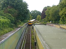
After the end of the Second World War, further construction of the line was firmly planned in the occupied sector city of West Berlin , but this time with the end point Tegel (since 1992: Alt-Tegel ), so that a through station was built from the outset . Immediately to the northwest of the station, an open ramp connects to the Scharnweberstrasse high station, which is located on an earth dam . There is a double-track turning and installation system. It is enclosed, and the exposed tracks to and from Tegel frame it on both sides.
Design of the station
Senate Building Director Bruno Grimmek was commissioned with the architectural design of the first post-war train stations . Like his predecessor Alfred Grenander , he designed a basic scheme that was adapted to the local conditions of the individual train stations. According to the scheme, the station has a central platform 10 meters wide, which is 7.66 meters deep (one and a half times the depth). The station ceiling rests on greenish central supports made of natural stone. It is angled lengthways and raised. The walls were given ivory-colored tiles, arranged in a vertical grid. In 2011/2012 the subway station was renovated and new wall cladding in beige and gray .
The station received four entrances, the two south-eastern ones formed a structural unit with a covered bus stop. The access structure to the northwest of the Kurt-Schumacher-Damm was built in the 1970s to cover the entrances there; shops and restaurants are integrated there. In 1989 the south-eastern entrances disappeared into the street facade of a shopping center.
All escalators were retrofitted, probably in the 1970s and 1980s. On December 21, 2017, an elevator from the subway platform to the median of Kurt-Schumacher-Damm was put into operation, so that the station has been barrier-free since then .
Connection
At the underground station you can change to bus lines 122, 125, 128, 221, M21 and X21 of the BVG .
Web links
- BVG map of the station (PDF; 43 kB)
- Kurt-Schumacher-Platz underground station on untergrundbahn-berlin.de
- History of the U6 underground line on berliner-untergrundbahn.de
Individual evidence
- ↑ a b c d e Alexander Seefeldt: U6. The "North-South Railway" through Mitte . 1st edition. Robert Schwandl, Berlin 2012, ISBN 978-3-936573-34-3 , p. 70 f .
- ^ Alexander Seefeldt: U6. The "North-South Railway" through Mitte , p. 4.
- ^ Jürgen Meyer-Kronthaler: Berlin's subway stations. The first hundred years . be.bra, Berlin 1995, ISBN 3-930863-07-3 , pp. 156 .
- ↑ Three times up! BVG press release of December 22, 2017
Coordinates: 52 ° 33 ′ 48.8 " N , 13 ° 19 ′ 35.7" E


