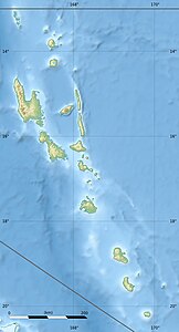
Uri (Malakula)
| Uri | ||
|---|---|---|
| Waters | Coral sea | |
| Archipelago | New Hebrides | |
| Geographical location | 16 ° 5 ′ S , 167 ° 27 ′ E | |
|
|
||
| Highest elevation | 20 m | |
Uri is a small island in the New Hebrides off the coast of Malakula in the island state of Vanuatu .
geography
The island is opposite the main town, Lakatoro . Together with the islet of Uripiv, it forms the continuation of a headland that extends north from Bushman's Bay and forms the Bay of Lakatoro. Only a narrow strip of water separates the island from Pointe Chong'neou (Mangrove Point, Pte des Palétuviers, Pte Stanley). In the interior of the bay is the island of Taïtaka between the headland and the mainland.
The elongated island rises only about 20 m from the water. There are a few bungalows on the western tip.
