
Usaquén

|
|
| Basic data | |
|---|---|
| Surface: | 65.31 km 2 |
| location | 4 ° 42 ′ N , 74 ° 2 ′ W |
| Height above d. M .: | 2560 m |
| Population (2005): | 425.192 |
| Post Code: | 110111 (Usaquen Central-Santa Barbara) 110121 (Cédritos-Bella Suiza) 110131 (Las Orquídeas) 110141 (Verbenal-Codíto) 110151 (Torca) |
| politics | |
| Department : | Bogotá |
| Mayor: | Mayda Velásquez Rueda |
| Usaquén website | |
| location | |

|
|
Usaquén is the 1st district ( localidad ) of the Colombian capital Bogotá , which has been part of the city since 1954. The district is located in the northeast of the city on the eastern mountain range and borders the municipality of Chía to the north, the municipality of La Calera to the east, the municipality of Chapinero to the south and the municipality of Suba to the west .
Today there are residential complexes and shopping centers in the district, the population of the district was 425,192 in 2005.
history
Origin of the name
There are different versions of the meaning of the name. On the one hand, it is assumed that the name in the pre-Hispanic times in the life of the indigenous people of the Muisca represented an honorary title in contrast to the so-called Zipa or Bacatá. Another version refers to a religious practice: before a house was built for a chief, pits were dug to fix stakes. Before that, however, a girl's body was buried under earth and wood as a symbol of strength and happiness. This ceremony was called Usaqué, which in the Chibcha language means "under the stake". Another theory is that Usaquén meant "land of the sun" for the Chibcha people, while it is also believed that Usaquén came from Usaca, who is the daughter of Tisquesusa, who was married to the Spanish captain Juan Mará Cortés . Juan Mará Cortés is said to have received large areas of Usaquén as trousseau. Until 1777 Usaquén was inhabited by an indigenous people, who left the area due to a Spanish decree and due to poor agricultural conditions and settled in the south of the city.
19th century
At the beginning of the 19th century the quarter consisted of only 120 houses, most of them made of straw, of which only 100 actually belonged to the said quarter. The quarter was the seat of well-known country estates, for example Santa Ana, Santa Bárbara or El Cedro. These former estates are now used as shops, residential areas or shopping centers.

In 1852 the sector was declared a municipality, in 1860 a battle broke out between the troops of the government and the troops of Tomás Cipriano de Mosquera , who emerged victorious and took control of the country.
20th century
In 1905 the Carretera Central del Norte was constructed, which considerably improved the connections between Usaquén and Chapinero and Bogotá. Until 1954, Usaquén belonged to the department of Cundinamarca , had a size of 71 km² and was 12 km from the center of Bogotá. Because of this, Usaquén was a popular place to live for wealthy families in the city.

While only 4617 people lived in Usaquén in 1938 and most of the houses were in poor condition, the number of residents increased enormously in the 1940s - as in Bogotá. In 1951, Usaquén already had a population of 11,207, of which only 2,469 were born in Usaquén.
The increasing sand mining at this time explains the growth of the La Cita and San Cristóbal Norte districts , which were created by the division of the mining companies operating in the area. During this period, the Barrancas district also developed as immigrant families settled in the 153 and 163 Calles area.
After the foundation of the Bogotá district (Distrito Especial) in 1955, Usaquén was integrated into the city, but kept its institutions as an independent municipality. Usaquén was however subject to the supervision of the mayor of the Bogotá district. At the same time the parcelling of the Hacienda Santa Ana began. It was inspired by the residential complexes in the El Chicó and El Cedro sectors . The plots were aimed at the emerging middle class, which developed through the modernizing dynamics of the city.
At the beginning of the 1960s , the sector comprised 18 districts. Due to the unusual urbanization, the transport was dependent on the Carrera Séptima. Although the sector was surrounded by a few roads, there was no direct access to them, and public transport was very limited. The less fertile agriculture forced the new residents of the district to go to the market in Bogotá.
In 1972, the town's small mayor offices were introduced, including Usaquén. This gave the sector back some autonomy. In addition, a financing system for apartments was developed, which became known as Unidad de poder adquisitivo constante (UPAC). The construction of the Unicentro shopping center in 1976 is of great relevance. The construction brought about a new urban development, accompanied by the emergence of the districts of Multicentro and Antigua. These projects, districts and urbanizations were mainly driven by Pedro Gómez y Cia . Gómez y Cia also developed some other areas of today's Usaquén, such as Santa Coloma, La Pradera, Belmira or Bosque Medina . In January 1979, the M-19 guerrilla movement carried out an arms robbery from the army's central arsenal in Usaquén, during which more than 5,000 weapons were stolen through an 80-meter-long tunnel.
In 1991 the former municipality was recognized as a district through a constitutional amendment.
location
Usaquén is located in the northeast of the city on the eastern mountain range and borders on the north by Calle 240 on the municipality of Chía in the department of Cundinamarca . In the east, the eastern mountain range separates Usaquén from the municipality of La Calera . Usaquén borders on the Chapinero district in the south through Calle 100 and on the Suba district in the west through Autopista Norte .
Attractions
- The colonial quarter with the parish of Santa Bárbara (built in 1665, modernized in the 20th century), the old estate of the same name (now a shopping center), schools and the famous flea market .
- The Universidad El Bosque in Calle 134 with Avenida 9.
- The Nueva Granada Military University at Calle 100 with Carrera 11.
- The Country Club: Club with a large golf course for families of the upper class.
- Unicentro Shopping Center: one of the largest shopping centers in the city, where residents from all over the city come to.
- Santa Ana shopping center on Avenida Novena: one of the most exclusive shopping centers in the city.
- The Cedritos shopping center on Calle 150 with Carrera 16.
- The Palatino shopping center on Calle 140 with Carrera 7.
- The Hacienda Santa Bárbara shopping center: combines the modern with the colonial, as it was built on the land on which the colonial hacienda of Pepe Sierra was located.
- The Santa Bárbara corporate center: a connection of nine buildings located between Calles 112 and 116 and Carreras 7 and 9.

Church in Usaquén

School building in Usaquén, Carrera 6 with Calle 119
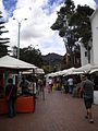
Usaquén flea market every Sunday

Santa Bárbara corporate center building
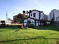
Railway station in Usaquén

TransMilenio stop at Calle 127 on the Autopista Norte

Antigua neighborhood, Calle 134

Building in the Santa Bárbara district


transport
Usaquén can be reached by city buses, which mainly run on Carrera Séptima , Avenida Novena , Avenida Carrera 19 and Avenida Carrera 15 . TransMilenio stations are only available in the western part of the district, from the Autopista Norte to the Portal del Norte there are alimentadores. In addition, buses from the Sistema Integrado de Transporte de Bogotá (SITP) stop at various stops in Usaquén. The Usaquén Railway Station is opposite the Santa Ana Shopping Center. Trains run from there to the communities of the Bogotá savannah. There is also the San Antonio train station, which is out of order.
Unidades de Planeamiento Zonal (UPZ)
Usaquén is divided into nine Unidades de Planeamiento Zonal ("Zone-like planning units"). These units in turn consist of several small city districts.
| UPZ | Borough |
|---|---|
| Paseo de los Libertadores | Canaima, La Floresta de La Sabana, Torca |
| Verbenal | Altos de Serrezuela, Balcones de Vista Hermosa, Balmoral Norte, Buenavista, Chaparral, El Codito, El Refugio de San Antonio, El Verbenal, Horizontes, La Estrellita, La Frontera, La Llanurita, Los Consuelos, Marantá, Maturín, Medellín, Mirador del Norte, Nuevo Horizonte, San Antonio Norte, Santandersito, Tibabita, Viña del Mar |
| La Uribe | Bosque de San Antonio, Conjunto Camino del Palmar, El Pite, El Redil, La Cita, La Granja Norte, La Uribe, Los Naranjos, San Juan Bosco, Urbanización Los Laureles |
| San Cristóbal Norte | Ainsuca, Altablanca, Barrancas, California, Cerro Norte, Danubio, Don Bosco, La Perla Oriental, Las Areneras, Milán (Barrancas), Pradera Norte, San Cristóbal Norte, San Cristóbal Norte parte alta, San Cristóbal Norte parte baja, Santa Teresa, Soratama, Torcoroma, Villa Nydia, Villa Oliva |
| Toberín | El Toberín, Babilonia, Darandelos, Estrella del Norte, Guanoa, Jardín Norte, La Liberia, La Pradera Norte, Las Orquídeas, Pantanito, Santa Mónica, Villa Magdala, Villas de Aranjuez, Villas del Mediterráneo, Zaragoza |
| Cedritos | Acacias, Antigua, Belmira, Bosque de Pinos, Caobos Salazar, Capri, Cedritos, Cedro Bolívar, Cedro Golf, Cedro Madeira, Cedro Narváez, Cedro Salazar, El Contador, El Rincón de Las Margaritas, La Sonora, Las Margaritas, Lisboa, Los Cedros, Los Cedros Oriental, Montearroyo, Nueva Autopista, Nuevo Country, Sierras del Moral |
| Usaquén | Bella Suiza, Bellavista, Bosque Medina, El Pañuelito, El Pedregal, Escuella de Caballería I, Escuela de Infantería, Francisco Miranda, Ginebra, La Esperanza, La Glorieta, Las Delicias del Carmen, Sagrado Corazón, San Gabriel, Santa Ana, Santa Ana Occidental, Santa Bárbara Alta, Santa Bárbara Oriental, Unicerros, Usaquén |
| Country Club | Country Club, La Calleja, La Carolina, La Cristalina, Prados del Country, Recodo del Country, Santa Coloma, Soatama, Toledo, Torres del Country, Vergel del Country |
| Santa Bárbara | Santa Bárbara Occidental, Campo Alegre, Molinos del Norte, Multicentro, Navarra, Rincón del Chicó, San Patricio, Santa Bárbara, Santa Bárbara Central, Santa Bibiana, Santa Paula |
literature
- Werner Hörtner: Understanding Colombia. Past and present of a torn country. Rotpunktverlag, Zurich 2006, ISBN 978-3-85869-326-6
Web links
- Bogotá City Bus Systems Website (Spanish)
- The Bogotá savannah (spanish)
- Street system - explanation of the urban street system by Katja Stemmler
- Universidad El Bosque (Spanish)
- Wikipedia entry on Pepe Sierra (Spanish)
- Unicentro website (Spanish)
- List of municipalities in Bogotá
- Country Club Bogotá (Spanish)
- Hacienda Santa Bárbara (Spanish)
Individual evidence
- ↑ DANE: Población Ajustada de Bogotá DC, por localidad ( MS Excel ; 54 kB)
- ^ Website of the city of Bogotá
- ↑ site Unicentro unicentrobogota.com. Retrieved December 22, 2016 (Spanish)
- ↑ cf. Hörtner (2006): p. 122
- ↑ Universidad El Bosque (Spanish)
- ↑ Unicentro website (Spanish)
- ↑ Hacienda Santa Bárbara (Spanish)
- ^ Website of the bus systems of the city of Bogotá
- ↑ The savannah of Bogotá (Spanish)

Antonio Nariño | Barrios Unidos | Bosa | Chapinero | Ciudad Bolívar | Engativá | Fontibón | Kennedy | La Candelaria | Los Mártires | Puente Aranda | Rafael Uribe Uribe | San Cristóbal | Santa Fe | Suba | Sumapaz | Teusaquillo | Tunjuelito | Usaquén | Usme