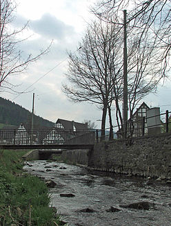
Veischede
| Veischede | ||
|
Veischede near Kirchveischede |
||
| Data | ||
| Water code | DE : 276636 | |
| location | District of Olpe , North Rhine-Westphalia ( Germany ) | |
| River system | Rhine | |
| Drain over | Lenne → Ruhr → Rhine → North Sea | |
| source | near the Feldberg between Olpe - Oberneger and - Oberveischede 51 ° 4 ′ 23 ″ N , 7 ° 54 ′ 54 ″ E |
|
| Source height | approx. 510 m above sea level NHN | |
| muzzle | in Lennestadt - Grevenbrück in the Lenne Coordinates: 51 ° 8 ′ 43 ″ N , 8 ° 0 ′ 42 ″ E 51 ° 8 ′ 43 ″ N , 8 ° 0 ′ 42 ″ E |
|
| Mouth height | approx. 245 m above sea level NHN | |
| Height difference | approx. 265 m | |
| Bottom slope | approx. 16 ‰ | |
| length | 16.6 km | |
| Catchment area | 42.829 km² | |
| Medium-sized cities | Olpe , Lennestadt | |
The Veischede (also called Veischedebach ) is a 16.6 km long, left or southwestern tributary of the Lenne in the North Rhine-Westphalian district of Olpe ( Germany ). It flows entirely in the area of the Sauerland-Rothaargebirge nature park .
Course and catchment area
The Veischede rises between the mountains Feldberg ( 556.2 m above sea level ) in the north-west, Homert ( 536.7 m ) in the south-west and Twilkenberg ( 531.2 m ) in the north-east. Its source ( 510 m ) is on the site of a garbage dump between the northeastern Olper districts of Oberneger and Oberveischede . The flowing water is cleaned by a sewage treatment plant 400 m below its origin at the landfill exit . A few hundred meters southwest of it there is a composting plant directly adjacent to the landfill with the nearby Neger spring .
In the Sauerland-Rothaargebirge nature park, the Veischede flows initially in a north-easterly direction and later in a northerly direction along federal highway 55 . First, it gradually runs through Oberveischede. Below it, it flows through the Lennestadt districts of Bruchhausen , Kirchveischede , Bilstein and Bonzel to Grevenbrück .
After flowing from Grevenbrück opens the Veischede about 250 m NNE the ruins Peper Burg to 245 m height in the zoom there from southeast flowing Ruhr influx Lenne .
The catchment area of the Veischede covers 42.829 km².
Worth seeing and cultural
The Wallburg Jäckelchen ramparts lie on a ridge between Veischede and Repetal near Bruchhausen, and the Hofkühl ramparts on the opposite hilltop . In Bilstein the Veischede flows past below the Bilstein Castle . The observation tower on the Hohe Bracht , which is just under 2 km southeast of the village, is also worth a visit. Above the Veischede estuary is the Peperburg ruin near Grevenbrück .
The Veischedetalbahn used to run between Grevenbrück and Kirchveischede .
Individual evidence
- ↑ a b c d e f g Topographical Information Management, Cologne District Government, Department GEObasis NRW ( information ) (query on November 10, 2010)
- ↑ Topographic map 1: 25,000
- ^ German basic map 1: 5000

