
Burkhardtsdorf administrative community
| coat of arms | Germany map | |
|---|---|---|
 Help on coat of arms |
Coordinates: 50 ° 44 ' N , 12 ° 55' E |
|
| Basic data | ||
| Existing period: | 2008– | |
| State : | Saxony | |
| County : | Erzgebirgskreis | |
| Area : | 33.69 km 2 | |
| Residents: | 10,484 (Dec. 31, 2019) | |
| Population density : | 311 inhabitants per km 2 | |
| License plate : | ERZ, ANA, ASZ, AU, MAB, MEK, STL, SZB, ZP | |
| Association key : | 14 5 21 5 103 | |
| Association structure: | 3 municipalities | |
| Association administration address : |
Am Markt 8 09235 Burkhardtsdorf |
|
| Administrative Chairman: | Thomas Probst | |
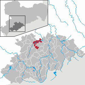
| Location of the administrative community Burkhardtsdorf in the Erzgebirgskreis | ||
  |
||

The administrative community Burkhardtsdorf is an administrative community in the Erzgebirge in the Free State of Saxony .
geography
The B 180 and the Chemnitz-Aue railway line run north of the administrative community through the Zwönitz valley . The B 95 runs a little east of the area. The A 72 runs west of the community. This can be reached via the connections Stollberg-Nord and Stollberg-West approx. 10 km. The area is located in the Middle Ore Mountains , approx. 20 km south of Chemnitz and 15 km east of the former district town of Stollberg / Erzgeb. The heights in the community area reach over 600 m above sea level. NN .
history
The administrative community was founded on March 21, 2008. It came into being after the Auerbach administrative community was dissolved .
Member municipalities
The administrative community currently consists of three municipalities:
- Auerbach
- Burkhardtsdorf with the districts Burkhardtsdorf, Eibenberg with Neu-Eibenberg, Kemtau and Meinersdorf
- Gornsdorf
Web links
Individual evidence
- ↑ Population of the Free State of Saxony by municipalities on December 31, 2019 ( help on this ).
- ↑ Administration structure ( page no longer available , search in web archives ) Info: The link was automatically marked as defective. Please check the link according to the instructions and then remove this notice.
- ↑ Administrative community ( page no longer available , search in web archives ) Info: The link was automatically marked as defective. Please check the link according to the instructions and then remove this notice.
- ^ Administrative community Auerbach-Burkhardtsdorf-Gornsdorf in the regional register of Saxony