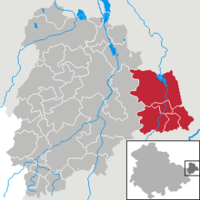
Administrative community Wieratal
| coat of arms | Germany map | |
|---|---|---|
 Help on coat of arms |
Coordinates: 50 ° 57 ' N , 12 ° 35' E |
|
| Basic data (as of 2018) | ||
| Existing period: | 1992-2018 | |
| State : | Thuringia | |
| County : | Altenburger Land | |
| Area : | 75.38 km 2 | |
| Residents: | 3336 (Dec. 31, 2017) | |
| Population density : | 44 inhabitants per km 2 | |
| License plate : | ABG, SLN | |
| Association key : | 16 0 77 5008 | |
| Association structure: | 5 municipalities | |
| Association administration address : |
Platz der Einheit 4 04618 Langenleuba-Niederhain |
|
| Chairman : | Gerd Werner | |
In the administrative community of Wieratal in the Altenburger Land district in Thuringia (Germany), five municipalities had come together to handle their administrative business. The river Wiera or the Wieratal flowing through the area of the administrative community gave it its name .
The seat of the administrative community was Langenleuba-Niederhain .
The municipalities
The following are the municipalities and their number of inhabitants in brackets (as of December 31, 2017):
- Frohnsdorf (244)
- Goepfersdorf (235)
- Jückelberg (287)
- Langenleuba-Niederhain (1756)
- Ziegelheim (814)
history
The administrative community was founded on April 1, 1992 by the five member communities. On July 6, 2018, the municipalities of Frohnsdorf, Jückelberg and Ziegelheim were incorporated into Nobitz as part of the Thuringia district reform in 2018 and 2019 . Nobitz became a fulfilling community for Göpfersdorf and Langenleuba-Niederhain.
Population development
Development of the population:
|
|
|
|
- Data source: from 1994 Thuringian State Office for Statistics - values from December 31st
Attractions
- Langenleuba-Niederhain
- Half lock
- church
- Schömbach dam
- Neuenmörbitz Church
- Heidelbach Bridge
- Lohma church on the Leina
- Leinawald
- Brick home
- former pilgrimage church with Kreuzbach organ
- Old rectory
- Central German traveling puppet theater Engertsdorf
- Frohnsdorf
- historical half-timbered courtyard
- Wiesebach Viaduct
- Goepfersdorf
- historical horse stable
- Church with Hesse organ
- Quellenhof Garbisdorf
- Katharinenkirche Garbisdorf
- Jückelberg
- historical gatehouse Flemmingen
- Romanesque church in Flemmingen
- Listed location Wolperndorf with St. Walpurga Church
See also for the churches: List of churches in the Altenburger Land
Individual evidence
- ↑ Thuringian Law and Ordinance Gazette No. 7 2018 of July 5, 2018. Thuringian State Parliament, accessed on January 21, 2019 .
- ↑ Administrative community: Wieratal. Thuringian State Office for Statistics (TLS), accessed on January 21, 2019 .

