Viaur
| Viaur | ||
|
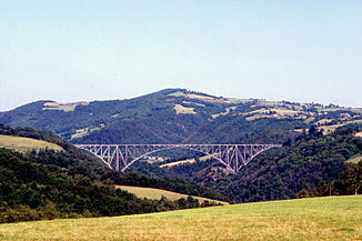
Railway viaduct in the Viaur valley |
||
| Data | ||
| Water code | FR : O5-0290 | |
| location | France , Occitania region | |
| River system | Garonne | |
| Drain over | Aveyron → Tarn → Garonne → Atlantic Ocean | |
| source | at the Puech de Pal east of Vézins-de-Lévézou 44 ° 16 ′ 38 ″ N , 3 ° 0 ′ 13 ″ E |
|
| Source height | approx. 1070 m | |
| muzzle | at Saint-Martin-Laguépie in the Aveyron coordinates: 44 ° 8 ′ 39 ″ N , 1 ° 58 ′ 1 ″ E, 44 ° 8 ′ 39 ″ N , 1 ° 58 ′ 1 ″ E |
|
| Mouth height | approx. 155 m | |
| Height difference | approx. 915 m | |
| Bottom slope | approx. 5.4 ‰ | |
| length | 168 km | |
| Discharge at the Laguépie A Eo gauge : 1530 km² |
MQ Mq |
15 m³ / s 9.8 l / (s km²) |
| Left tributaries | Vioulou , Céor | |
| Right tributaries | Lieux , Lézert , Jaoul | |
| Reservoirs flowed through | Reservoir de Pont-de-Salars | |
The Viaur is a river in southern France , in the Occitanie region .
geography
It rises east of Vézins-de-Lévézou , flows in an east-west direction parallel to the Aveyron running north and the Tarn running south, and after a distance of 168 kilometers it flows into the Aveyron as a left tributary at Saint-Martin-Laguépie . The Viaur flows through a sparsely populated valley, for more than 100 km the river does not touch a city.
Crossed departments
Places on the river
Attractions
At Tauriac-de-Naucelle , it is spanned by the filigree Viaur Viaduct ( Viaduc du Viaur ), the largest steel bridge in France. It is classified as a monument historique .
Web links
Commons : Viaur - collection of images, videos and audio files
Commons : Viaur Viaduct - collection of images, videos and audio files
Individual evidence
- ↑ a b geoportail.fr (1: 16,000)
- ↑ a b The information on the length of the river is based on the information about the Viaur at SANDRE (French), accessed on January 7, 2011, rounded to full kilometers.
- ↑ hydro.eaufrance.fr (station: O5572910 , option: Synthèse )
- ↑ Entry no. PA00094189 in the Base Mérimée of the French Ministry of Culture (French)
